Mosquito Meets MODIS & Landsat: South Dakota Fights West Nile Virus
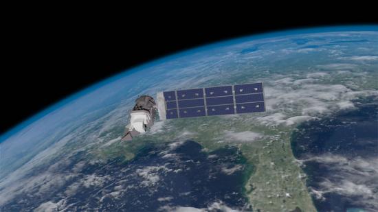
Source: NASA Video @ YouTube South Dakota is the U.S. hotspot for West Nile disease. Scientists and public health officials there developed a way

Source: NASA Video @ YouTube South Dakota is the U.S. hotspot for West Nile disease. Scientists and public health officials there developed a way
Naga Manohar Velpuri, works with the USGS Famine Early Warning Systems Network (FEWS NET). The project has recently initiated a large-scale project to monitor surface water bodies in the pastoral regions of Africa using multi-source satellite data and hydrologic modeling techniques. Currently, a total of 293 water points are being monitored in 10 countries. Velpuri shared some of the projects findings he presented at #AGU15.
Justin Roberts-Pierel from the Joint Center for Earth Systems Technology, uses Landsat 8 to detect landslides in the Himalayas. He provided information about his studies at #AGU15. We talked with him about his work.
At #AGU15 Yurika Kato, a Geosciences graduate student at the University of Missouri-Kansas City, presented his research about how the 2010 Haitian earthquake and resulting human migration affected landslide occurrences in the Port-au-Prince province. We spoke with Kato about his research.
Elodie Robert from the French National Center for Scientific Research presented preliminary results of her research at #AGU15 that aims to track microbiological heath hazards based on surface water turbidity in West Africa.

There is a global effort afoot to fight hunger and reduce poverty by allowing anyone with an internet connection to see agricultural projections.
For those who live along its shores, Lake Tanganyika in east Africa is the backbone of local transportation and serves as an essential source of household water and protein. Every night, fishers lure nocturnal, sardine-like fish called dagaa with compression lamps that are strung between their boats. From the shore, the lake sparkles with the lights of miniature moons as people gather the treasured catch.
Turkana County in northwest Kenya has been reeling from several years of crippling drought. As a consequence, the nomadic peoples in the region have suffered. Livestock such as goats and cattle, the sole source of income for these pastoralists, have perished by the droves from starvation, and the resulting economic hardship has left many children malnourished. Many have also died from violent clashes over increasingly scarce resources.
Earlier this year, I attended a workshop in Arusha, Tanzania to train research scientists from South Africa, Ivory Coast, Mauritania, Botswana, Kenya and Tanzania on how to use products derived from NASA satellites to monitor climate and environmental factors that influence the transmission of vector-borne diseases such as malaria, leishmaniasis, trypanosomiasis, schistosomiasis and Rift Valley Fever. Together, these diseases represent a scourge to both humans and animals in the region, affecting millions in East Africa alone.
If you start feeling better as spring begins pushing up its tender shoots, you might be living proof of a trend discovered in data from the Survey of the Health of Wisconsin: The more green space in the neighborhood, the happier people reported feeling.
Over 2500 villages were destroyed during six years of conflict in Darfur between 2002 and 2008. Dr. Andrew Marx, a 2013 fellow at the Center for the Prevention of Genocide at the U.S. Holocaust Memorial Museum, has found that this type of destruction—associated with human rights violations—can be detected using freely available Landsat data.
Large underground water reserves have been found in Turkana, one of Kenya’s driest and poorest regions. The discoveries were made by the natural resources exploration firm, Radar Technologies International, during the course of a survey of groundwater conducted for the Kenyan Government on behalf of the UN. The aquifers were detected with the WATEX System, RTI’s state-of-the-art, space-based exploration technology.
WNYC’s Leonard Lopate talks with SkyTruth president, John Amos, about using public domain satellite imagery, such as Landsat, to monitor the environment. SkyTruth uses all types of satellite imagery to monitor environmental changes and disasters; Landsat is prominently mentioned among them.
In June, air pollution over Singapore and Malaysia spiked as forests in neighboring Sumatra (Indonesia) burned. Using NASA’s daily fire alerts and official national maps, the fires were located in the vicinity of oil palm and acacia tree plantations. However, the coarse resolution of the fire alerts coupled with outdated national maps, made it hard to establish culpability.
Images from Landsat satellites provided free to the public by the Department of the Interior’s U.S. Geological Survey were the starting points for “a new
Does remote-sensing information, such as that from Landsat and similar Earth-observing satellites, provide economic benefits to society, and can this value be estimated? Using satellite data for northeastern Iowa, U.S. Geological Survey scientists modeled the relations among land uses, agricultural production, and dynamic nitrate (NO3–) contamination of aquifers.
Cladophora, a nuisance, native green algae that grows attached to solid substrate in all of the Laurentian Great Lakes, has expanded its range partially due
The presence of birds near an aircraft runway is a constant concern. Although deadly crashes are rare, a bird strike to the windshield can cause
Source: Charles L. Walthall, USDA Agricultural Research Service Forum It’s ironic that just when Earth-monitoring satellites are needed more than ever to address the food and
• UNESCO began mapping groundwater this January in the drought-stricken Horn of Africa, in order to bring the population a sustainable water supply. Drought has
Eastern Africa is in the grip of the worst drought it has seen in 60 years and the region is facing severe famine. In Somalia
As the world moves toward adding a few more billion people in the coming decades, many people who keep an eye on the horizon find
In the mid-1990s, highly pathogenic avian influenza (bird flu) emerged in southern China. Severe outbreaks in the winter of 2005-2006 spread the virus, designated H5N1,
Glacial Retreat to Rapid Urbanization Chronicled in Landmark Satellite Report to Africa’s Environment Ministers Source: United Nations Environment Programme Africa’s rapidly changing environmental landscape, from
Contact: Gretchen Cook-Anderson, NASA/GSFC When two catastrophic natural disasters struck within days of each other in May 2008, disaster relief, humanitarian aid, and health officials, as
A rare bird has been flying over the Great Lakes recently, and it isn’t migrating or searching for prey. This hawkeyed species is a Learjet
Remote sensing is a critical tool for agriculture, land use worldwide Source: Cheryl Pellerin, America.gov, U.S. Department of State Over the 35 years that U.S. Landsat
Contributor: Susan Maxwell Human health scientists have associated cancer, neurological disorders, and adverse reproductive outcomes with exposure to agricultural chemicals. Lack of information on historical environmental
Contributors: Assaf Anyamba with Kenneth J. Linthicum, Compton J. Tucker, Robert Mahoney, and Randall During the period of August to September 2000, the Yemen Ministry of Agriculture
