
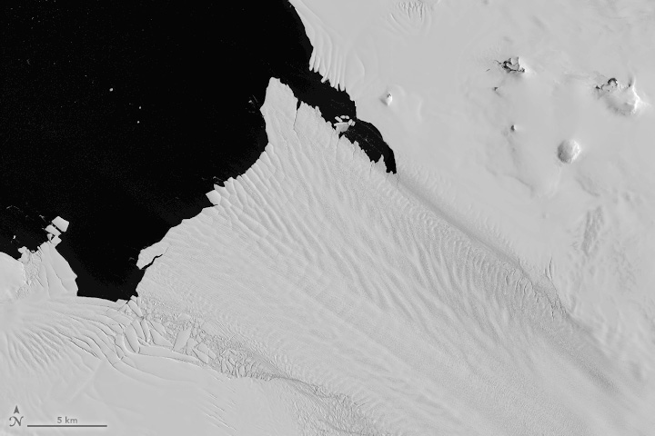
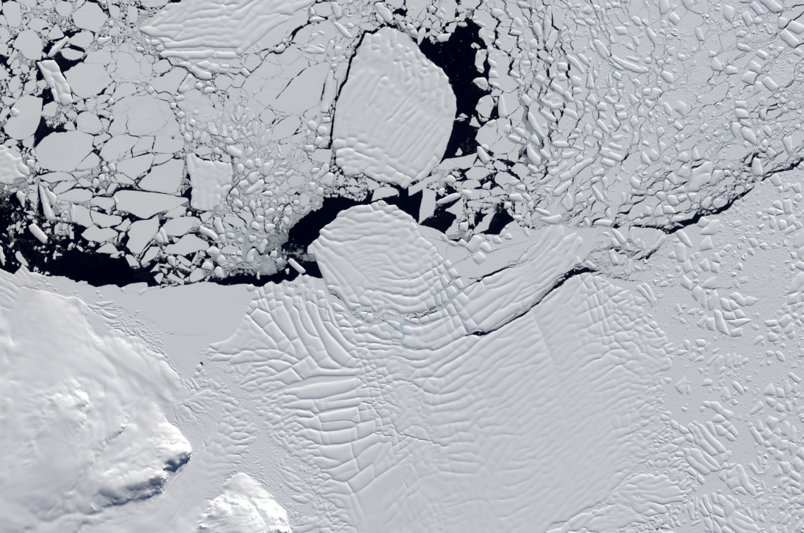
Scenes from the Polar Night
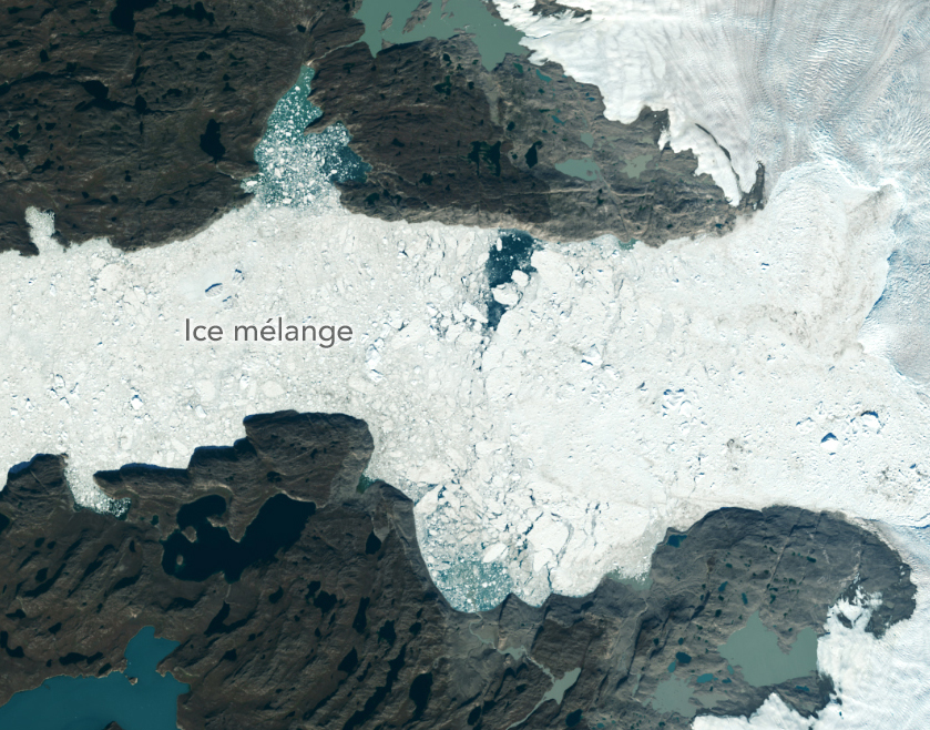
Landsat satellites have begun regularly acquiring images of ice at the poles during the winter, with enlightening results.

Landsat satellites have begun regularly acquiring images of ice at the poles during the winter, with enlightening results.
New research shows that while some Antarctic ice shelves have been thinning since at least the 1970s, widespread thinning accelerated in the 1990s.
A delve into Landsat-based studies revealing the environmental impact of river mining, the decline in global lake water levels, and the risks of rising sea levels on coastal habitats. Plus, a sneak peek at what the future of the Landsat program holds with the introduction of Landsat Next.
By fusing multispectral Landsat data with forest structure products from the GEDI mission, researchers and scientists have unlocked a deeper understanding of complex forest processes and dynamics and empowered land managers and policymakers to manage forests with greater effectiveness and sustainability.
As the world looks for sustainable solutions, a system tapping into Landsat data for water management has passed a critical test.
A new, comprehensive analysis of satellite data finds that majority of glaciers on the landmass have retreated significantly.
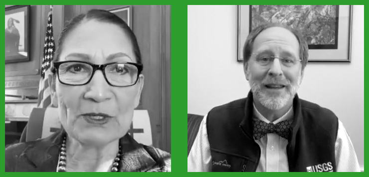
In an Instagram Live event titled “Guided by Science,” Deb Haaland, U.S. Secretary of the Interior, spoke with USGS Director Dr. David Applegate. The Landsat portion of that discussion is shared here.
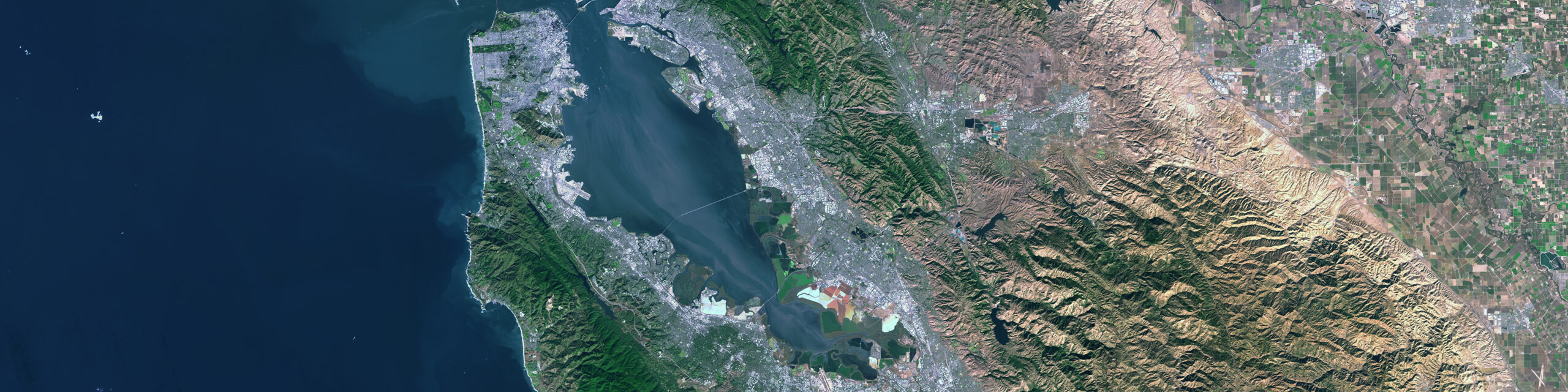
The 2023 American Geophysical Union Fall Meeting (AGU23) was held in San Francisco, California, from December 11-15. The Landsat program has repeatedly had a strong presence at AGU meetings and it occupied a prominent position among presenters at AGU23.
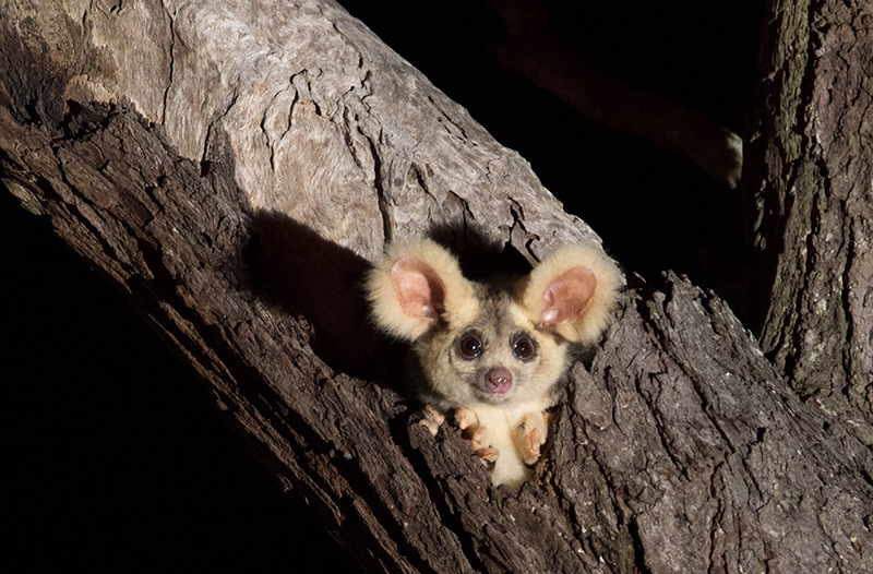
Using satellite data, including Landsat, Griffith University researchers found that less than 13 percent of the endangered greater gliders’ habitat in Queensland is protected.
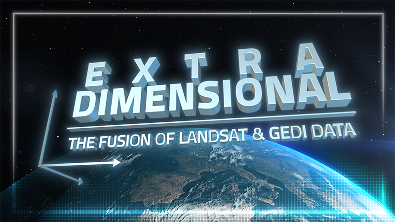
When Landsat’s vast decades-long archive is combined with data from other instruments it can provide amazing insight into how our world is evolving with us and around us. Here are some of the ways Landsat and GEDI data are being harnessed to help us better understand the complex relationship between humanity and nature.

The Pale Blue Dot Visualization Challenge—aimed at making Earth observation data accessible to everyone—has officially kicked off.
While floating algae, emergent aquatic vegetation, and historic surface scum can be tracked throughout the Landsat record, researchers warn data users that older Landsat sensors lack the precision needed to be used for water-column studies.
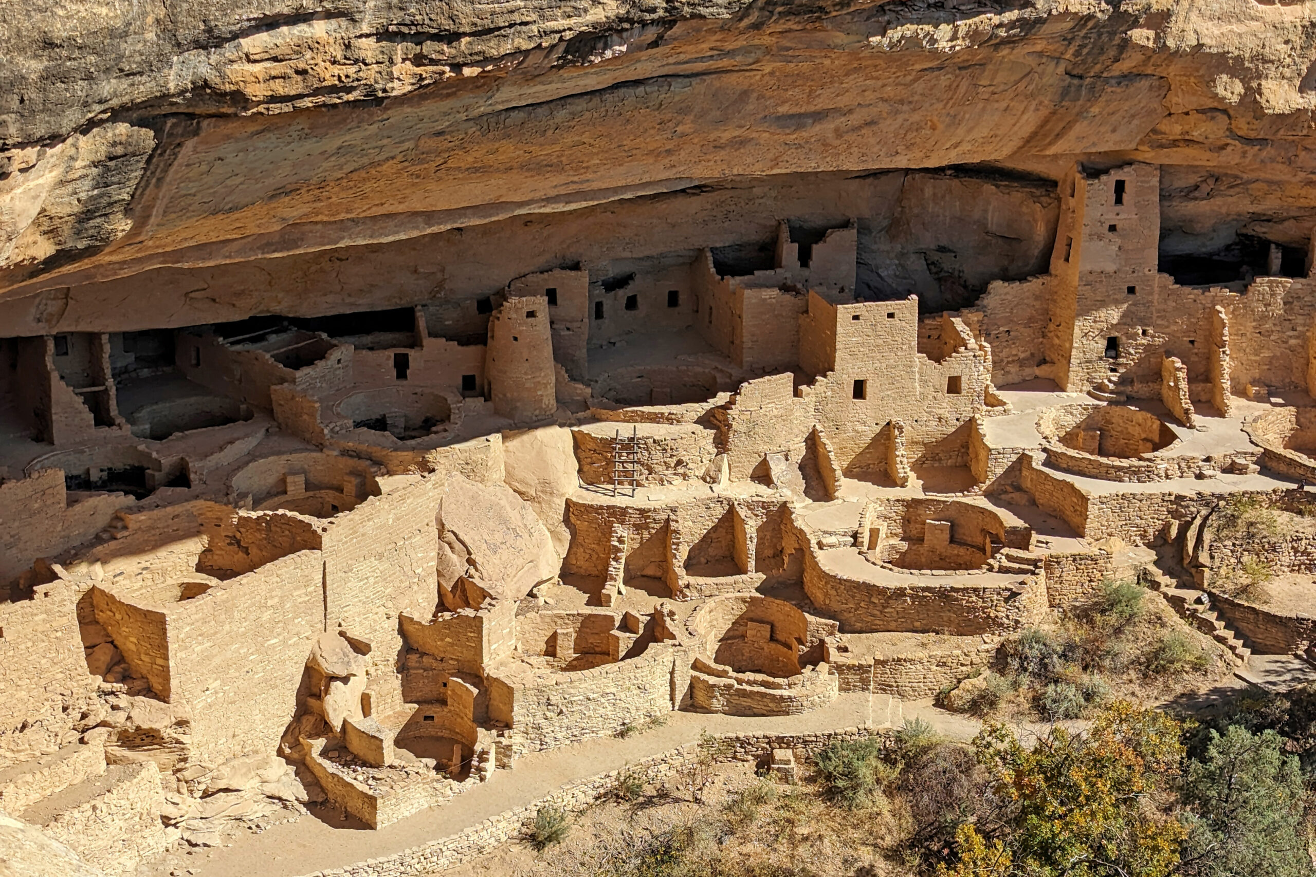
On Saturday, October 14, 2023, regions of North, Central, and South America experienced an annular solar eclipse. Through the Earth to Sky Partnership, NASA coordinated with Mesa Verde National Park to host a series of outreach events.
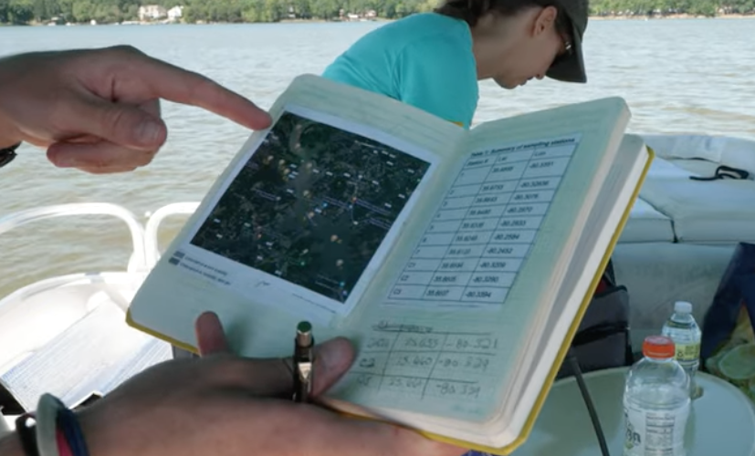
Safeguarding freshwater resources is crucial, and while scientists use a variety of ground-based techniques to gauge water quality, the Landsat program has provided water quality data from orbit for decades.
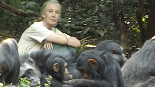
The Jane Goodall Institute has been working with NASA and using Earth science satellite imagery and data—including Landsat (NASA/USGS)—in its chimpanzee and forest conservation efforts in Africa, particularly the Gombe region.
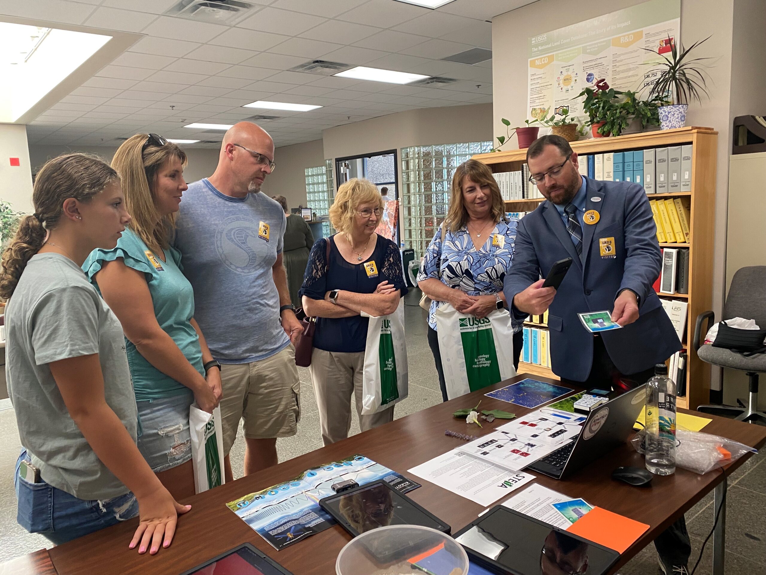
The Earth Resources Observation and Science (EROS) Center celebrated its 50th anniversary in August. Learn more about the EROS Center, the anniversary celebration, and the Landsat-related outreach activities at the event—with a spotlight on STELLA, a DIY spectrometer.
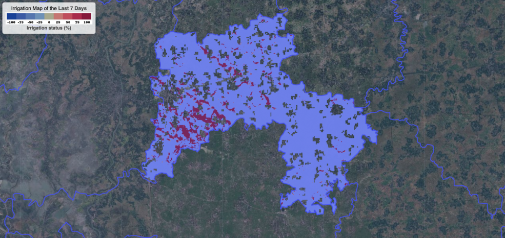
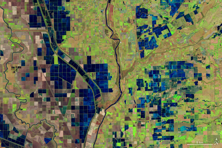
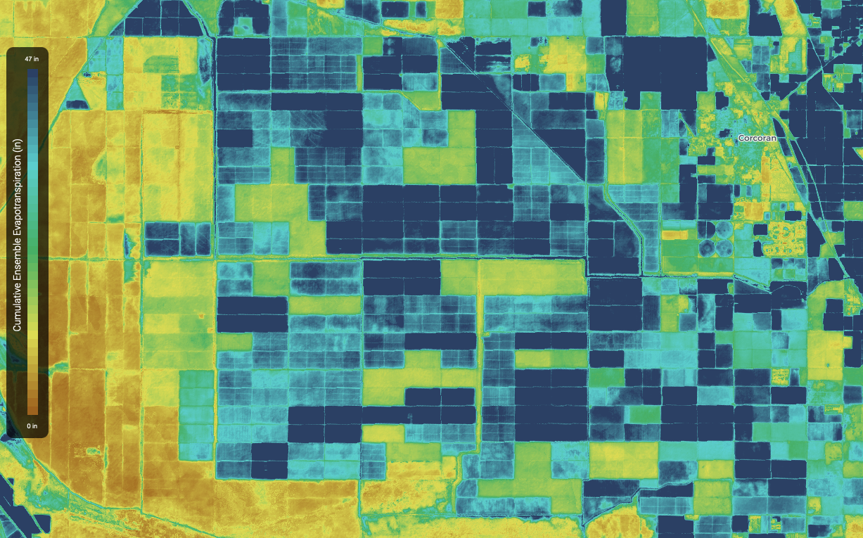
Satellite data are providing information to Bangladeshi farmers about how much water they are using, how much they have, and how much their crops need.

Bex Dunn is an Earth Observation Scientist at Geoscience Australia where she uses Landsat data to better understand wetlands.
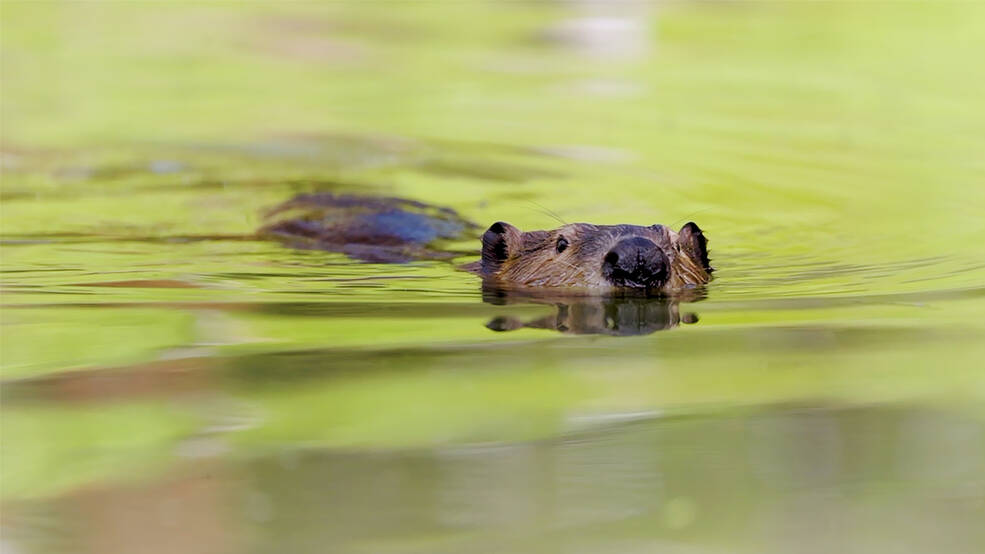
Satellites like Landsat are quantifying how beavers can have an outsized and positive impact on local ecosystems.
Practitioners managing the wellbeing of wetlands have a new tool at their disposal. The Wetland Insight Tool, developed by Geoscience Australia, provides a visual summary of 35+ years of wetland dynamics.
Landsat 8 very nearly flew without a thermal infrared sensor. This is the backstory of how TIRS made it onto Landsat 8.
Opening the Landsat archive has benefited science and society.
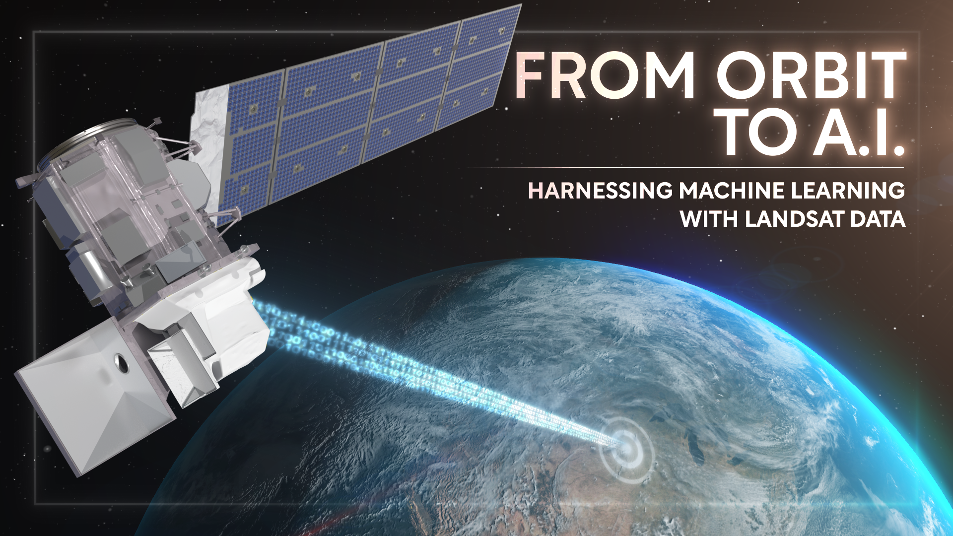
Over the past few years, machine learning techniques have been increasingly used to analyze the vast amount of data collected by the Landsat mission, which has been circling the globe for over 50 years.
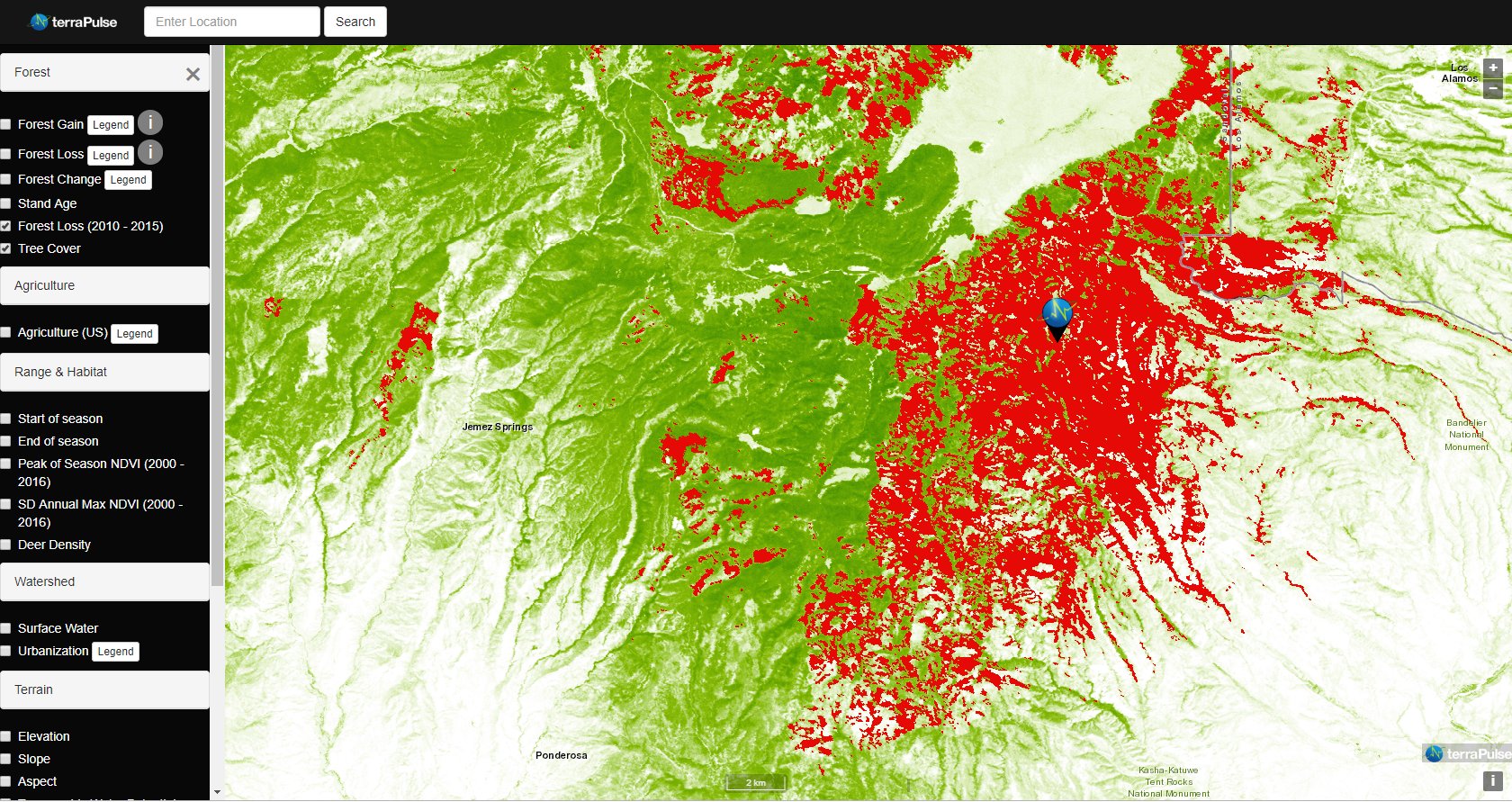
Applying AI to Earth data—including Landsat—helps terraPulse reveal sustainable options for farming, reforestation, and land management.
Merging data from multiple satellites, OPERA can help government agencies, disaster responders, and the public access data about natural and human impacts to the land.
Washington-Allen is a longtime Landsat data user working towards drylands restoration and sustainability solutions.
The collaboration between NASA and IBM is a unique application of artificial intelligence (AI) foundation model technology to NASA Earth observation data.
An international team of researchers has combined satellite imagery and climate and ocean records to obtain the most detailed understanding yet of how the West Antarctic Ice Sheet – which contains enough ice to raise global sea level by 3.3 metres – is responding to climate change.
NASA Harvest gathered agricultural remote sensing experts to discuss how Landsat fundamentally transformed agricultural monitoring over the last half century.
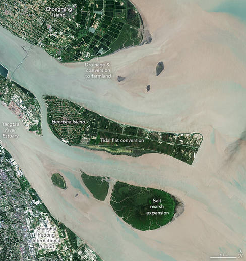
The world has lost 561 square miles (1,453 square kilometers) of salt marshes over the past 20 years.
Satellites offer a wealth of information pertinent for water and food security. Landsat has long been a foundational piece of the “Space for Ag” initiative.
New research uses Landsat observations and advanced computing to chronicle wetlands lost (and found) around the globe.
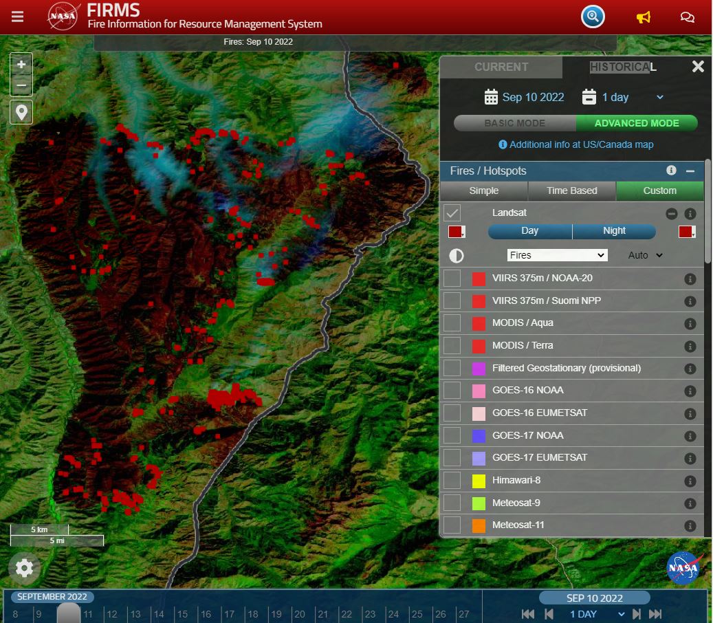
Thirty-meter Landsat 8 and 9 data have been added to NASA’s Fire Information for Resource Management System (FIRMS).
