Over 150 Landsat Images Provided to the International Charter in September 2015
This month, 166 Landsat scenes were ingested by the USGS Hazard Data Distribution System to provide data for Charter activations.

This month, 166 Landsat scenes were ingested by the USGS Hazard Data Distribution System to provide data for Charter activations.
For those who live along its shores, Lake Tanganyika in east Africa is the backbone of local transportation and serves as an essential source of household water and protein. Every night, fishers lure nocturnal, sardine-like fish called dagaa with compression lamps that are strung between their boats. From the shore, the lake sparkles with the lights of miniature moons as people gather the treasured catch.
By incorporating seasonal variability of herbaceous cover and biomass in the Southwest U.S., fine fuel loading can be measured. The measurements are then used to capture changes to fire behavior fuel models based on the current fire season.
The LANDFIRE program produces annual fire disturbance maps for the conterminous U.S. Recently, the program developed an image tiling and compositing process to aid in vegetation change mapping.
On Saturday, September 26, over 20,000 people attended an all-day public open house at NASA’s Goddard Space Flight Center in Greenbelt, Maryland.
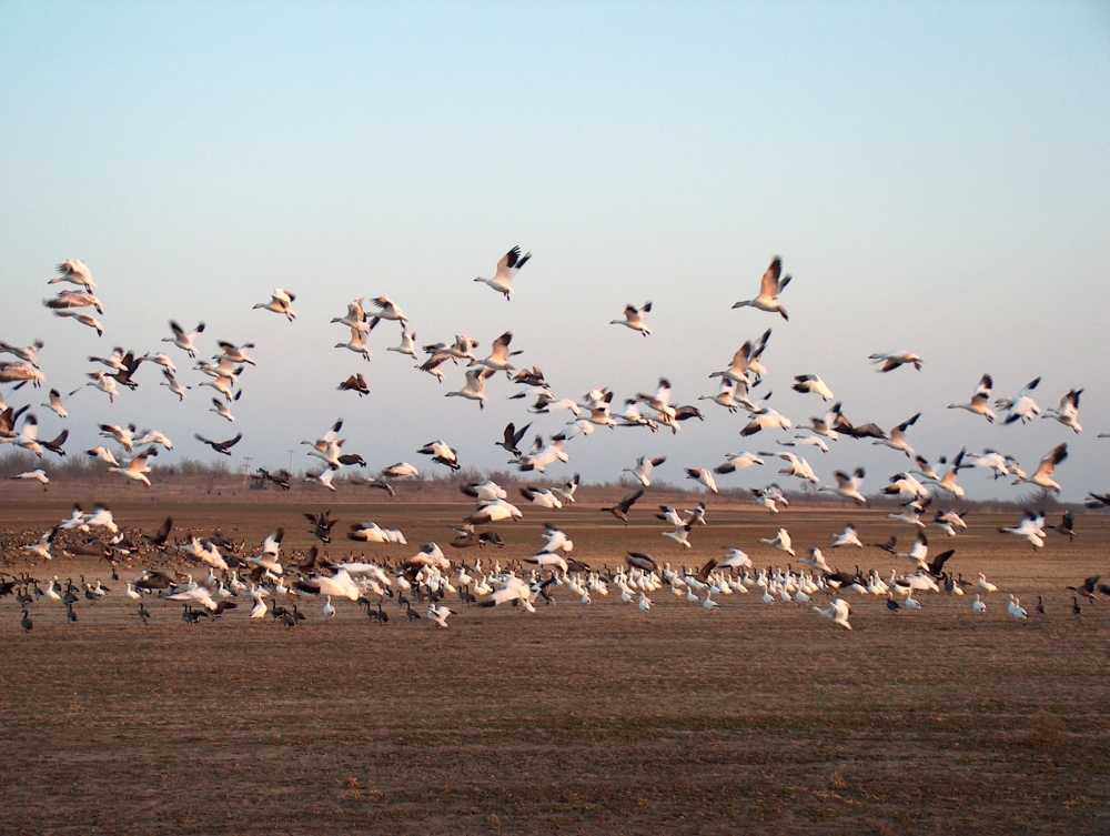
The BirdReturns program, created by The Nature Conservancy of California, is an effort to provide “pop-up habitats” for some of the millions of shorebirds, such as sandpipers and plovers, that migrate each year from their summer breeding grounds in Alaska and Canada to their winter habitats in California, Mexico, Central and South America.
More and more we hear the term “anthropocene” used to describe the current epoch of our planet when humankind has had a profound impact on Earth. This month, the U.S. Geological Survey has released a Landsat-based report and dataset on anthropogenic land use trends in the U.S. between 1974 and 2012.
Delivering maps and tabular summaries of live water hyacinth coverage in waterways of the Sacramento-San Joaquin River Delta from the latest cloud-free Landsat satellite imagery.
The world lost more than 18 million hectares (45 million acres) of tree cover in 2014, an area twice the size of Portugal, according to new data from the University of Maryland (UMD) and Google released by Global Forest Watch. The data find that tropical forests are in the most trouble, losing 9.9 million hectares (24.5 million acres) of tree cover in 2014 – over half of the global total. A three-year-average shows tree cover loss is the highest it’s been since 2001.
