The Landsat archive—the world’s longest record of Earth’s land surface—is invaluable for workforce development given its high quality data, consistency through time, multi-faceted utility, and accessibility for no cost. Landsat is a learning window into remote sensing overall as well, because Landsat observes the landscapes in which we live, and the data are tangibly linked to peoples’ personal experiences and sense of place.
An endeavor to marry community college curriculum with the geospatial skill set needed to exploit the power of Landsat data led to a professional development program for instructors, “Integrated Geospatial Education and Technology Training,” or “iGETT.” The National Science Foundation’s Advanced Technological Education Program, funded iGETT between 2007 and 2015. iGETT serves two-year college instructors of Geographic Information Systems (GIS), enabling them to understand, download, analyze and integrate Landsat data into GIS for problem solving, creating and expanding a community of educators who can now give students a solid foundation in remote sensing. Over the period of two iGETT projects from 2007 to 2015, over 6,000 students were reached with remote sensing instruction by 76 iGETT participants: 60 two-year college instructors (including eight Tribal college instructors), eight four-year college/university professors; and eight high school instructors.

A great many publicly available resources have been produced by iGETT participants and staff that can support others who wish to help build the national geospatial workforce. These resources include participant-authored classroom labs and videos, staff-created workshop agendas and associated multimedia materials; lessons learned about delivering remote sensing technology education; and a well-networked community of practice that includes leaders in geospatial education who built their skills and confidence while engaged in iGETT.
Each iGETT participant spent 18 months with the project and was served through the following activities:
- two online courses: a GIS refresher course and an introduction to remote sensing, completed prior to the first Summer Institute;
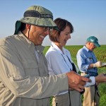
- two intensive Summer Institutes (in person), focused on remote sensing instruction and data resource utilization at resource-rich private and federal locations;
- remote sensing analysis and GIS software from ITT VIS and Esri;
- monthly webinars during the academic years.

Participants were required to write their own laboratory exercises, in which students download, analyze and integrate Landsat, MODIS and/or ASTER data into GIS for problem solving. The exercises focus on agriculture, disaster management, forestry, land use/land cover change, natural resources management, human health, or urban growth. Each exercise covers a minimum of two weeks of class time. Participants chose their own topics for the exercises, with titles that include the following:
- Agriculture: Estimating Areas Suitable for Livestock Grazing in Wyoming
- Agriculture: Quantifying Areas in Cultivation in Maricopa County
- Disaster Management: Estimating Economic Losses from Potential Dam Failure in North Dakota
- Disaster Management: Examining Drought and Land Use Conflicts in Sudan
- Disaster Management: Evaluating Post-Fire Vegetation Recovery in San Diego County, CA
- Disaster Management: Mapping Wildfire Burn Severity in California
- Disaster Management: Determining Flood Risk in Iowa
- Disaster Management: Investigating Tsunami Damage in Southeast Asia
- Energy: Identifying Biomass Sources for Local Ethanol Production in Iowa
- Forestry: Evaluating Insect Damage to Forest Resources in New Mexico
- Forestry: Detecting Gypsy Moth Defoliation in Virginia and West Virginia
- Land Use/Land Cover: Using Supervised vs. Unsupervised Classification to Map Geology
- Land Use/Land Cover: Impervious Surfaces
- Land Use/Cover: Determining Greenway Potential in Western New York State
- Land Use/Land Cover: Visualizing and Analyzing Landform Change of Surface Coal Mines
- Natural Resource Management: Monitoring Land Surface Heat in Yellowstone National Park
- Natural Resource Management: Comparing Urban Sprawl and Sediment Loading in the Chesapeake Bay
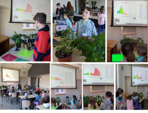
Participants were also required to create Concept Modules for student learning. These are short videos illustrating fundamental remote sensing concepts or techniques. They are posted on the iGETT Remote Sensing Education YouTube Channel. Examples of the Concept Module titles include, “Introduction to Band Combinations for Landsat images;” “Image Analysis using NDVI to Assess Vegetation Greenness;” and “How to use Maximum Likelihood Classification for Analyzing Remote Sensing Imagery.”
Geography provided the bridge between federal remote sensing and GIS for the iGETT public-private education partnership. Geography is a broad discipline concerned with both physical and human environments. At its core is the study of landscapes and their features. What is the nature of these features and why are they where they are? What is their sphere of influence? What do they affect and what affects them? What patterns can be discerned across landscapes and what do the patterns mean for the lives of people and ecosystems? How can we use our understanding of how and why such patterns are changing to predict future trends of societal concern? These are some of the questions also asked by remote sensing scientists, for whom every data point from a satellite mission must be identified in terms of location. Appropriately, NSF funding for iGETT was provided to the National Council for Geographic Education, a non-profit organization chartered in 1915 to enhance the status and quality of geography teaching and learning at all levels.
Partway through the period of iGETT, guidance documents for geospatial workforce development were produced at the national level. The Department of Labor identified a new Occupational Code for Remote Sensing Technicians [www.onetonline.org/link/summary/19-4099.03]; NSF funded development of the Geospatial Technology Competency Model [www.careeronestop.org/competencymodel/competency-models/geospatial-technology.aspx] and also funded the Geospatial Technology Center of Excellence (GeoTech Center, www.geotech.org) to develop both the Core Competencies for the Remote Sensing Technician and specifications for a model course, Introduction to Remote Sensing. These products and others now serve as guiding frameworks and references for students, college administrators, instructors, and employers in support of a coherent and effective national approach to geospatial technology workforce development.
Through the 76 iGETT participants, approximately 6,000 students have been reached with remote sensing instruction. At least 35 courses have been enhanced with remote sensing and 20 new courses have been developed—and the course accomplishments of the project’s last cohort of participants have yet to be counted.
iGETT participants came from a national pool of applicants representing a variety of disciplines: agriculture, biology, computer science, engineering, geography, physical science and social science; and they represented a range of workforce-based programs from park management to applied technology. During the application periods for each of the four cohorts, consistently more than twice as many applications were received as the project could accommodate. Applicants for Cohorts 3 and 4 included a higher proportion of high school and four-year school instructors than did the applicant pool for Cohorts 1 and 2, which would appear to indicate potential for expanding the project to serve more instructors at those levels in the future.
An important result of iGETT has been the creation and fostering of a new community upon which project graduates now rely. As the external evaluator for iGETT Elaine Craft, SCATE Inc., expressed it, the impact on participating instructors “can only be described as transformative.” Several participants have also taken on new leadership roles in national and regional geospatial education, securing grants to bring the training to others. iGETT has given two-year college instructors enhanced confidence and new practical tools, and has successfully pioneered the integration of remote sensing and GIS for entry level workforce preparation.
A survey of all four participant cohorts was conducted in January 2015 in order to assess the longer-term impact of the project on participants and their programs and to obtain guidance on the shape future programs might take. 48 of 76 living participants responded, for a 65% response rate. Elaine Craft remarked, “The response rate is excellent, particularly for a survey that required so much written input…iGETT work has and continues to really make a difference.” A summary of survey responses appears below.
- 28 of the 48 participants indicated that iGETT has been “Highly Beneficial” and 20 indicated it has been “Beneficial.” None indicated it was not beneficial.
- 6,750 students have developed remote sensing data analysis skills as a result of their instructors’ participation in iGETT. Cohort 4 has not completed their involvement in the project, so that number should significantly increase over the next couple of years.
- 22 new courses on remote sensing have been created and 51 courses have been modified to include remote sensing.
- 32 programs have been modified to include remote sensing.
- The network of new colleagues has been a very important and continues to be so.
- Most participants want more technical training.
- Many participants want to extend remote sensing to other departments, from conservation to nursing and business.
Quotes from participants:
“… adding remote sensing to our curriculum has been revolutionary. It’s now a major draw in our program and is the only workforce-oriented remote sensing class available in the state.”
“The iGETT experience thoroughly changed my approach to my courses and my success as an educator. It provided me with a wealth of information and teaching resources. I became part of a network of educators who contribute our mutual understanding of the science and technology and provide professional support…. I routinely incorporate the Learning Units that were developed by modifying them with local data.”
“iGETT has had a tremendous impact on not only my GST content knowledge, but also my pedagogy. The lesson plans, the peer networking, and the modeling of classroom dynamics continue to drive my teaching.”

Osa Brand from the National Council for Geographic Education serves as the iGETT Principal Investigator. Co-Principal Investigators are Jeannie Allen, Science Systems and Applications at NASA Goddard Space Flight Center (author); Ann Johnson, GeoTech Center; Rachel Headley, Black Hills State University; Christopher Cruz, West Valley College and U.S. National Park Service; and Laura Rocchio, Science Systems and Applications, Inc. The iGETT staff enlisted the oversight of an Advisory Board that has brought expertise from both government and private organizations: Bill Hodge, City of Midland, TX; Torry Johnson, NASA; Jon Dykstra, MDA Information Systems, Inc.; Joseph J. Kerski, Esri; Marguerite Madden, University of Georgia; Rich Serby, GeoSearch, Inc.; Jeffrey M. Young, LizardTech; R. Maxwell Baber, U.S. Geospatial Intelligence Foundation; and Rodney D. Jackson County Community College, NC. The Board has met by webinar twice per year. Board members have approved the process and results of the project, providing guidance, particularly on topics to be covered during the Institute.
Anyone wishing access to iGETT resources or to the complete results of the January 2015 survey may contact the author and project Co-PI Jeannie Allen, SSAI, at: Jeannette.E.Allen@nasa.gov.
The project website is in transition to a new home (from its old one at: igettremotesensing.org). Anyone wishing to know when the new site is publicly accessible can contact Allen as well.


