
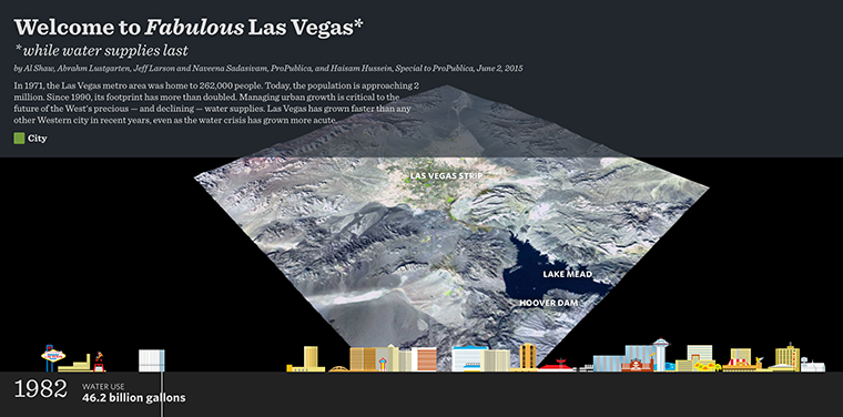
As part of ProPublia’s “Killing the Colorado” investigation, viewers can watch the footprint of the city grow on the Landsat images, while its skyline swells and its water consumption rises and then plateaus.

Data in Harmony: NASA’s Harmonized Landsat and Sentinel-2 Project
NASA’s Harmonized Landsat and Sentinel-2 (HLS) project is a groundbreaking initiative that combines data from Landsats 8 & 9 with the European Space Agency’s Sentinel-2A & 2B satellites.


