Session I
Sentinel-2 Data Preparatory Studies
The European Space Agency’s (ESA) Sentinel-2 mission is a land-monitoring constellation of two satellites that will provide high-resolution optical imagery. Data from Sentinel-2 complement data from the current Landsat missions. The launch of the first satellite, Sentinel-2A, occurred June 23, 2015; Sentinel-2B will be launched in mid-2016. Garik Gutman [NASA Headquarters (HQ)—LCLUC Program Manager] presented a brief overview of the Sentinel-2 (S2) preparatory components, Sentinel-2 Data Use Preparation (S2DUP) projects, and deliver-ables.
He focused on how S2 data could be used syner-gistically with Landsat data to create higher-temporal-frequency coverage and higher-level LCLUC products. He also introduced the LCLUC Multi-Source Land Imaging (MuSLI) Science Team. Gutman next discussed the utility of NASA Earth Exchange (NEX) in LCLUC projects and encouraged all LCLUC principal investigators (PIs) to register in the system and use it if they’re processing large volumes of data.
His pre-sentation ended with a brief summary of the upcom-ing LCLUC-related meetings, which include the Mapping Urban Areas from Space, to be held at the ESA European Space Research Institute (ESRIN), November 4-5, 2015, and the First International MuSLI Science Team Meeting, to be held in conjunction with the twentieth anniversary LCLUC Science Team Meeting in the Washington, DC, area in April 2016.
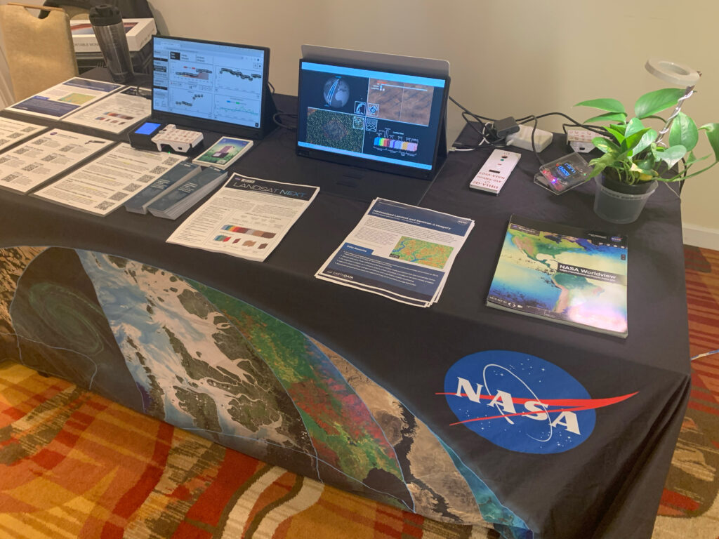
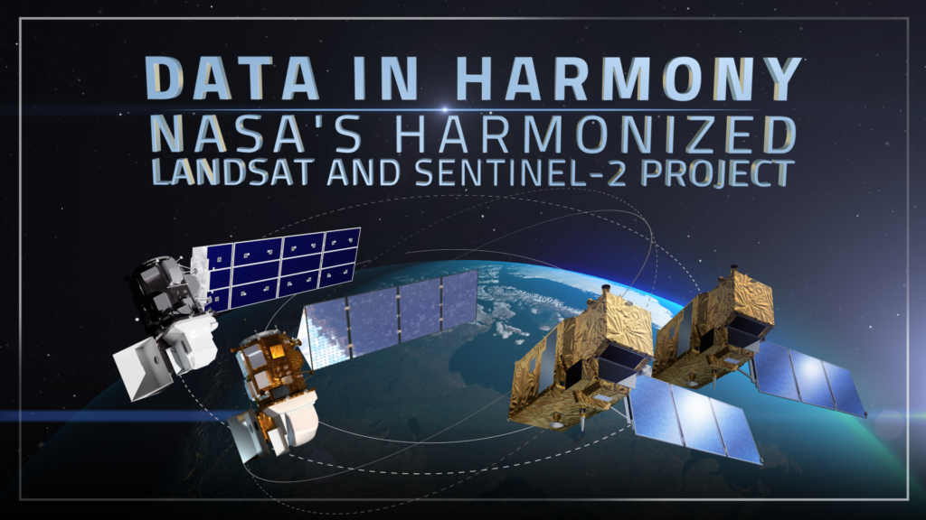
Jeff Masek [NASA’s Goddard Space Flight Center (GSFC)] followed with a status update on S2-Landsat integration. He highlighted how combining data from S2 with those from Landsat 7 and Landsat 8 offers 30-m (~98-ft) global coverage between 3 and 5 days, thereby providing the geographic coverage and temporal frequency required for many time-series-based applications in agriculture and forestry.
The 13 spectral bands of S2 offer additional opportunities for vegetation analysis, correction for atmospheric perturbations, and land classification. The U.S. Geological Survey (USGS) Earth Resources Observation Systems (EROS) Data Center plans to provide a copy of the complete archive of S2 data, and will be the source of data for the MuSLI team. The path ahead looks promising; an agreement between the European Commission and U.S. Department of State is in the process of being signed, which will allow the USGS S2 archive and distribution activities to proceed.
Radiometric Characterization and Calibration/Validation
This session included presentations from Brian Markham [GSFC]; Larry Leigh [South Dakota State University]; Jeff Czapla-Myers [University of Arizona]; and Aaron Gerace [Rochester Institute of Technology]. Markham presented an overview of the S2 and Landsat 8 characterization and cross-calibration. Compared to Landsat 8’s Operational Land Imager (OLI), S2’s Multispectral Instrument (MSI) has a wider swath and field-of-view, a shorter repeat cycle, comparable equatorial crossing time, and greater number of spectral bands. MSI also has a wider spectral response compared to OLI in the visible and near-infrared (VNIR) region.
Orbital analysis of S2 and Landsat 8 revealed that the pattern of intersections of Landsat 8 and S2 coverage repeats every 80 days. For example, if on day 1, Landsat 8 images location A on the ground at 10:13 AM at a 15° angle and S2 images the same location at 10:30 AM at a 20° angle, the same pattern of observation will be observed at the same location (location A) 80 days later (on day 81). Comparison of instrument coverage showed that in some swaths there is near-simultaneous data acquisition from both platforms with the same view angles, while for others the same view angle may be obtained a day apart.
For the continental U.S., S2 ground tracks move three orbital tracks to the east each day on the descending side. Comparative measurements of MSI solar diffuser witness samples and the ESA reference diffuser are being carried out at U.S. and ESA calibration facilities. Leigh gave an update on the pseudo-invariant calibration sites based on calibration of S2 and Landsat 8. He highlighted the need for Spectral Band Adjustment Factor (SBAF) and Relative Spectral Response (RSR) comparisons for sensor calibration. RSR comparisons showed that between S2 and Landsat 8, responses of some bands are very similar while others are quite different. For example, the red bands of the two sensors appear to have less spectral overlap when compared to other bands in the visible region, while spectral responses are more closely matched for NIR, short wave infrared (SWIR), and cirrus bands. Furthermore, S2 has multiple NIR bands.
Spectral Band Adjustment Factor compensation is necessary to evaluate true calibration differences. The SBAF was studied with reference to the spectral signature from targets used for calibrating the Hyperion imaging spectrometer onboard NASA’s Earth Observing-1 (EO-1) satellite. The SBAF correction was found to be more important for the Enhanced Thematic Mapper plus (ETM+) compared to OLI. As a result, an improved absolute calibration model was developed that can be applied to MSI, post-launch.
Czapla-Myers presented the plans for postlaunch radiometric calibration of MSI, proposed to be carried out at the Radiometric Calibration Test Site (RadCaTS) in central Nevada. RadCaTS is presently used to calibrate sensors, such as the ETM+, OLI, Moderate Resolution Imaging Spectroradiometer (MODIS), Multi-angle Imaging SpectroRadioeter (MISR), Advanced Spaceborne Thermal Emission and Reflection Radiometer (ASTER), Visible Infrared Imaging Radiometer Suite (VIIRS), Hyperion, RapidEye, and WorldView-3.
Gerace discussed the development of the Digital Imaging and Remote Sensing Image Generation (DIRSIG) model to facilitate cross-calibration between sensors and data normalization studies in support of S2–Landsat 8 calibration efforts. DIRSIG allows scene content, atmospheric opacity, and instrument performance to be specified, thus providing “synthetic” imagery from multiple sensing systems. Harmonizing Sentinel-2 and Landsat Reflectance Products and Bidirectional Reflectance Distribution Function. This session included presentations from Martin Claverie [University of Maryland, College Park (UMD)]; Eric Vermote [UMD]; Curtis Woodcock [Boston University]; Crystal Schaaf [University of Massachusetts]; and David Roy [South Dakota State University].
Claverie provided an overview of the processing flow of the Harmonized Landsat Sentinel-2 (HLS) surface reflectance prototype products. The processing flow includes MSI and OLI atmospheric corrections, cloud masking algorithms, bidirectional reflectance distribution function (BRDF) and bandpass adjustment (for MSI only), and regridding of merged products. The planned HLS output product has a spatial resolution of 30 m (~98 ft) for OLI data, gridded in sinusoidal projection and a temporal resolution of approximately five days also in sinusoidal projection.
MSI spectral bands that overlap with those from OLI will be adjusted, and the red-edge bands from MSI and the thermal band from OLI will be maintained in the output HLS product. Vermote presented the MSI and OLI prototype atmospheric correction algorithm. The algorithm relies on recent improvements made to the MODIS Collection 6 surface reflectance product, and takes advantage of the additional coastal/aerosol blue band that was missing in previous Landsat sensors. Aerosol optical thickness (AOT) is retrieved at 30-m (~98-ft) spatial resolution using a spatially explicit map (derived from MODIS and MISR data analysis) of the ratio between the two blue bands and the red spectral bands. Some adjustments with respect to cloud and cloud shadow and retrieval over water remain to be implemented in the developing algorithm. The standard algorithm is performing well for Landsat 8 surface reflectance (SR) and will be used to process synthetic MSI data.
Woodcock spoke on the utility of the Landsat and S2 bands in developing cloud-masking algorithms. He stated that improved cirrus cloud-detection algorithms will lead to better land-cover classification maps. He showed how cirrus clouds affect spectral reflectance in different regions of the spectrum. A comparison of cloud masks developed using each sensor showed that Landsat 8 and S2 performed far better than legacy Landsat sensors.
This is because Landsat 8 with all three cloud-detection bands (optical, thermal, cirrus) performs better than S2, which has two cloud-detection bands (optical and cirrus). Legacy Landsat satellites (i.e., Landsats 4-7) with two cloud-detection bands (optical and thermal) perform the worst.
Use of temporal information further improved the cloud masks. Schaaf introduced the issue of BRDF effects that may affect the interuse of OLI and MSI SR products. The Landsat 8 albedo product algorithm and validation scheme were presented. OLI high-resolution surface albedo is based on OLI reflectances coupled with a priori BRDF information retrieved from MODIS products; the same strategy can be adopted for MSI.
Claverie presented an evaluation study on high-spatial-resolution BRDF retrieval method using multi-angular SPOT4 (Take5) data. Roy discussed the gridding, projection, and compos-iting issues for the HLS product. Sinusoidal equal-area projection and inverse mapping, as used in the NASA-funded web-enabled Landsat Data (WELD) project, were found to be most suitable.
The use of nearest-neighbor resampling was suggested to preserve the categorical and ordinal per-pixel quality assurance information after reprojection. The MODIS-tiling scheme with the nested WELD-tiling scheme seems most suitable for the merged product. The compositing algorithm will be similar to Global Version 3.0 WELD processing flow, which incorporates use of BRDF adjustment factors.
Higher-Level Processing and Product Generation
This session included presentations from Chris Justice [UMD] and Sangram Ganguly [NASA’s Ames Research Center]. Justice presented an overview of the potential higher-level products that could be generated from S2 and Landsat data. He pointed out that higher-level products for use in land-cover science are generated using MODIS imagery, but no such products have been generated from Landsat imagery.
However, with increased acquisitions and available high-end computer processing, the concept of “global” Landsat data—i.e., with MODIS-like data products at 30 m (~98 ft)—is becoming a reality, and so these are indeed exciting times for the remote sensing community.
In the international context, the requirements for Essential Climate Variables (ECV) have been developed for products with coarse resolution ranging from 250 m to 1 km (~820 to 3280 ft). Land cover is perhaps the only ECV that is available at finer resolution between 10 and 30 m (~32 and 98 ft). Moderate-resolution imagery at higher temporal frequency is necessary to observe rapidly changing land conditions.
Combining data from Landsat 8 and S2 satellites offers an opportunity for more-frequent observations. Other opportunities include merging data from Landsat 8 with data from similar spatial-resolution sensors like those onboard the China-Brazil Earth Resources Satellite (CBERS 4), Indian Resourcesat 2, and ESA’s Sentinel-1A. Some of the higher-level products that may be developed from S2–Landsat 8 fusion include: a generic, uninterpreted change product; forest-cover change products; vegetation phenology products; leaf area index (LAI)/fractionally absorbed photosynthetically available radiation (FPAR); fire and burned area products; agricultural products (e.g., crop type, crop condition, crop residue); flooding extent; urban characterization; and built-area change.
Justice recommended that product developers exercise caution when merging datasets from different sensors, since fusion approaches are still new. Ganguly discussed the role of NEX in S2 processing flow and presented a comparison between simulated S2 and Landsat 8 with respect to red and NIR reflectance, normalized difference vegetation index (NDVI), and LAI.
Session I Summary and Conclusion
Jeff Masek led a summary discussion following the presentations. Some of the issues raised for discussion were:
• the need for more dialogue between the research communities at NASA and ESA;
• the confusion potential for multiple versions of S2 products; and
• agreement on the resolution of the merged products, compositing method, and the role of EROS vs. NEX in S2 data distribution.
Concerns were raised regarding the schedule for the S2 archiving at EROS, and data availability and the phased geographic extent of S2 acquisitions. The community members noted that there was no similar Landsat 8–S2 fusion product developed from the European side, which offers considerable potential for collaboration.
The team recommended that a series of technical telecons and meetings be held once the S2 data acquisitions begin and as project funds are set up. Garik Gutman closed the session with a remark that a white paper needs to be developed by August-September to facilitate more interaction and as a framework for ongoing research.
Session II
Contributions of Remote Sensing to LCLUC Modeling and Scenarios
Garik Gutman gave an update on the current status of the program and briefly introduced how NASA’s LCLUC Program relates to the NASA Carbon Cycle and Ecosystems Focus Research Area meeting. He pointed out that among the international and regional LCLUC-supported networks, a new program focused on LCLUC research in South Asia, called the South Asian Research Initiative (SARI), and the NASA-ESA international MuSLI Science Team was formed since the last meeting.
He also noted that previously supported networks [the Northern Eurasia Earth Science Partnership Initiative (NEESPI) and Monsoon Asia Integrated Regional Study (MAIRS)] are moving into the Future Earth frame-work. He highlighted the significance of the recently published National Research Council’s (NRC) report, Advancing Land Change Modeling: Opportunities and Research Requirements, which was partly supported by the NASA program and the USGS.
He strongly encouraged both LCLUC and MuSLI PIs to promote their research by sharing their products with the broader LCLUC com-munity through the newly formed Metadata section of the LCLUC website, as well on their individual project websites. In terms of outreach activities, the LCLUC Science Team has been interacting with the broader community through knowledge dissemination via online webinars, a Facebook page, and by publishing a new, quarterly newsletter.
With the backdrop of the much-discussed S2–Landsat 8 synergy and higher-level product generation in Session I, Ioannis Manakos [EARSeL5 Special Interest Group on Land Use and Land Cover—Chairman] spoke on existing and potential areas of European collaborations with NASA’s LCLUC Program, and highlighted current priorities on the European side. He emphasized how societal- and policy-driven studies funded in Europe are driving Earth-observation requirements and how, in return, Earth-observation data are increasingly being used to inform policy.
He acknowledged that NASA’s Earth-observation products are freely available and that historically the Landsat archive has played a significant role in supporting Earth-observation research in Europe. The first joint workshop of the EARSeL Special Interest Group on Land Use and Land Cover and NASA’s LCLUC Program was held in Berlin in March 4 Future Earth is an international hub to coordinate new, interdisciplinary approaches to research on three themes: dynamic planet, global sustainable development, and transformations towards sustainability 2014, and there is interest to continue these collaborative interactions. For more information, visit www.futureearth.org. EARSel stands for European Association of Remote Sensing Laboratories.
Chris Justice followed with an outline of the objectives of the LCLUC meeting and agenda. The meeting was divided into four sessions: Contribution of Remote Sensing to LCLUC Modeling and Scenarios, Regional Program Development in Southern Asia (SARI), Early Career Scientists Reporting on their Research Results, and Discussion of Research Priorities for Remote Sensing in LCLUC Modeling and Scenarios.
Dan Brown [University of Michigan] highlighted the role of remote sensing in establishing LCLUC baseline and boundary conditions, expanding variables and measures, and enhancing land-change process models. He emphasized integrating remote sensing data with socioeconomic data to transition to a process-based model, reflecting on the role of humans in land-use models as compared to biophysical modeling.
Richard Moss [Pacific Northwest National Laboratory, Joint Global Change Research Institute] summarized the U.S. Global Change Research Project (USGCRP) workshop on LCLUC scenarios. The Scenarios and Interpretive Science Coordinating Group of USGCRP held a workshop from June 25-27, 2014, that focused on subnational LCLUC scenarios, which identified gaps and challenges relating to inconsistencies in data; missing data; scaling issues in modeling and scenario development; understanding relationships across disciplines; and model integration issues.
Introduction to LCLUC Modeling and Scenarios in the U.S.
This session included presentations from Scott Goetz [Woods Hole Research Center]; Yuyu Zhou [Pacific Northwest National Laboratory, Joint Global Institute]; and Kelly Cobourn [Virginia Tech]. Goetz discussed the modeling strategies for adaptation to coupled climate and land-use change in the U.S. Of the four Representative Concentration Pathways (RCP) investigated, RCP 8.5 showed substantial changes in gross primary productivity (GPP) compared to RCP 4.5. Run-off was reported to be subtle for the U.S. on average, but subject to dramatic regional and seasonal variations.
Zhou described urban-expansion modeling scenarios. Using a cluster-based method to map urban areas using night light data, he developed a Global Urban Extent map. The map can be used to investigate future urban energy use under various scenarios of urban growth and climate change.
Cobourn showed how water rights, water source, and climate variability impact water availability, which in turn influences land allocation decisions. In the Snake River Basin in eastern Oregon and Idaho, for example, low or variable water availability was associated with sowing of drought-resilient crops (e.g., sugar beets) and with letting fields lie fallow. Irrigators who own senior surface-water rights allocated more land to water-intensive crops like alfalfa, while the junior surface-irrigators preferred more drought-resilient crops like sugar beets. The same effect was less pronounced among groundwater irrigators.
The LCLUC South Asia Regional Program
Krishna Vadrevu [UMD] introduced the newly established South Asia Research Initiative (SARI). The objective of SARI is to advance LCLUC science in the South Asian region and facilitate the development of new partnerships between the national and international space agencies, universities, and nongovernmental organizations; enhance data sharing mechanisms and development of regional LCLUC products; and build capacity.
A new SARI website is currently being constructed. A background document containing all relevant information has been developed and will be available from the website. The SARI is focused on the following broad areas: agricultural LCLUC, land-atmosphere interactions, urban LCLUC, and forests and LCLUC. In this connection, the current NASA LCLUC ROSES-2015 call has a focus on South Asia, and the next LCLUC international meeting is scheduled to be held in Myanmar in January 2016.
LCLUC Impacts in Northern Eurasia
This session included presentations from Kirsten de Beurs [University of Oklahoma] and Jessica McCarty [Michigan Technological University]. De Beurs discussed the significant role played by rural population density and ethnicity in Russia’s agricultural developments and global food security. Using MODIS surface phenology and Landsat land-cover data she investigated regional variation in agricultural patterns and related it to regional demographics. De Beurs concluded that regions in southern Russia show more variability in agricultural patterns than the regions in northern Russia due to adaptation measures by communities in the face of drought.
McCarty presented the relationship between fire regimes and land abandonment in European Russia, stating that she found more fires over stable nonforested areas due to the presence of hay and pastureland, and investigated the socioeconomic determinants of human-induced fires.
LCLUC Impacts in Asia and Pacific
This session included presentations from Stephen Leisz [Colorado State University] and Jason Julian [Texas State University]. Leisz showed how improved transportation routes along the Southeast Asian East-West Economic Corridor impact LCLUC in the region. He found that increased connectivity between countries led to changes in farming systems, rural urbanization, increased cross-border trade and increased tourism, all of which resulted in growth of residential and industrial built-up areas.
Julian focused on the impacts of land management on water quality across multiple scales in New Zealand. He showed the first-ever comparison of 8-day land-cover change at 30-m (~98-ft) spatial resolution with long-term water quality datasets. Comparison of the disturbance index from the above dataset, combined with water clarity data, showed that increased disturbance in the watershed leads to a decrease in water clarity.
LCLUC Impacts in Africa and Latin America
This session included presentations from Michael Coe [Woods Hole Research Institute]; Kelly Jones [Colorado State University]; Greg Husak [University of California, Santa Barbara]; Gillian Galford [University of Vermont]; and Tatiana Loboda [UMD].Coe discussed past transitions in LCLUC in the Cerrado—a vast tropical savanna ecoregion of Brazil—and modeled the future with respect to human and biophysical drivers of change and its impacts on the ecosystem. His research showed that policies favoring agricultural intensification over extensification may be more effective in meeting the dual objectives of reducing deforestation and meeting the global demands for agricultural products.
Jones showed how land cover and land use has changed between 1986 and 2010 in Montecristo Trifinio Trinational Park, a transboundary protected area in Central America. Currently, Jones and his research team are investigating the drivers of change and the effectiveness of the transboundary protected areas in conserving the forest cover.
Husak described the impacts of variable food availability on nutritional status in the context of climate change. For example, in West Africa, a decrease in crop production by 25% resulted in an increase in stunting growth in 34-38% children, while an increase in crop production resulted in increased births.
Galford presented the environmental and socioeconomic outcomes of the New African Green Revolution in Malawi. She showed how a fertilizer subsidy in Malawi led to improved yields and helped the nation progress towards their millennial development goals.
Loboda showed how global governance affects land-use decisions. In Subsaharan Africa, stronger capacity to aspire for development and poverty reduction was related to reductions in forest clearing. However, high-level aspirations for development and poverty reduction, when coupled with limited alternatives, were linked to potential species extinction.
Session II Summary Discussion
After the presentations in this session, Dan Brown moderated a concluding discussion. Prioritizing management inputs such as fertilizer applications and irrigation in remote sensing products was suggested. The need to divide forestland into well-defined categories for use in integrated assessments was also raised. The community also acknowledged the lack of knowledge on the role of climate variability, shocks, short-term drivers, and variability in long-term trajectories, as well as extreme events in LCLUC processes.
The absence of human factors in model parameters was also recognized as a gap that needs to be filled. Earth System Integrated Assessments lack the land-cover data needed to include human influence on scenarios. Remotely sensed disturbance datasets along with socioeconomic data could help to fill this gap. The issue of scaling remotely-sensed datasets to fit model temporal and spatial resolution was also raised. Downscaling and the need to constrain models were identified as a priority area.
Currently there is no established methodology to scale 30-m (~98-ft) pixels for large-scale models. Both the remote sensing and modeling communities need to work together to develop robust methods to address this topic. Validation of models was recognized as another problem area, with very limited attention currently given to model validation.
Categorical differences in land cover complicates the task of validation. Information on land-management boundaries is either lacking or outdated. In the absence of adequate time-series of land-cover data needed to initialize models, models struggle with initial depiction of land cover.
Moreover, the uncertainty in some land-cover products, such as LAI or MODIS GPP, further complicate the problem. Land-surface models are known to perform poorly in Northern Eurasia with respect to GPP and ecosystems. The lack of historical time-series, e.g., 400-500-year-old data, not available through remote sensing, was identified as another gap.
The creation of consistent multi-decadal LCLUC products from remote sensing is a high priority that needs to be addressed through future continuity missions and international cooperation.
Concluding Discussion
Chris Justice led a wrap-up discussion, addressing the gaps in remote sensing products to provide an input to modeling. Filling the gaps would require the combined effort of both the remote sensing and the land-cover/land-use modeling communities, working together to develop community-level models. This calls for larger group-level funding, as previously seen in the Interdisciplinary Science (IDS) investigators, funded as part of NASA’s Earth Observing System.
Apart from NASA, other organizations—like the U.S. Department of Agriculture, the U.S. Forest Service, the U.S. Department of Energy, and other organizations that benefit from land-use modeling research—might be brought together, for example, under the rubric of the U.S. Global Change Research Program (USGCRP) to expand support for such interdisciplinary studies.
Presently, a lot of organizations use land-use models and end-user products in their research, but few are willing to invest in a much needed “community model” development effort. Integrating social science with remote sensing has always been a value-added dimension in NASA’s LCLUC Program. Availability of high-resolution data free of charge from the National Geospatial-Intelligence Agency (NGA) has added stronger impetus to study social processes at higher resolutions than ever. Justice encouraged industry-university partnerships to promote LCLUC research.
Further Information:
+ Land Cover / Land Use Change Program


