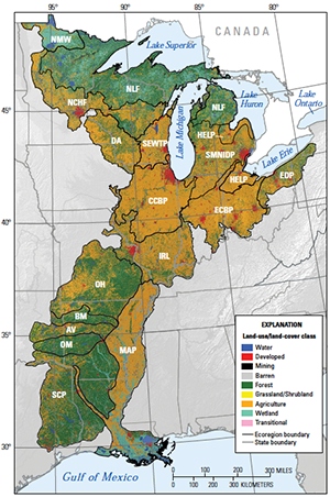

The Midwest–South Central United States is one of four major regions of the conterminous United States that were studied in the U.S. Geological Survey’s “Status and Trends of Land Change” study. This research activity provides a holistic appraisal of contemporary land-use/land-cover change across the nation, filling a research niche that could not be supported by current resource inventories that are based on thematic land categories and ownership (Loveland and Acevedo, 2006). The U.S. Geological Survey, supported by the U.S. Environmental Protection Agency and the National Aeronautics and Space Administration, initiated the “Status and Trends of Land Change” study to better understand the spatial and temporal dimensions, as well as the consequences, of national land-use and land-cover change in the late 20th century (Loveland and others, 2002).
Abstract
U.S. Geological Survey (USGS) Professional Paper 1794–C is the third in a four-volume series on the status and trends of the Nation’s land use and land cover, providing an assessment of the rates and causes of land-use and land-cover change in the Midwest–South Central United States between 1973 and 2000. Volumes A, B, and D provide similar analyses for the Western United States, the Great Plains of the United States, and the Eastern United States, respectively. The assessments of land-use and land-cover trends are conducted on an ecoregion-by-ecoregion basis, and each ecoregion assessment is guided by a nationally consistent study design that includes mapping, statistical methods, field studies, and analysis. Individual assessments provide a picture of the characteristics of land change occurring in a given ecoregion; in combination, they provide a framework for understanding the complex national mosaic of change and also the causes and consequences of change. Thus, each volume in this series provides a regional assessment of how (and how fast) land use and land cover are changing, and why.
The four volumes together form the first comprehensive picture of land change across the Nation.
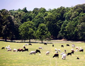
Geographic understanding of land-use and land-cover change is directly relevant to a wide variety of stakeholders, including land and resource managers, policymakers, and scientists. The chapters in this volume present brief summaries of the patterns and rates of land change observed in each ecoregion in the Midwest–South Central United States, together with field photographs, statistics, and comparisons with other assessments. In addition, a synthesis chapter summarizes the scope of land change observed across the entire Midwest–South Central United States. The studies provide a way of integrating information across the landscape, and they form a critical component in the efforts to understand how land use and land cover affect important issues such as the provision of ecological goods and services and also the determination of risks to, and vulnerabilities of, human communities. Results from this project also are published in peer-reviewed journals, and they are further used to produce maps of change and other tools for land management, as well as to provide inputs for carbon-cycle modeling and other climate change research.
Reference:
Auch, R.F., and Karstensen, K.A., eds., 2015, Status and trends of land change in the Midwest–South Central United States—1973 to 2000: U.S. Geological Survey Professional Paper 1794–C, 190 p., http://dx.doi.org/10.3133/pp1794C.
For additional information, contact:
U.S. Geological Survey
Earth Resources Observation and Science (EROS) Center
47914 252nd Street
Sioux Falls, SD 57198-0001
http://eros.usgs.gov/


