
Consider Leonardo da Vinci’s sketches and models of his ingenious flying machines. Naturalist John J. Audubon’s detailed paintings of North American birds. Maps meticulously penned by ancient—and modern—cartographers. And stunning images of the Earth’s surface taken by orbiting satellites. Thirty-seven such images form the new Earth as Art 4 (EAA4) collection, USGS’s most recent installment of its Earth as Art exhibits.
Landsat and Land Change
Earth-observing Landsat satellites capture hundreds of images of the planet’s surface every day. Their primary purpose is a scientific one: document the condition of the Earth’s land areas, day after day and year after year, to help reveal how those areas are changing over time. The vast Landsat archive, maintained at the USGS Earth Resources Observation and Science (EROS) Center, is an unparalleled digital record of how continents, islands, and coastlines have been altered as a result of natural and human impacts since 1972.
A Unique Perspective
From their vantage point in space, Landsat satellites view the Earth in ways we cannot. They see geographic features—deserts, mountains, river valleys, glaciers—from a very different perspective than ours down here on the ground. Furthermore, their sensors detect particular wavelengths, or bands, of both visible and invisible (infrared) light.
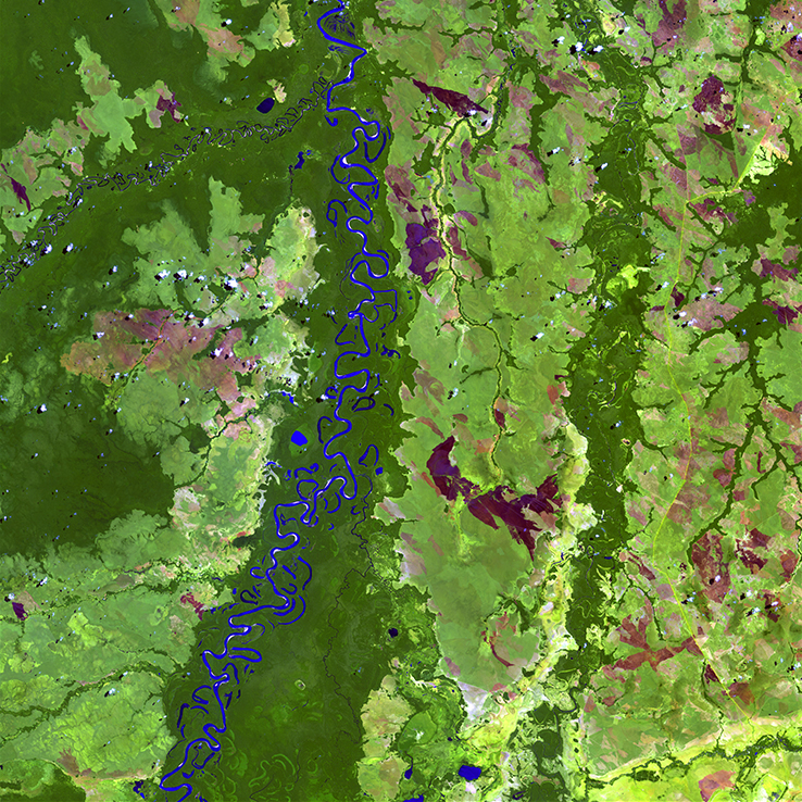
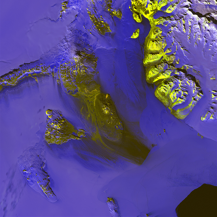
It’s when different bands are combined in Landsat images that a sort of magic can take place. Striking patterns, colors, and shapes emerge from nature, transforming an image of a section of the Earth’s surface into what more closely resembles a gorgeous work of abstract art.
From Inspiration to Exhibition
That is precisely how the Earth as Art exhibits got their start. Back in the late 1990s and early 2000s, staff at the EROS Center tasked with image calibration began collecting Landsat images that struck them as extraordinary.
“Every once in a while we’d see an image that was so amazing, so remarkable, that we started squirreling them away,” said EROS engineer Jon Christopherson, who was part of that group. “We wrote them to CDs back then, and it wasn’t long before we had a drawer full of spectacular images.”
So spectacular, in fact, that it seemed a shame not to somehow display them. One brainstorming session led to another until the first Earth as Art exhibit became a reality in 2002. Initially, the images—24” x 24” framed prints—were displayed at local venues. Then the EAA exhibit headed to USGS Headquarters in Reston, VA. More exposure led to more venues, ranging from Capitol Hill and the Library of Congress to museums and universities across the nation, and, ultimately, to other countries as well.
EAA4
That first Earth as Art exhibit was succeeded by Earth as Art 2 (EAA2), which featured images captured by Landsat 7, the MODIS sensor aboard NASA satellites Terra and Aqua, and the ASTER sensor on Terra. EAA3 followed a few years later, with images taken by Landsat 5 and 7.
All the images in EAA4 were acquired by Landsat 8, the most recent Landsat program satellite that was launched by NASA in 2013. Released online in late March 2016, the entire collection can be accessed and downloaded at the Earth as Art 4 website. In keeping with tradition, the collection has also been produced as a traveling exhibit, with its first venue being USGS Headquarters.
What do YOU See?
As with previous Earth As Art exhibits, the EAA4 images were selected solely for their aesthetic appeal rather than any role they might play in scientific research. Many have been digitally manipulated to enhance color variations or details.
We invite you to explore these “masterpieces” for yourself. You’ll see images that may remind you of faces or familiar patterns, ancient mosaic panels or stained glass, and perhaps the canvases of Impressionist painters who worked in broad strokes of oil, acrylic, and pastel.
As with all art forms, however, beauty—and interpretation—is in the eye of the beholder. One thing is certain, though: the images of EAA4 offer singular views of our magnificent planet.
Related Reading:
+ USGS Landsat
+ NASA Landsat
+ Landsat: Continuing to Improve Everyday Life
+ Landsat Seen as Stunning Return on Public Investment

Scenes from the Polar Night
Landsat satellites have begun regularly acquiring images of ice at the poles during the winter, with enlightening results.


