Search
Close this search box.

NASS Releases 2013 Geospatial Data for U.S. Crops

NASS Releases 2013 Geospatial Data for U.S. Crops

CropScape map [Source: USDA] The U.S. Department of Agriculture’s (USDA) National Agricultural Statistics Service (NASS) updated its online geospatial exploring tool, CropScape, adding Cropland Data Layers from crop year 2013. This tool gives public an easy access to interactive visualization, geospatial queries and dissemination without the need to download specialized software.
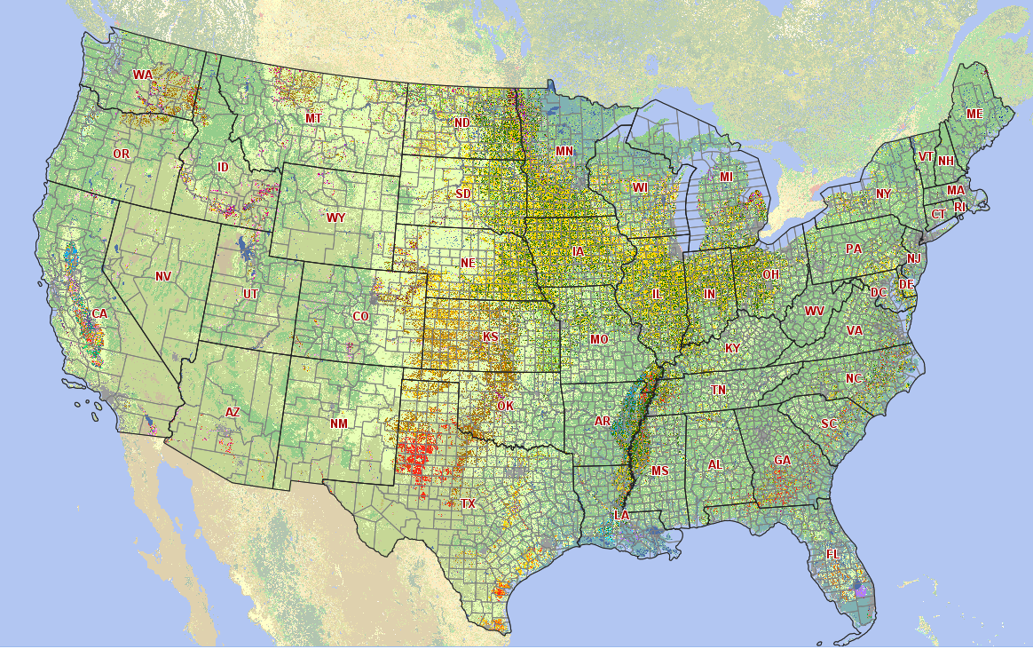
These new Cropland Data Layer products, which are derived from satellite image observations at 30-meter (0.22 acres per pixel) resolution, help users visualize U. S. crop planted area during the last calendar year. Three earth observing satellites were used for the production of this product, including; the newly launched Landsat 8, and Disaster Monitoring Constellation’s Deimos-1 and UK2.
NASS developed CropScape in cooperation with the Center for Spatial Information Science and Systems at George Mason University in Fairfax, Va. This tool is available online.

On Key

Recent Posts

STELLA Photos

STELLA Spring Webinar: April 15, 2024

STELLA users will talk about their experiences using the DIY spectrometer during this webinar. Panelists include Bianca Cilento (RIT), Karen Karker (SUNY), and Peder Nelson (OSU and NASA GLOBE Observer).

Read More »
On Key

Related Posts

STELLA Photos

STELLA Spring Webinar: April 15, 2024

STELLA users will talk about their experiences using the DIY spectrometer during this webinar. Panelists include Bianca Cilento (RIT), Karen Karker (SUNY), and Peder Nelson (OSU and NASA GLOBE Observer).

Read More »