
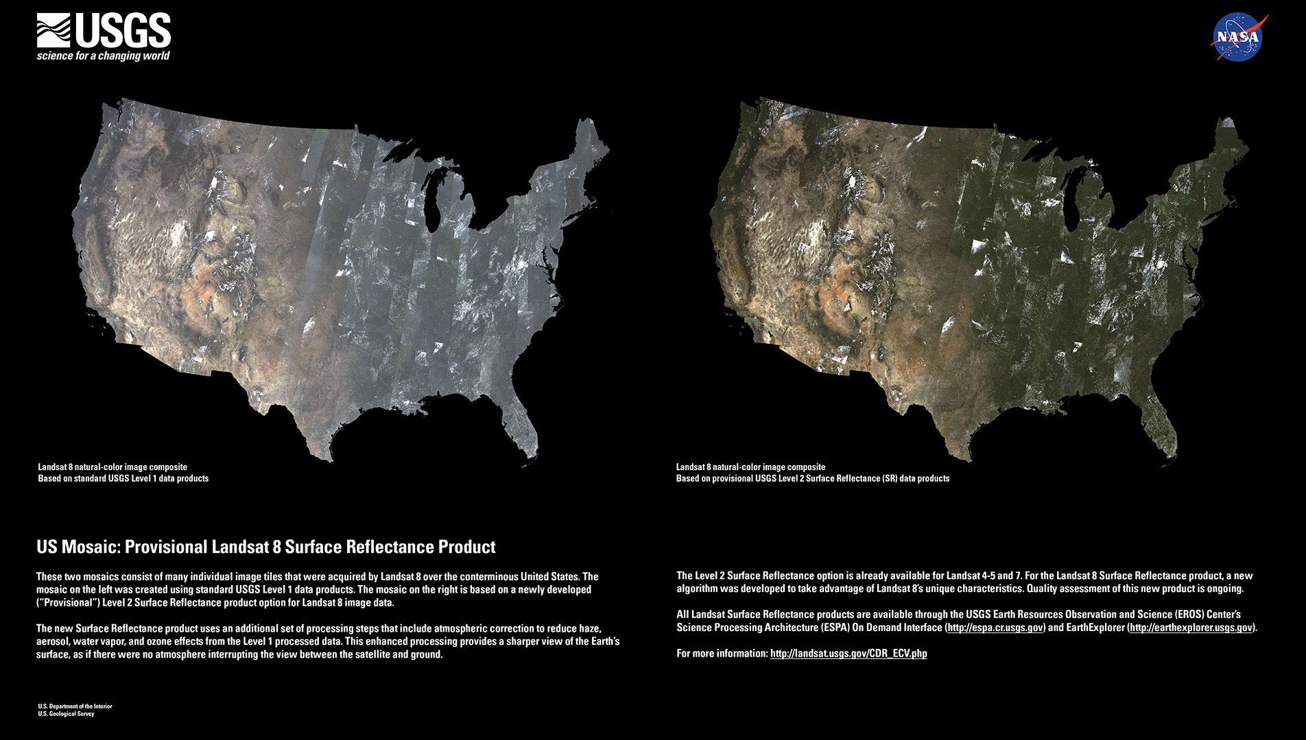
USGS released provisional Landsat surface reflectance products in December. Surface reflectance products correct for atmospheric distortions thereby providing “less hazy” images.
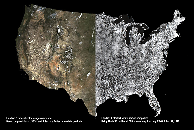
To visually demonstrate the difference, USGS created Landsat image mosaics of the U.S. before and after the data were atmospherically corrected—i.e. converted from “top of atmosphere” reflectance to surface reflectance.
Today, mosaics like these can be made relatively quickly with computers, but that wasn’t always the case.
The First Landsat Photomosaic of the Lower 48
In 1973, NASA geologist, Dr. Nicholas Short conceived the notion of using Landsat 1 images to create a large Landsat photomosaic of the contiguous U.S. for the first time.
So in 1974, using 595 single band (black and white) Landsat 1 images, the aerial photo lab at the U.S. Department of Agriculture’s Soil Conservation Service Cartographic Division created a 10 foot by 16 foot mosaic (at a scale of 1:1,000,000). The process involved a lot of photographic image processing to turn the Landsat data into photographic prints and then careful mosaicking by hand. All of the nearly cloud-free Landsat 1 images were collected between July 25 and Oct. 31, 1972 in the satellite’s first few months of operation.
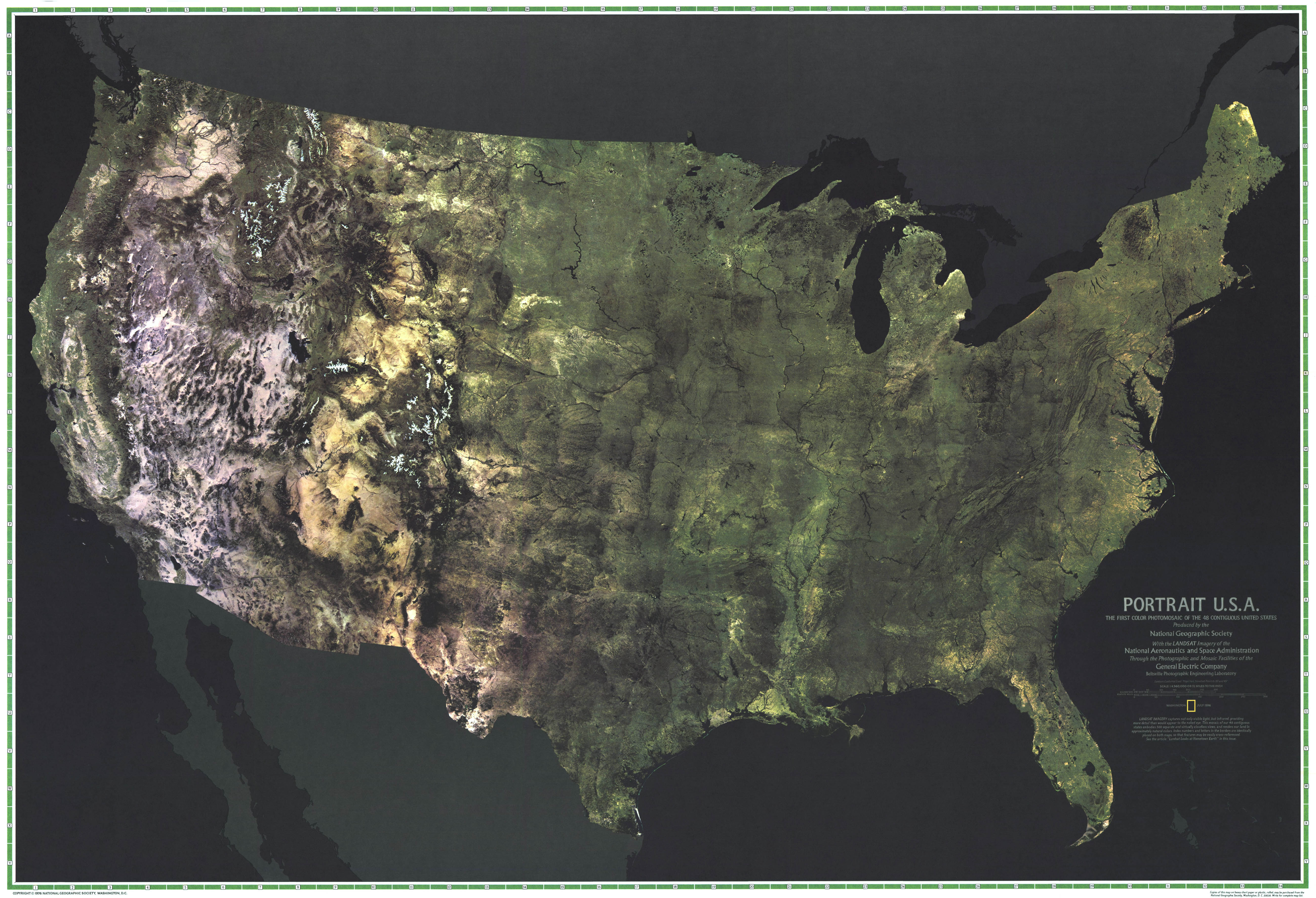
After the black and white U.S. mosaic image was completed, a more ambitious color (RGB composite) mosaic was created by General Electric’s Beltsville Photographic Engineering Laboratory in 1976 using 569 nearly cloud free false-color infrared images. The GE lab sorted through some 30,000 Landsat 1 and 2 images to select the clearest available images—mainly collected during spring, summer, and fall (to consistently use images in which trees had leaves).
National Geographic Magazine used the same Landsat scenes, but a “pseudo-natural” color composite (Red = red band, Green = green band, Blue = infrared band) to create a large color composite that was featured in its U.S. bicentennial issue in July 1976 as a large fold-out map titled “Portrait U.S.A”.
Big Country
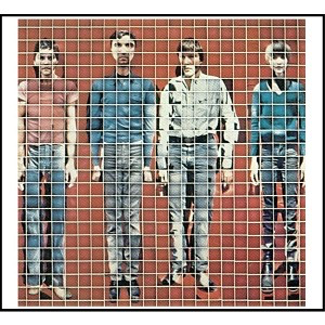
Two years later in July 1978, band Talking Heads released their More Songs About Buildings and Food album featuring a version of the Landsat color composite on its backside—fitting considering that their song “Big Country” is on this album. On the frontside of the album, the band created a composite photo of themselves using over 500 polaroid photos.
Here are their liner notes on the Landsat composite:
The back cover is a reproduction of “Portrait U.S.A.”, the first color photomosaic of the United States. It is made up of 569 photos taken from space by the Landsat satellite.
Each photo in the mosaic is made up of four separate photos of different parts of the light spectrum: Green, Red, and two different Infra-red regions. These light regions were chosen because they help bring out the differences in geographical forms and types of vegetation.
Each image is made up of many scan lines, much like a T.V. picture… analog information is converted to digital information and then transmitted to various ground receiving stations. This information is then converted into a black-and-white picture corresponding to each spectral region. These can then be combined to make the color pictures that are used in this mosaic.
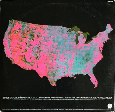
In the version reproduced on the cover, the information from the green spectral region is printed as yellow, the red region is printed as magenta, and the infrared region is printed as cyan. This is called a false color image. In this version vegetation appears as turquoise, rocks and soil appear as red, yellow, brown, and towns, roads, and water appear as black. Objects as small as 33 feet are visible on the Landsat photos if the object is in contrast to its environment. The practical applications of the Landsat photos are many, some of which are forest-fire damage, regional planning, assessment of land use: Which crops are being grown where, mapping of ice for shipping, mapping and detection of air and water pollution, and monitoring surface mining.
Portrait U.S.A. is copyrighted by the General Electric Co., 1976. It was produced by their Beltsville Photo Engineering Lab with the assistance of the National Geographic Society and the National Aeronautics and Space Administration.


