
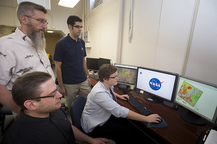
The Idaho Disasters III Project Team working at ISU’s GIS Training and Research Center, one of only eight regional NASA DEVELOP Nodes in the United States, created reliable map images that BLM managers can use to identify cheatgrass infested areas. The map covers a large swath of eastern Idaho.
The researchers have been using new imagery collected by the Landsat 8 satellite, a collaboration between NASA and United States Geological Survey, which was launched in February 2013.
“By using Landsat 8 imagery, and classification tree analysis, which is an advanced artificial intelligence routine, we have been able to construct a reliable classification system to identify cheatgrass infestations that is accurate,” said Keith Weber, director of the ISU GIS Center. “This has implications for fire susceptibility. Cheatgrass is driving wildfire on rangelands and we need to identify areas that have heightened susceptibility to wildfire.”
The new maps have a variety of uses. Land managers can use this type of information to plan prescribed fires, fuel treatments, and other wildfire prevention/rehabilitation programs. In addition, the models may be used to assess the overall land health.
“These images are incredibly helpful for us,” said Shelli Mavor, fire ecologist for the BLM Pocatello Field Office. “We can use this tool for burn recovery and habitat restoration. This will also be a very useful tool for sage grouse habitat rehabilitation and planning.”
Jeff May, the lead on this DEVELOP project, gave a project presentation this July in Washington, D.C. at the NASA Applied Science Application Showcase, which highlights NASA DEVELOP achievements.
“One of the main objectives of the NASA DEVELOP program is to take NASA technologies and find ways that land managers can apply them to make better land management decisions,” May said. “And we feel like we succeeded with this project.”
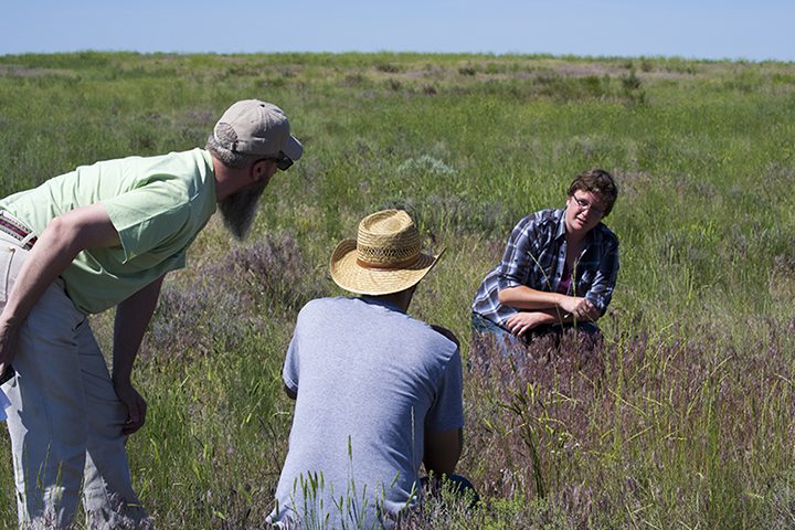
Simpson will take the lead on the next NASA DEVELOP project at ISU, which will be a two-term, 20-week project using high resolution images and geospatial technologies to look at juniper encroachment on public lands and how juniper stands have changed over time. That project will be started this fall and finished next spring.
“We are working hand-in-hand on these projects with ISU and NASA,” said the BLM’s Mavor. “They are coordinating with us about what would be the most useful projects using remote sensing for planning purposes. I am really excited to use the models created from the cheatgrass project and am excited about the next project on juniper encroachment mapping.”
The juniper encroachment mapping project will include input and participation by the Idaho Department of Fish and Game’s Mule Deer Initiative as well.
A presentation of the cheatgrass project was held Aug. 6 at the ISU GIS Training and Research Center, ISU Pocatello campus. The official title of the research project is “Idaho Disasters III Project Team – Using Landsat 8 Earth Observations to Identify Increased Fire Susceptibility Due to Invasion of Cheatgrass (Bromus tectorium).”
Further reading:
+ A Burnin’ Range of Fire: Wildfire Susceptibility and Fuel in Idaho
Video:

Data in Harmony: NASA’s Harmonized Landsat and Sentinel-2 Project
NASA’s Harmonized Landsat and Sentinel-2 (HLS) project is a groundbreaking initiative that combines data from Landsats 8 & 9 with the European Space Agency’s Sentinel-2A & 2B satellites.


