
Presentation Title:
An automated algorithm for producing land cover information from Landsat surface reflectance data acquired between 1984 and present
What are the major findings of your research?
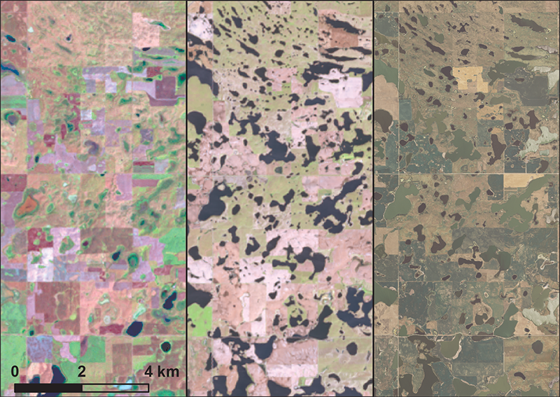
Incorporating data from the Landsat archive provides an opportunity to assess long-term changes occurring on the surface of the earth. Our automated approach requires fewer resources to extract information from Landsat data. For example, the changing size of lakes and wetlands through the seasons and years provide insight into how the surface waters are connected to ground water, nearby streams, rivers, or other lakes and wetlands. Land cover information, including land use change, drought and moisture data, are useful for understanding why surface water extents change over time.
What insight did you gain from Landsat that would have been impossible to glean otherwise?
Assessing land cover change, especially the dynamics of smaller water bodies, requires spatial resolution and temporal frequency that are currently only available from the Landsat program. The continuation of the Landsat program will increase the data quantity available for analysis.
Do you see open data and open source software as important elements of realizing the potential of Earth observation data to provide societal benefits and enable environmental stewardship?
Absolutely! In order to fully utilize the data archive, open data and procedures for processing data are required for land managers to make better-informed decisions.
What are some of the potential applied uses of your data product?
In the future, the approach will be applied in large regions to help explain how lakes and wetlands respond to land use, climate, and permafrost change.
Co-authors:
Martin Goldhaber
USGS-Denver Federal Center
Cheryl Holen
Stinger Ghaffarian Technologies (SGT, Inc.)
Ray Dittmeier
Stinger Ghaffarian Technologies (SGT, Inc.)
Steve Wika
Stinger Ghaffarian Technologies (SGT, Inc.)
Daniel Steinwand
USGS Earth Resources Observation and Science Center
Devendra Dahal
Stinger Ghaffarian Technologies (SGT, Inc.)
Brian Tolk
Stinger Ghaffarian Technologies (SGT, Inc.)
Robert Quenzer
Stinger Ghaffarian Technologies (SGT, Inc.)
Kurtis Nelson
USGS Earth Resources Observation and Science Center
Bruce Wylie
USGS Earth Resources Observation and Science Center
Michael Coan
Stinger Ghaffarian Technologies (SGT, Inc.)
Anyone can freely download Landsat data from the USGS EarthExplorer or LandsatLook.
Further Reading:
+ Landsat at #AGU15

Scenes from the Polar Night
Landsat satellites have begun regularly acquiring images of ice at the poles during the winter, with enlightening results.


