
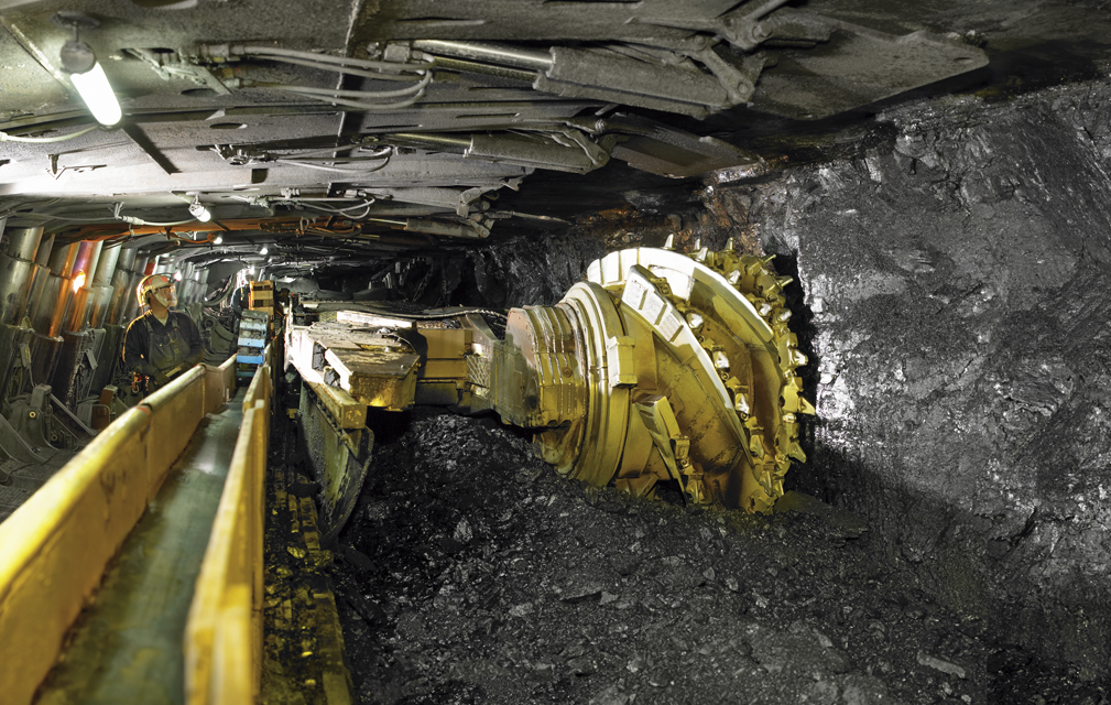
Longwall mining is a method of carving “hallways” into underground coal seams and then mining long corridors of coal adjacent to the hallway. As the coal is mined and carried away via conveyer belt to the surface, the ceiling above the mined coal collapses. This can cause subsidence on the surface. Erin Pfeil-McCullough, a graduate student at the University of Pittsburgh, gave a talk at #AGU15 today on insights that she has gained from her research to determine what impacts longwall mining has on forest canopies above as the ground subsides and local hydrology is altered.
Presentation title:
Assessing mining impacts utilizing a Landsat derived vegetation moisture index to characterize impacts of longwall subsidence on forest ecosystems
What are the major findings of your research?
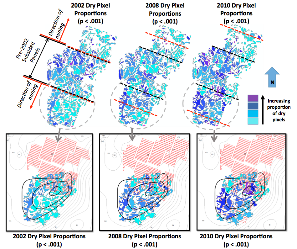
Longwall coal mining impacts to soil and forest canopy moisture are poorly characterized and difficult to observe, particularly in humid climates. My research demonstrates that remote sensing of tree canopies can detect changes in canopy and soil moisture conditions following mine subsidence. We examined the relative canopy dryness of forest pixels and analyzed changes in the number of relatively dry pixels for 64 forest patches in southwestern PA. The changes in tree canopy moisture patterns detected seem to be related to the depth of the coal seam under the patch.
What insight did you gain from Landsat that would have been impossible to glean otherwise?
The use of Landsat imagery provided historical data that made possible the assessment of areas that had been impacted by historical mining activity. Moreover, derivation of the NDMI (normalized difference moisture index) vegetation index from Landsat imagery enabled quantification of hydrological changes at a broad landscape scale not possible with available or even feasible ground based hydrological data.
Do you foresee any possible applied outcomes of your research?
While changes in canopy moisture are expected following longwall mining, they have not necessarily been quantified at this scale. The patterns detected are consistent with the empirical science of longwall mining—the shallower the coal seam, the more intense the hydrological changes. However, even in the most stringently regulated longwall mining fields, canopy and soil moisture are not monitored. Longwall mining will continue in the eastern U.S. for the foreseeable future; these results show that our developed methodology could serve as an additional tool for assessing shallow-coal longwall mining impacts.
Co-author:
Daniel Bain
University of Pittsburgh Pittsburgh Campus
Anyone can freely download Landsat data from the USGS EarthExplorer or LandsatLook.
Further Reading:
+ Landsat at #AGU15


