

Presentation title:
New Products for Near Real-Time Enhanced Landslide Identification and Precipitation Monitoring
What are the major findings of your research?
Landsat 8 can be used to map landslides and changes in bare earth in the Himalayan region in near-real time using optical and infrared sensors.
What insight did you gain from Landsat that would have been impossible to glean otherwise?
The public availability of a sensor with high spatial and temporal resolution makes it possible to create a free and easy to use product that is open to the public globally. This product will help researchers create customized landslide catalogs to help identify landslides much more quickly than visual inspection and in an iterative mode that is not available using most classification software while also being available across operating systems.
How will your research help the inhabitants of Nepal and the Himalayan region?
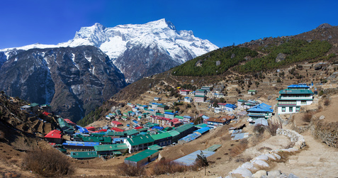
Nepal is a hotspot for rainfall induced landslide activity due to its mountainous topography, monsoon rains, and building practices that often weaken surrounding terrain. The Sudden Landslide Identification Product (SLIP) takes advantage of spectral change properties of vegetation, minerals, and ground wetness in near-real time to identify landslides and possible changes in bare earth that may be indicators of future landslides. By automating landslide event detection in a simple cross platform capacity, SLIP has the capability to improve landslide susceptibly mapping and has the ability to advance emergency response and preparedness efforts.
Co-authors:
Aakash Ahamed
Boston College
Jessica Fayne
University of South Carolina Columbia
Amanda Rumsey
SSAI/NASA DEVELOP
Anyone can freely download Landsat data from the USGS EarthExplorer or LandsatLook.
Further Reading:
+ Nepal earthquake caused fewer landslides than feared, Nature
+ Taking Stock of Landslides after the Gorkha Earthquake, NASA Earth Observatory
+ Landsat at #AGU15


