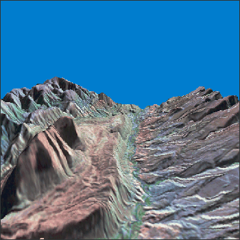
Location: Camargo Syncline, Bolivia
Source: RSD Portal

This is a perspective view of the Camargo syncline in central Bolivia. It was created from a true stereo pair of images taken one year apart (June 6, 1985 and June 16, 1986) in Landsat TM channels 5,4,2. Landsat imaged the area from slightly different angles. The two different locations of the satellite act just like your two eyes, which are separated by a small distance. Combining the two images with a terrain model allows the creation of a stereo image. The vertical scale in this image has been exaggerated by about a factor of 10.
(Image by K. Palaniappan, F. Hasler and H. Pierce of NASA/Goddard, from data provided by T. Gubbels of Cornell University).

From Orbit to A.I.—Harnessing Machine Learning with Landsat Data
Over the past few years, machine learning techniques have been increasingly used to analyze the vast amount of data collected by the Landsat mission, which has been circling the globe for over 50 years.


