
To determine what land cover changes have occurred since 1972, researchers using Landsat need to know that they are comparing apples-to-apples when they analyze Landsat images from different time periods. This is where the Landsat Calibration/Validation, or Cal/Val, team comes into play. This team of scientists and engineers ensures that Landsat data users can be confident that measurements made day-to-day, year-to-year, and Landsat sensor-to-sensor are intercomparable.
Landsat 8 launched in February 2013 carrying two new scientific sensors, the Operational Land Imager (OLI) and the Thermal Infrared Sensor (TIRS). The new sensor technology used for Landsat 8 made the calibration process much more complex.
Jim Irons, the Landsat 8 Project Scientist, explains, “OLI and TIRS employ an advanced technology for collecting images relative to the sensors on all of the earlier Landsat satellites. The new technology—pushbroom imaging—improves instrument performance while presenting new difficulties for calibration.”
He continues: “To relate the images from the OLI and TIRS to images from previous Landsat sensors, the Cal/Val Team was required to develop new methodologies and algorithms for relating the radiometric response of tens-of-thousands of detectors across the OLI and TIRS focal planes to the energy reflected from the Earth surface and for geo-locating the images generated by those detectors on the surface of the Earth.”
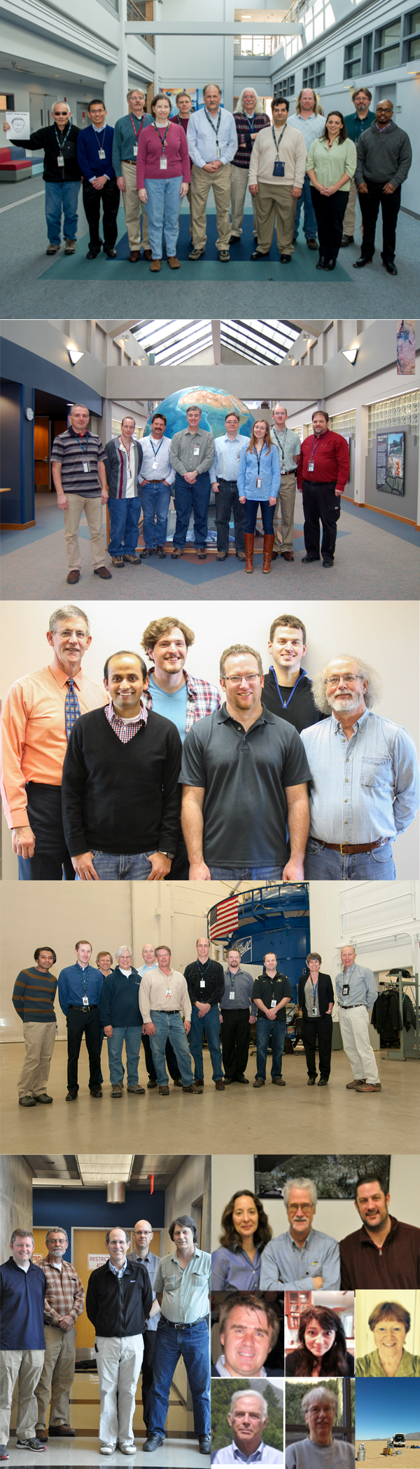
The Cal/Val team arose to the challenge. The team—consisting of 52 people from NASA Goddard Space Flight Center, the U.S. Geological Survey, Ball Aerospace & Technology Corp., South Dakota State University, Rochester Institute of Technology, University of Arizona, and Jet Propulsion Lab—successfully and swiftly developed methodologies and algorithms needed to turn raw Landsat 8 data into accurate, intercomparable information about Earth’s surface.
The work continues with the calibration team closely monitoring sensor behavior over time. In short, the scientific work of the Landsat Cal/Val team makes all other Landsat science possible. Their work has been recognized with the 2013 Robert H. Goddard Award for Science. Brian Markham, the team leader and Landsat 8 Cal/Val manager, will accept the award on the team’s behalf at the May 8th awards ceremony.
Irons remarks: “The inherent scientific value of the Landsat image record can only be realized with accurate cross-calibration and it is the efforts of this team that enable the time-series analysis of Landsat images to track forest disturbance, glacial retreat, urban expansion, fresh water consumption, food production, and a host of additional global land cover and land use changes across more than 40 years.”
The Landsat Cal/Val Team is Brian Markham, Phil Dabney, Jeff Pedelty, Dennis Reuter, Ramsey Smith, Kurtis Thome, Julia Barsi, Ed Kaita, Raviv Levy, Allen Lunsford, Matt Montanaro, Lawrence Ong, Zelalem Tesfaye, Brian Wenny, Terry Arvidson, Michael Choate, Ron Hayes, Esad Micijevic, Donald Moe, Ron Morfitt, Pat Scaramuzza, Jim Storey, Kelly Vanderwerff, Tim Beckman, Eugene Fosnight, Douglas Hollaren, Dave Lloyd, Brent Canova, Hansford Cutlip, Linda Fulton, Ed Knight, Geir Kvaran, Kenton Lee, Khurrum Ansari, Eric Donley, Brian Donley, Roger Drake, Hugh Kieffer, Amy Newbury, Leanne Presley, Dennis Helder, David Aaron, Jacob Brinkman, Larry Leigh, Nischal Mishra, Frank Pesta, John Schott, Nina Raqueno, Aaron Gerace, Stuart Biggar, Jeff Czapla-Meyers, and Simon Hook.
Further Information:
+ SDSU students among NASA award winners
+ Eye Exam for a Satellite
+ Landsat 8 Images Earth’s Biggest Satellite—Check it Out
+ Commissioning the Landsat Data Continuity Mission

Scenes from the Polar Night
Landsat satellites have begun regularly acquiring images of ice at the poles during the winter, with enlightening results.


