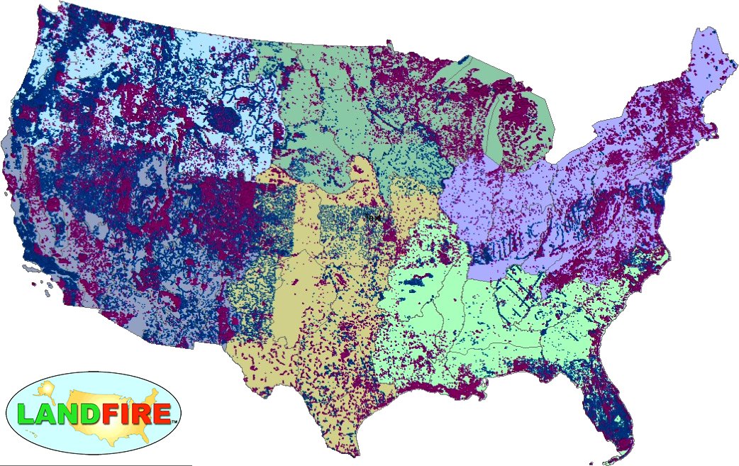
LANDFIRE Remap Is Here
LANDFIRE has released its Remap dataset; new techniques and new data provide significant improvement.

LANDFIRE has released its Remap dataset; new techniques and new data provide significant improvement.
A team of Boise State researchers is helping forecast tropical forest recovery from deforestation using Landsat satellite data.
The southeastern United States is a hotspot for forestry activity. The cyclical harvest and planting of trees on lands dedicated to timber and pulp production
Contributor: Curtis E. Woodcock, Boston University Fire, drought, and humans all can destroy forests and their ecosystems. While much attention is paid to deforestation in
A new way of studying and visualizing Earth science data from a NASA and U.S. Geological Survey satellite program is resulting in, for the first
A mosaic of Landsat Thematic Mapper (TM) images with overlays of aerial photography flightlines (N-S lines) and boundaries of physiographic strata was created to help
Contributor: David Skole Michigan State University Even though tropical deforestation is a well-known problem, the rate of deforestation in the tropics is currently known to
Contributor: Susan Moran, U.S. Department of Agriculture For farmers and land managers, increasing crop yields and cutting costs while reducing environmental pollution is a constant
Location: Imperial Valley, California Source: USGS Earthshots The Imperial Valley is actually an extension of the Gulf of California, cut off from the Gulf by
Location: Harrisburg, Pennsylvania This Landsat view shows Harrisburg and the Appalachian Mountains of central Pennsylvania. The Piedmont province is visible in the lower right corner. The
