Landsat’s Role in Managing Forests
People and economies around the world rely on forests for timber, carbon storage, flood control, biological diversity, recreation, and more. Forest managers face many challenges. In the last few years, forest fires have become more intense and more frequent; North American forests have experienced widespread infestations by pests such as the pine bark beetle; and tropical deforestation continues. Our changing climate adds complexity to government and commercial decisions about how to manage, protect, and sustain our forest resources. Landsat satellites provide key data for forest monitoring and management across the globe. Landsat gives us consistent views of the health, composition, and extent of forest ecosystems as they change over time. Curtis Woodcock, Professor, Boston University and specialist in remote sensing, has said, “I would argue that the Landsat data archive may be the most valuable environmental data record we have.” Designed, built, and launched by NASA, Landsat satellites have recorded global forest conditions every year since the 1970’s, and they have observed all U.S. forests once a season throughout those years. The U.S. Geological Survey provides this valuable data to the public at no cost. Landsat observations will continue into the future with Landsat 8.
Poster Featuring Landsat-based Research Wins 2018 NRCan Map Contest
Access to image data collected by the Landsat series of satellites has improved Canada’s ability to observe, track and study forest disturbances.
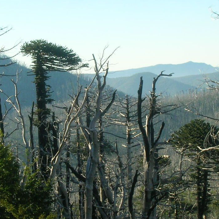
Looking at Burn Severity and Post-Fire Forest Regeneration in Chile’s Andean Cordillera, Home to the Monkey Puzzle Tree
The first study that connects field-measured data with satellite-derived burn severity in this corner of the world.
USGS Burned Area Products Group in Denver Touts Value of Landsat ARD
A new Burned Area algorithm has been developed by USGS to identify burned areas in images across the Landsat archive.
Landsat Used To Predict Tree Species Distributions in Peruvian Lowland Amazonia
Researchers have succeeded in producing distribution maps for a selection of important tropical tree species in Peruvian lowland Amazonia.
Evaluating Effects of Land Use Change on Watershed Health and Carbon Sequestration in Costa Rica's Osa Peninsula
This project used Landsat 5 and Landsat 8 data to create land use maps to analyze change in riparian case study areas.
Landsat Sees 30 Years of Yellowstone Recovery from 1988 Fires
A combination of lightning, drought and human activity caused fires to scorch more than one-third of Yellowstone National Park in the summer of 1988.