
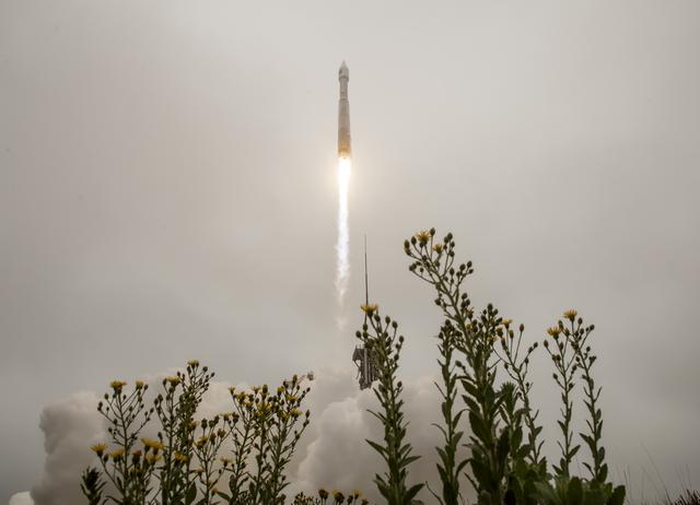
Landsat 9 was successfully launched on Monday, Sept. 27, 2021 from Vandenberg Space Force Base in California. Landsat 9 data is publicly available from USGS.
Landsat 9—a partnership between NASA and the U.S. Geological Survey— continues the Landsat program’s critical role in monitoring, understanding and managing the land resources needed to sustain human life.
Today’s increased rates of global land cover and land use change have profound consequences for weather and climate change, ecosystem function and services, carbon cycling and sequestration, resource management, the national and global economy, human health, and society.
Landsat is the only U.S. satellite system designed and operated to repeatedly observe the global land surface at a moderate scale that shows both natural and human-induced change.
+ Landsat 9: Empowering open science and applications through continuity (Masek et al., 2020)
More data | Better data
Since reducing the risk of a Landsat data gap is a high priority of the U.S. Sustainable Land Imaging Program, Landsat 9 has a design very similar to Landsat 8’s; which allowed the Landsat 9 build and launch to be expedited.
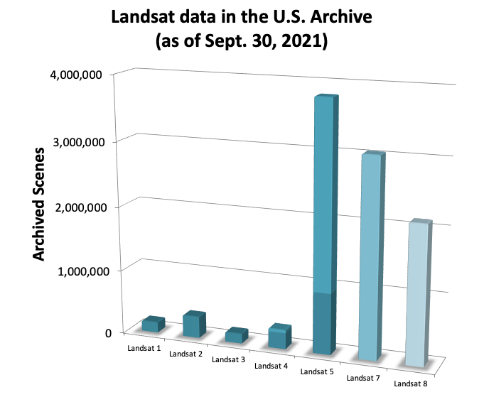
Landsat data in the U.S. archive contributed by each Landsat satellite as of Sept. 30, 2021. Landsat 8 has added more data per year than any proceeding satellite. Landsat 9 will collect data at the same rate as Landsat 8. Image credit: USGS/NASA
Landsat 9, launched September 27, 2021, joins Landsat 8 in orbit; the satellite orbits are 8 days out of phase. Landsat 9 replaces Landsat 7 (launched in 1999), taking its place in orbit (8 days out of phase with Landsat 8). The combined Landsat 8 + Landsat 9 revisit time for data collection with be every 8 days, like it currently is for Landsat 8 + Landsat 7.
Landsat 9, like Landsat 8, has a higher imaging capacity than past Landsats, allowing more valuable data to be added to the Landsat global land archive—around 1,400 scenes per day.
Landsat 9, like Landsat 8, is both radiometrically and geometrically better than earlier generation Landsats.
![]()
Quick Facts
- Science Instruments: OLI-2; TIRS-2
- OLI-2 build: Ball Aerospace & Technology Corp.
- TIRS-2 build: NASA Goddard Space Flight Center
- Design Life: 5 years
- Spacecraft Provider:Northrop Grumman Innovative Systems (NGIS)
- Image Data: > 700 scenes per day
- Launch Date: Sept. 27, 2021
- Launch Vehicle: United Launch Alliance Atlas V 401
- Orbit: near-polar, sun-synchronous at an altitude of 438 miles (705 km)
- Orbital Inclination: 98.2˚
- Spacecraft Speed: 16,760 mi/hr (26,972 km/hr),
- Consumables: 10 years
Landsat 9 Brochure
 (PDF, 6.3MB)
Landsat 9 Fact Sheet
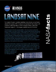 (PDF, 7.3MB)
