
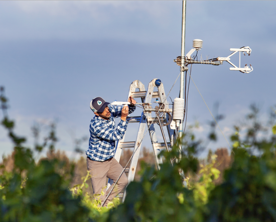
OpenET: A Satellite-Based Water Data Resource
Data from Landsat powers OpenET, a new web-based platform that puts water use information for 17 western United States into the hands of farmers, water managers and conservation groups.

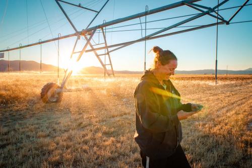
Bill Kustas: Advancing Water Research Drop by Drop
Kustas’ research informed the new OpenET app that uses Landsat thermal data as a key data input.
NASA Invites Media to Briefing on New Water Data Platform
NASA will hold a virtual media briefing at 1:30 p.m. EDT Thursday, Oct. 21, to share a powerful, new, web-based platform to help those who rely on water resources across the drought-stricken western U.S.
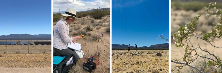
Finding “Cool Islands:” Landsat Used to Study Thermal Impact of Large Solar Parks
Using Landsat, scientists have discovered for the first time that large scale solar parks have a cooling effect on the land surrounding them.
Landsat Pixel Walkers: Getting a Feel for Field Work
Field work conducted in northern Alaska is being used in concert with the Landsat satellite data record in an effort to better understand the impacts of climate change on the Arctic.
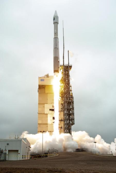
Landsat 9 Power-Positive and Proceeding Smoothly Through On-Orbit Checkout
Landsat 9 successfully launched on Monday, Sept 27, 2021 at 11:12 a.m. PDT and is now proceeding smoothly and accordingly through its scheduled on-orbit checkout period.
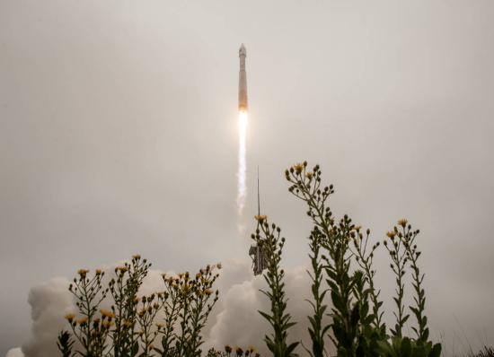
Newly Launched Landsat 9 Mission to Monitor Earth’s Landscapes
Landsat 9 successfully launched at 2:12 p.m. EDT Monday from Vandenberg Space Force Base in California.
Landsat 9 Continues a Legacy of 50 Years
by Jason Costa, Kennedy Space Center, Launch Services Program September 27, 2021 • After a United Launch Alliance Atlas V rocket successfully carried the Landsat 9 spacecraft into orbit from Vandenberg Space Force Base in
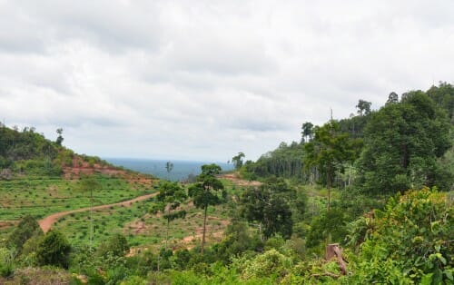
Nearby Forest Loss Predicts Future Deforestation on Protected Lands
A new analysis of protected forests worldwide finds that protected forests are unlikely to be cut down when they are surrounded by intact forests.
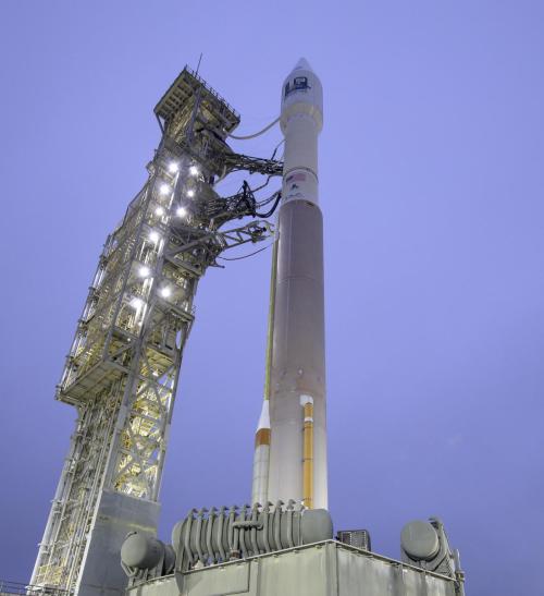
Landsat 9: Dress Rehearsal of Launch Day Completed
The Wet Dress Rehearsal enabled engineers to evaluate how the Landsat 9 rocket and ground systems behave prior to launch.
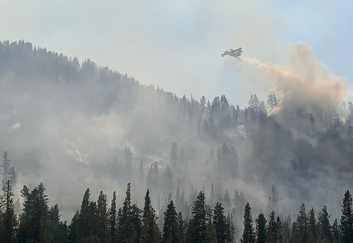
Climate Change Pushes Wildfires to New Heights
Wildfires in the western United States have been spreading to higher elevations over the past few decades due to warmer and drier conditions that are clearly linked to climate change.

A Trip Through Time With Landsat 9
Come along on a “roadtrip” through the decades to see how the technology on Landsat has evolved with the times to provide an unbroken data record.
Media Invited to Virtual Briefing on Launch of NASA, USGS Landsat 9
The Landsat 9 launch is targeted for no earlier than Thursday, Sept. 23, 2021.The media briefing will air live on NASA TV, the NASA app, and the agency’s website.
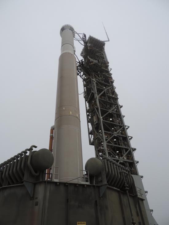
Landsat 9 Launch Date Reviewed by NASA & United Launch Alliance
Current pandemic demands for medical liquid oxygen have caused delivery delays of needed liquid nitrogen to Vandenberg, impacting the Landsat 9 launch date.

USGS 2nd National Imagery Summit: Landsat & Society
The free, virtual 2nd USGS National Imagery Summit is being held from Aug. 31–Sept. 2.

Go Now! Landsat & the Calypso Caper
This video takes you to the summer of 1975 when Jacques Cousteau and his divers helped NASA determine if Landsat could measure the depth of shallow ocean waters.
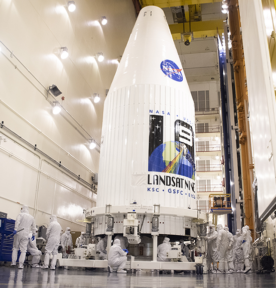
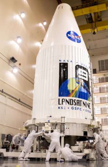
Landsat 9 Stowed and Sealed for Delivery to Orbit
In preparation for launch, the Landsat 9 observatory has been encapsulated in the fairing of the Atlas V 401 rocket that will deliver it into orbit this September.
Nearby Forest Loss Predicts Future Deforestation on Protected Lands
A new analysis of protected forests worldwide finds that protected forests are unlikely to be cut down when they are surrounded by intact forests.
Landsat 9: Dress Rehearsal of Launch Day Completed
The Wet Dress Rehearsal enabled engineers to evaluate how the Landsat 9 rocket and ground systems behave prior to launch.
Climate Change Pushes Wildfires to New Heights
Wildfires in the western United States have been spreading to higher elevations over the past few decades due to warmer and drier conditions that are clearly linked to climate change.
A Trip Through Time With Landsat 9
Come along on a “roadtrip” through the decades to see how the technology on Landsat has evolved with the times to provide an unbroken data record.
Media Invited to Virtual Briefing on Launch of NASA, USGS Landsat 9
The Landsat 9 launch is targeted for no earlier than Thursday, Sept. 23, 2021.The media briefing will air live on NASA TV, the NASA app, and the agency’s website.
Landsat 9 Launch Date Reviewed by NASA & United Launch Alliance
Current pandemic demands for medical liquid oxygen have caused delivery delays of needed liquid nitrogen to Vandenberg, impacting the Landsat 9 launch date.
USGS 2nd National Imagery Summit: Landsat & Society
The free, virtual 2nd USGS National Imagery Summit is being held from Aug. 31–Sept. 2.
Go Now! Landsat & the Calypso Caper
This video takes you to the summer of 1975 when Jacques Cousteau and his divers helped NASA determine if Landsat could measure the depth of shallow ocean waters.
Landsat 9 Stowed and Sealed for Delivery to Orbit
In preparation for launch, the Landsat 9 observatory has been encapsulated in the fairing of the Atlas V 401 rocket that will deliver it into orbit this September.
