
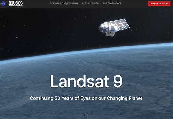
Landsat 9 Continues a Legacy of 50 Years
by Jason Costa, Kennedy Space Center, Launch Services Program September 27, 2021 • After a United Launch Alliance Atlas V rocket successfully carried the Landsat 9 spacecraft into orbit from Vandenberg Space Force Base in
Gearing Up for Landsat 9 Launch Week
Starting on Sunday, Sept. 19, 2021, a number of local Landsat-focused events will be taking place. From geocaching to family fun nights, from science cafe talks to women in STEM socials, there’s something for you to do during launch week.
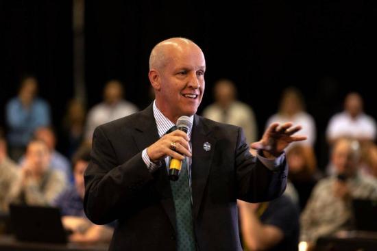
Meet the Landsat 9 Team: Tim Dunn
by Jim Cawley, NASA’s Kennedy Space Center September 22, 2021 • Landsat 9 is targeted for launch no earlier than Sept. 27, 2021, on a United Launch Alliance Atlas V 401 rocket from Space Launch
Modern Treasure Hunt for Landsat’s Long History Draws Crowds to Lompoc Ahead of Landsat 9 Launch
Adventurers, explorers, and satellite lovers alike descended on Lompoc, California, Sunday, Sept. 19 to kick-off Southern California’s first GeoTour: The History of Landsat in Lompoc.
NASA TV to Air Landsat 9 Launch, Prelaunch Activities
NASA will provide coverage of the upcoming prelaunch and launch activities for the NASA/USGS Landsat 9 satellite.
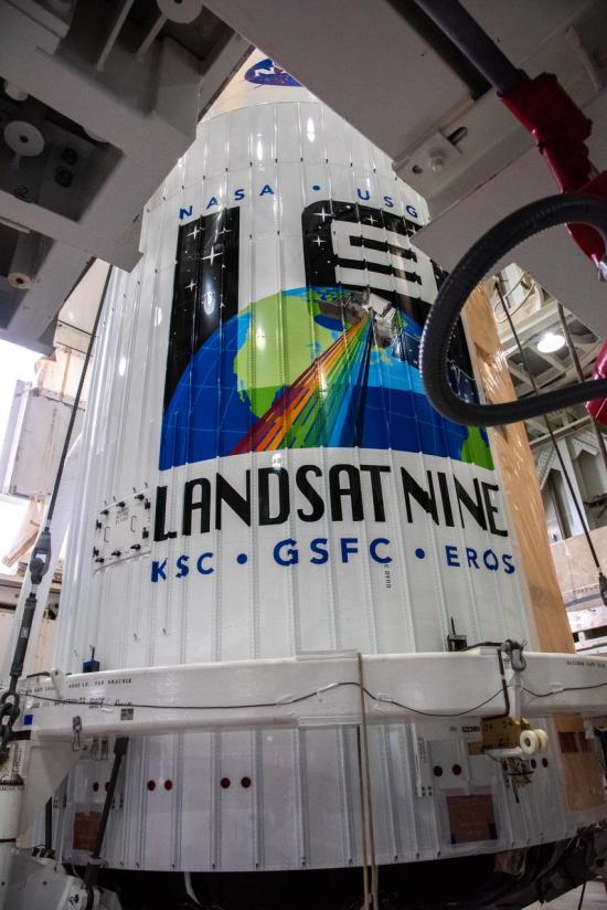
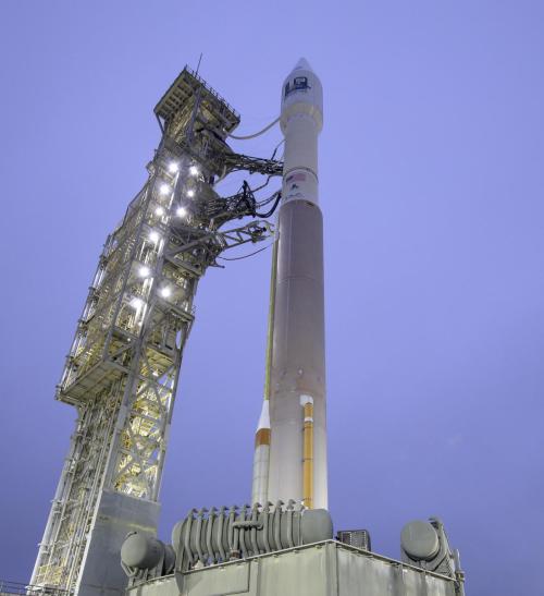
Landsat 9 on Launch Pad atop Atlas V Rocket
Landsat 9, now scheduled for launch on Monday, Sept. 27, is safely encapsulated in its fairing and mated to the launch vehicle in preparation for launch.
NASA and United Launch Alliance Update Landsat 9 Target Launch Date
The Landsat 9 launch is now scheduled for no earlier than Monday, Sept. 27, 2021.
Landsat Aids Efforts to Restore Earth’s Wild Lands
Remote sensing measurements using Landsat can help assess the effectiveness of various restoration interventions.
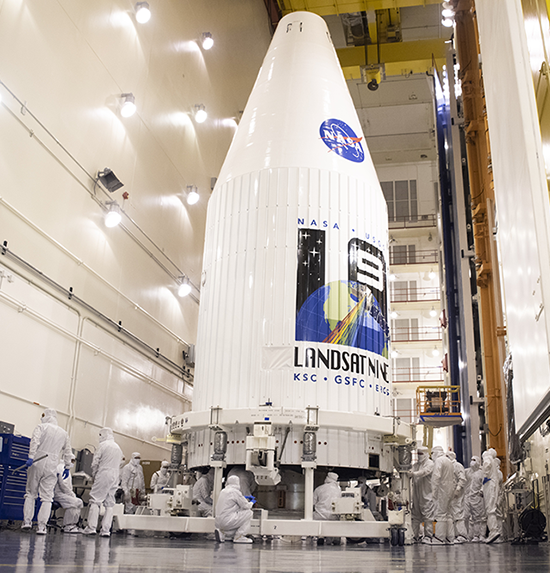
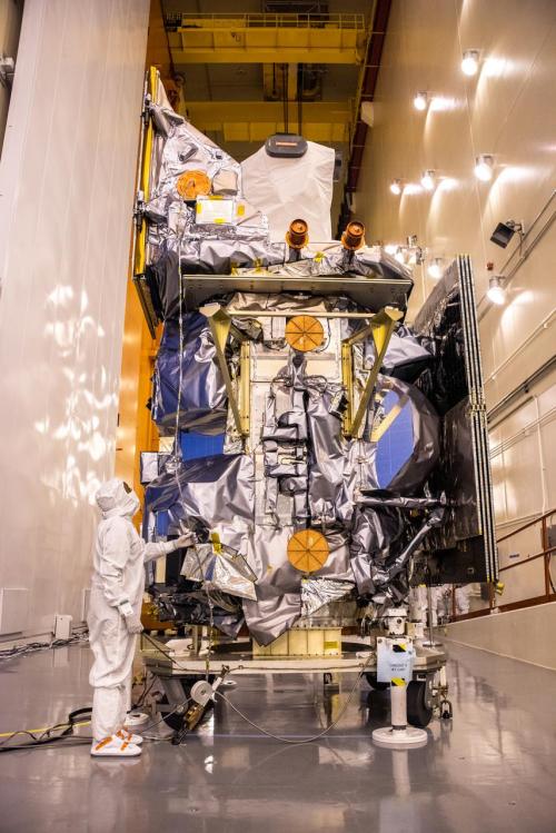
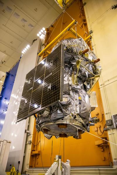
Landsat 9 Stowed and Sealed for Delivery to Orbit
In preparation for launch, the Landsat 9 observatory has been encapsulated in the fairing of the Atlas V 401 rocket that will deliver it into orbit this September.
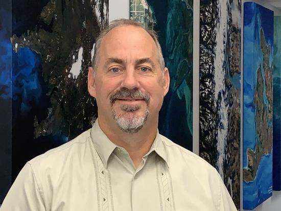
Meet the Landsat 9 Team: Mark Mertz
This is the second in a series of five features introducing members of the Landsat 9 team.
NASA Unveils New Interactive Website Ahead of Landsat 9 Launch
A new interactive Landsat 9 website has gone live.

Meet the Landsat 9 Team: Matt Johnson
This is the first in a series of five features introducing members of the Landsat 9 team.
Landsat 9 Passes Last Key Decision Point Before Launch
The Landsat 9 project has passed its final major lifecycle approval gateway.
Landsat Sees Dr. Beach’s Top 10 Beaches of 2021
For over 30 years, Dr. Beach, aka Dr. Stephen Leatherman, a professor and coast geomorphologist at Florida International University, has created a Top 10 Beach list based on criteria including water and sand quality, safety, and management. You can find his 2021 picks here and see how Landsat views them as well.
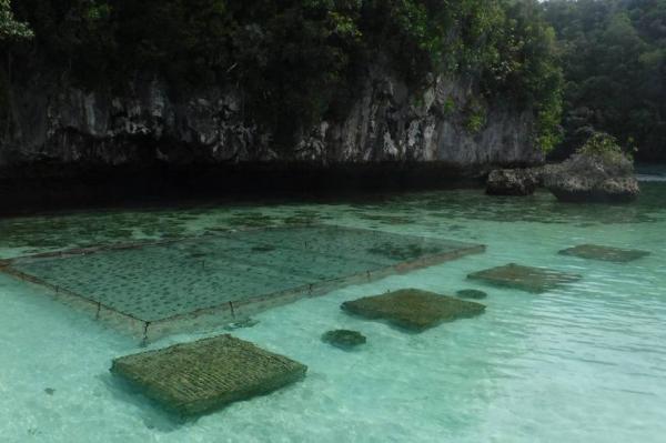
Planning the Future of Palau Fish Stocks with Satellites
In Micronesia, the nation of Palau is building sustainable aquaculture farms in the ocean with the help of satellites.
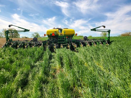
Shoring up the Corn Belt’s Soil Health
Soil is the foundation of our food systems, and sustainable farming depends upon healthy soil, which has impacts far beyond the field on air, water and climate.

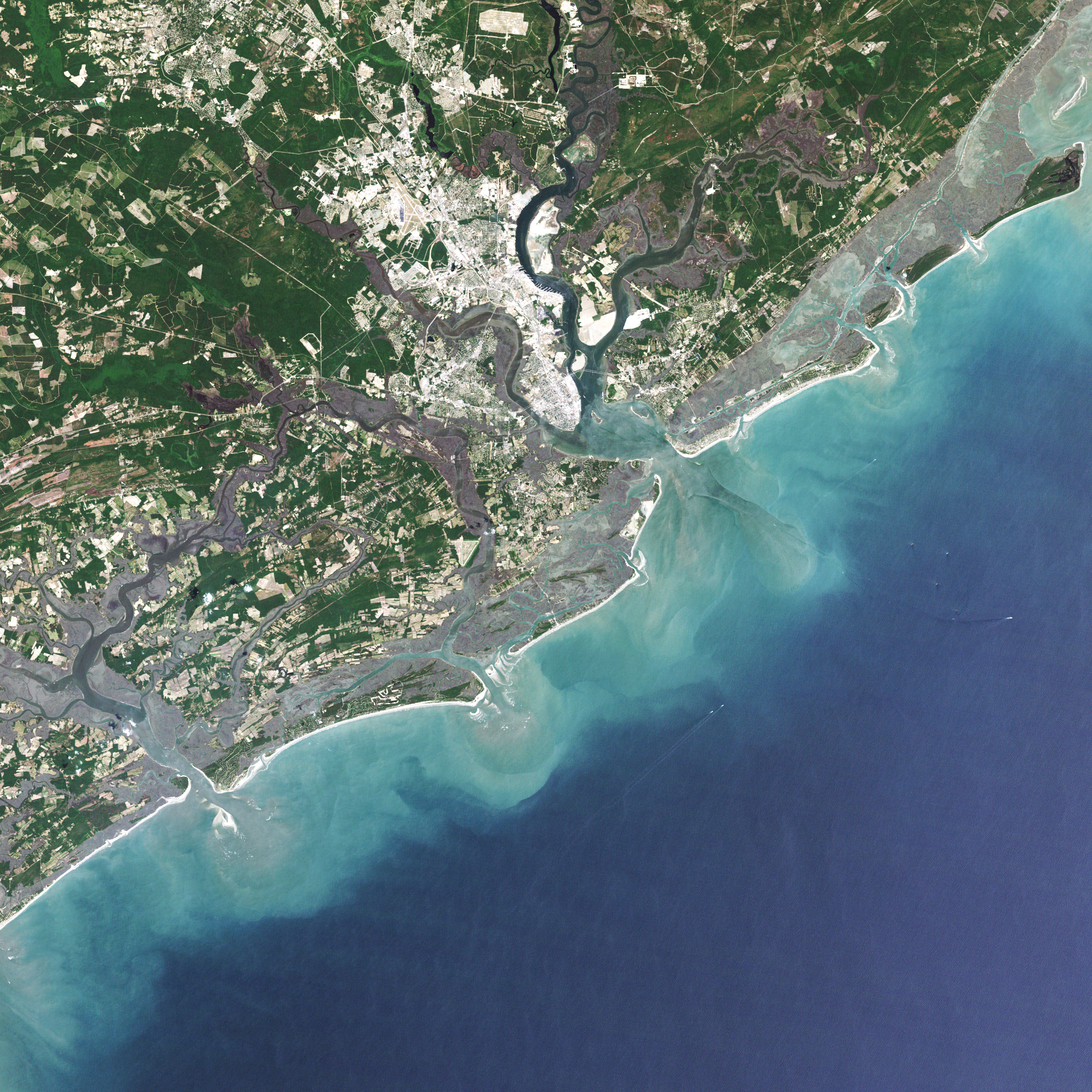
Landsat 9 at Work
For five decades, we have relied on Landsat’s high-quality, science-quality observations to understand and protect our home planet.
Landsat 9 Stowed and Sealed for Delivery to Orbit
In preparation for launch, the Landsat 9 observatory has been encapsulated in the fairing of the Atlas V 401 rocket that will deliver it into orbit this September.
Meet the Landsat 9 Team: Mark Mertz
This is the second in a series of five features introducing members of the Landsat 9 team.
NASA Unveils New Interactive Website Ahead of Landsat 9 Launch
A new interactive Landsat 9 website has gone live.
Meet the Landsat 9 Team: Matt Johnson
This is the first in a series of five features introducing members of the Landsat 9 team.
Landsat 9 Passes Last Key Decision Point Before Launch
The Landsat 9 project has passed its final major lifecycle approval gateway.
Landsat Sees Dr. Beach’s Top 10 Beaches of 2021
For over 30 years, Dr. Beach, aka Dr. Stephen Leatherman, a professor and coast geomorphologist at Florida International University, has created a Top 10 Beach list based on criteria including water and sand quality, safety, and management. You can find his 2021 picks here and see how Landsat views them as well.
Planning the Future of Palau Fish Stocks with Satellites
In Micronesia, the nation of Palau is building sustainable aquaculture farms in the ocean with the help of satellites.
Shoring up the Corn Belt’s Soil Health
Soil is the foundation of our food systems, and sustainable farming depends upon healthy soil, which has impacts far beyond the field on air, water and climate.
Landsat 9 at Work
For five decades, we have relied on Landsat’s high-quality, science-quality observations to understand and protect our home planet.
