
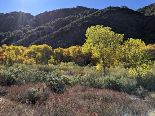
A Well-Rooted Study
Using Landsat to keep an eye on the trees offers an effective way to monitor groundwater along river corridors in the Southwest.
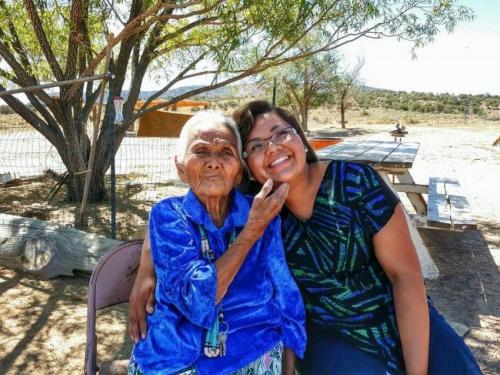
Connecting The Drops: Managing the Navajo Nation’s Water Resources with Satellites and Indigenous Knowledge
The NASA-funded Navajo Nation Drought Project has built a cloud-based web application that uses Landsat and Sentinel-2 data, among others, to improve drought reporting and management in the Navajo Nation.
AGU Panel Explores Environmental Impacts of the COVID-19 Pandemic, as Observed from Space
Landsat shows some of the ways in which COVID-19 is changing the environment.
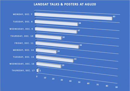
Landsat at #AGU20
This year over 350 presentations share work conducted with Landsat data.
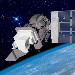
Landsat 9—Continuing the Legacy
This new four-part video series shares the history of Landsat, how Landsat 9 works, how Landsat data gets from the satellite to the ground, and how Landsat data can be used with other data to support a wide range of research and applications. Enjoy!
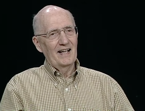
Remembering David Landgrebe
November 30, 2020 • This month, the world lost a giant in the world of quantitative remote sensing. David A. Landgrebe passed away on November 21, 2020 at the age of
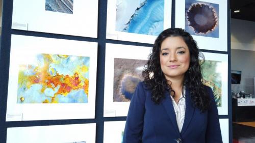
Africa Flores: Using Satellite Data to Monitor Algal Blooms
Scientist and Landsat data user Africa Flores recently talked with Science Friday about her work.
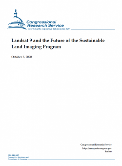
Report: Landsat 9 and the Future of the Sustainable Land Imaging Program
The Congressional Research Service has released a new report about the future of Landsat.

Global Survey Using Landsat Shows Dramatic Growth of Glacial Lakes
Using 30 years of Landsat data, researchers have found that the volume of glacial lakes worldwide has increased by about 50% since 1990.
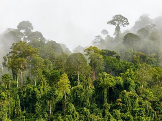
Pinpointing Tropical Forests with High Ecological ‘Quality’
Landsat and ICESat-2 satellite data have made it possible for scientists to develop maps showing the “quality” of tropical forests.
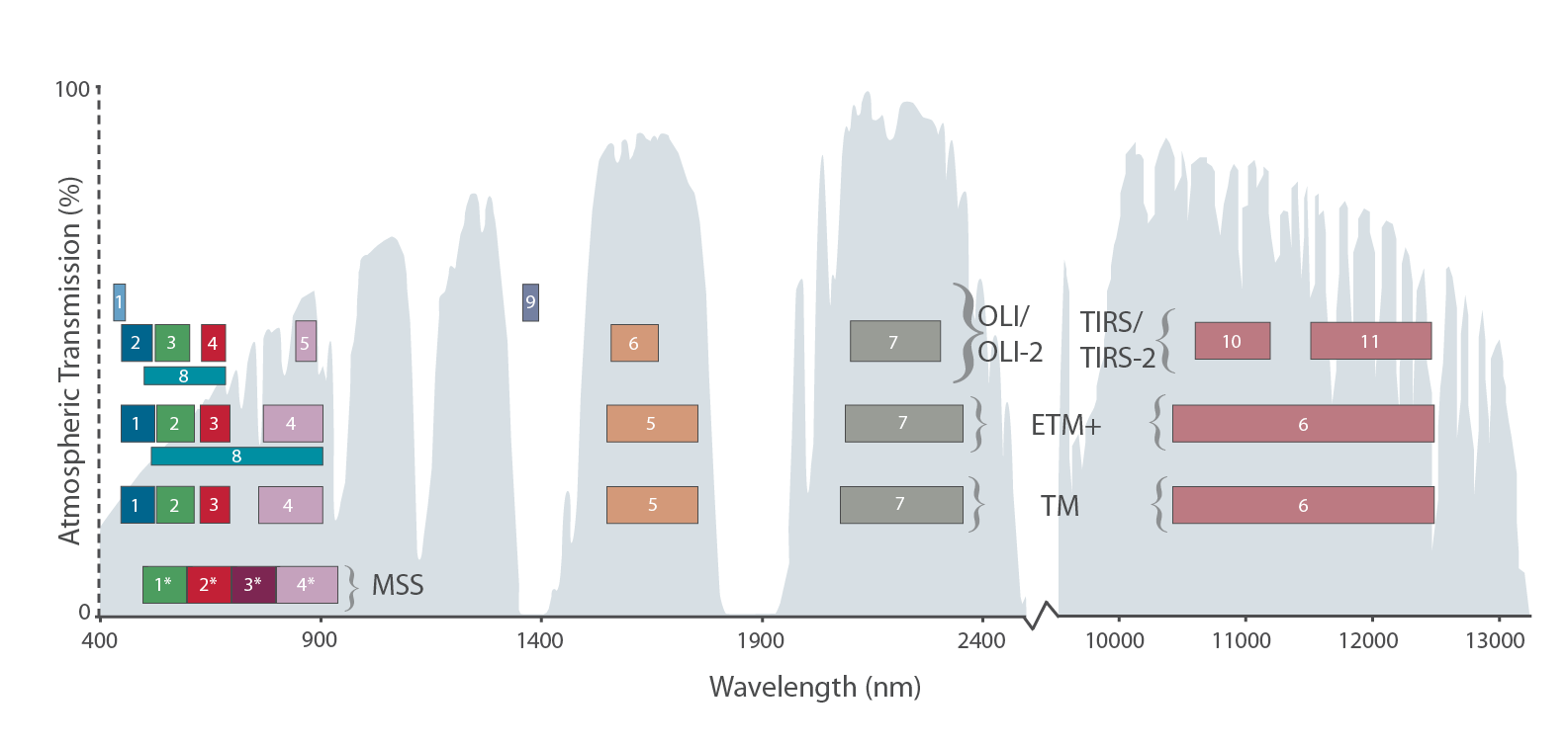
The Intervening Atmosphere: Tracing the Provenance of a Favorite Landsat Infographic
Learn more about the atmospheric transmission data used for our Landsat spectral band comparison graphic.
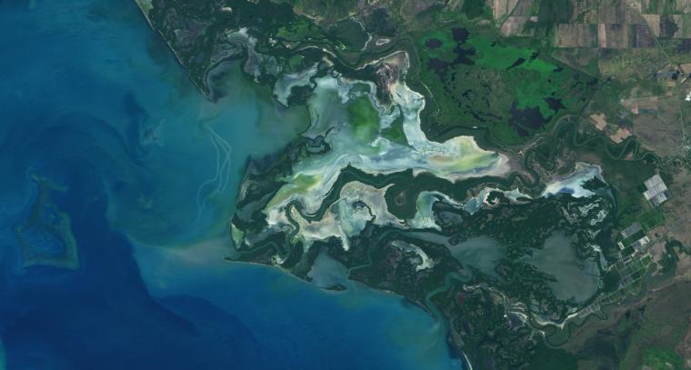
NASA Study Maps the Roots of Global Mangrove Loss
Using Landsat, researchers have created the first map of the causes of change in global mangrove habitats between 2000 and 2016—a valuable tool to aid conservation efforts for these vital coastline defenders.
‘Hyperlife’ Video from Beck/NASA Collaboration Features Landsat 8
In Beck’s “Hyperlife” video, the abstract beauty of our planet morphs from geographic location-to-location with the flow of the etherial track.

Virginia T. Norwood: The Mother of Landsat
We have Virginia Norwood to thank for the design and engineering that made the Landsat program a success and set the path for modern Earth observation.
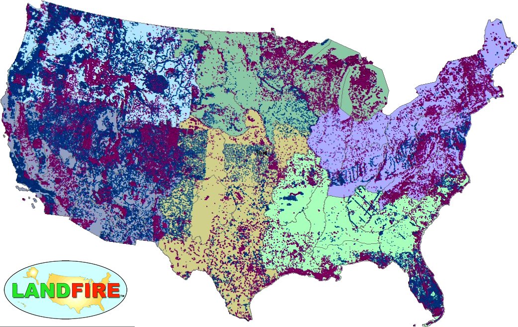
LANDFIRE Remap Is Here
LANDFIRE has released its Remap dataset; new techniques and new data provide significant improvement.

Student Liza Goldberg Uses National Geographic Young Explorers Grant to Bring Satellite Imagery into Classrooms
Goldberg will launch Cloud to Classroom, an innovative project that uses satellite imagery to help K-12 classrooms understand global environmental change through remote sensing.
Using Landsat Data to Assess Regeneration in Tropical Forests
A team of Boise State researchers is helping forecast tropical forest recovery from deforestation using Landsat satellite data.
Global Survey Using Landsat Shows Dramatic Growth of Glacial Lakes
Using 30 years of Landsat data, researchers have found that the volume of glacial lakes worldwide has increased by about 50% since 1990.
Pinpointing Tropical Forests with High Ecological ‘Quality’
Landsat and ICESat-2 satellite data have made it possible for scientists to develop maps showing the “quality” of tropical forests.
The Intervening Atmosphere: Tracing the Provenance of a Favorite Landsat Infographic
Learn more about the atmospheric transmission data used for our Landsat spectral band comparison graphic.
NASA Study Maps the Roots of Global Mangrove Loss
Using Landsat, researchers have created the first map of the causes of change in global mangrove habitats between 2000 and 2016—a valuable tool to aid conservation efforts for these vital coastline defenders.
‘Hyperlife’ Video from Beck/NASA Collaboration Features Landsat 8
In Beck’s “Hyperlife” video, the abstract beauty of our planet morphs from geographic location-to-location with the flow of the etherial track.
Virginia T. Norwood: The Mother of Landsat
We have Virginia Norwood to thank for the design and engineering that made the Landsat program a success and set the path for modern Earth observation.
LANDFIRE Remap Is Here
LANDFIRE has released its Remap dataset; new techniques and new data provide significant improvement.
Student Liza Goldberg Uses National Geographic Young Explorers Grant to Bring Satellite Imagery into Classrooms
Goldberg will launch Cloud to Classroom, an innovative project that uses satellite imagery to help K-12 classrooms understand global environmental change through remote sensing.
Using Landsat Data to Assess Regeneration in Tropical Forests
A team of Boise State researchers is helping forecast tropical forest recovery from deforestation using Landsat satellite data.
