

Landsat Outreach at the 2024 American Meteorological Society Meeting
This year, AMS meeting-goers had an opportunity to learn more about Landsat, its data, and its applications at the NASA Exhibit Booth.
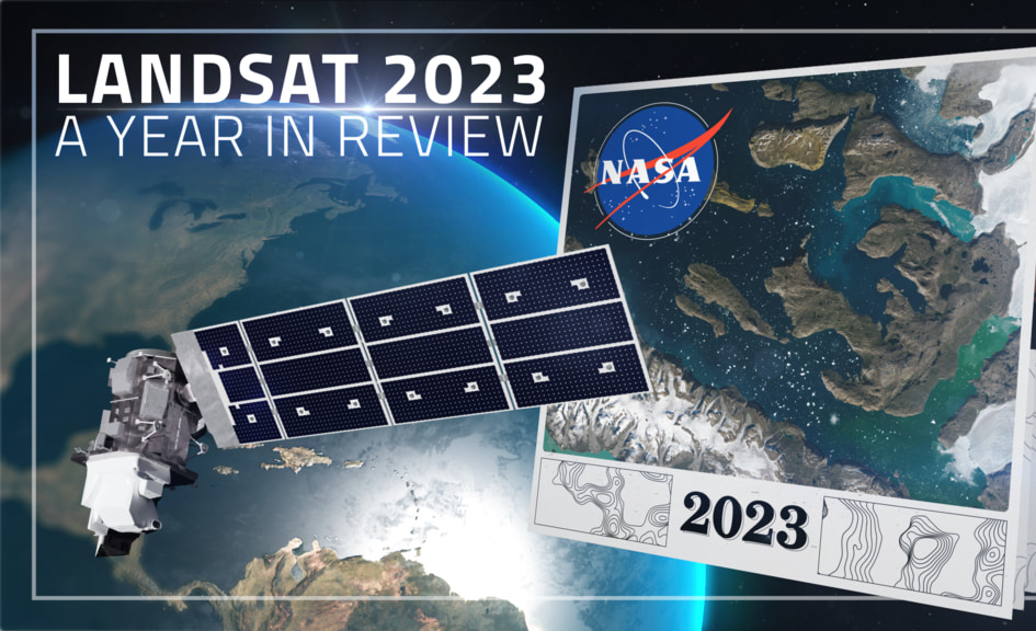
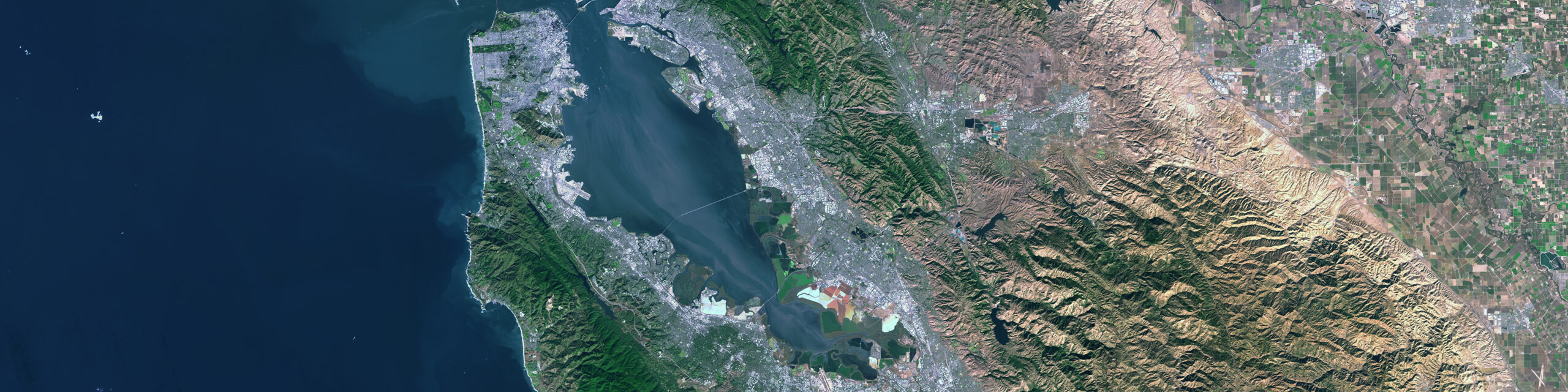
Landsat 2023 – A Year in Review
A delve into Landsat-based studies revealing the environmental impact of river mining, the decline in global lake water levels, and the risks of rising sea levels on coastal habitats. Plus, a sneak peek at what the future of the Landsat program holds with the introduction of Landsat Next.
Leveraging the Synergistic Power of Landsat and GEDI Data to Support Sustainable Forest Management
By fusing multispectral Landsat data with forest structure products from the GEDI mission, researchers and scientists have unlocked a deeper understanding of complex forest processes and dynamics and empowered land managers and policymakers to manage forests with greater effectiveness and sustainability.
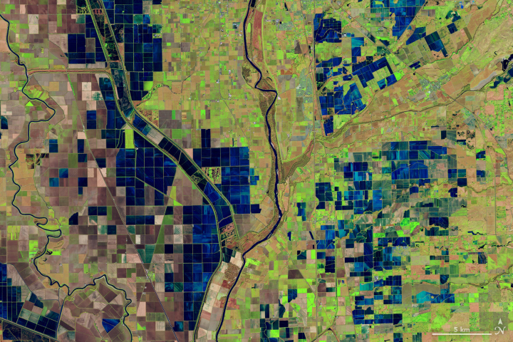
OpenET Study Helps Water Managers and Farmers Put Landsat to Work
As the world looks for sustainable solutions, a system tapping into Landsat data for water management has passed a critical test.
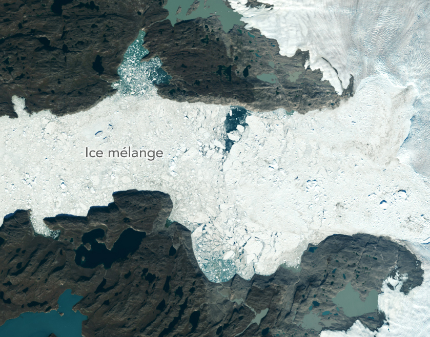
Satellites Show More Greenland Ice Lost Than Previously Estimated
A new, comprehensive analysis of satellite data finds that majority of glaciers on the landmass have retreated significantly.

USGS Director Talks Landsat
In an Instagram Live event titled “Guided by Science,” Deb Haaland, U.S. Secretary of the Interior, spoke with USGS Director Dr. David Applegate. The Landsat portion of that discussion is shared here.
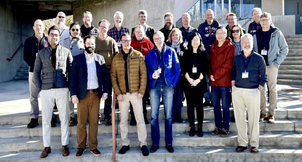
Advancing Landsat Science at AGU23
The 2023 American Geophysical Union Fall Meeting (AGU23) was held in San Francisco, California, from December 11-15. The Landsat program has repeatedly had a strong presence at AGU meetings and it occupied a prominent position among presenters at AGU23.
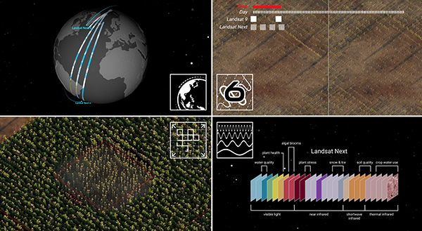
Landsat 2030 International Partnership Initiative Announced
The Landsat 2030 International Partnership Initiative will enhance U.S. and partner governments’ ability to sustainably manage their land, surface water and resource use.
Landsat 2023 – A Year in Review
A delve into Landsat-based studies revealing the environmental impact of river mining, the decline in global lake water levels, and the risks of rising sea levels on coastal habitats. Plus, a sneak peek at what the future of the Landsat program holds with the introduction of Landsat Next.
Leveraging the Synergistic Power of Landsat and GEDI Data to Support Sustainable Forest Management
By fusing multispectral Landsat data with forest structure products from the GEDI mission, researchers and scientists have unlocked a deeper understanding of complex forest processes and dynamics and empowered land managers and policymakers to manage forests with greater effectiveness and sustainability.
OpenET Study Helps Water Managers and Farmers Put Landsat to Work
As the world looks for sustainable solutions, a system tapping into Landsat data for water management has passed a critical test.
Satellites Show More Greenland Ice Lost Than Previously Estimated
A new, comprehensive analysis of satellite data finds that majority of glaciers on the landmass have retreated significantly.
USGS Director Talks Landsat
In an Instagram Live event titled “Guided by Science,” Deb Haaland, U.S. Secretary of the Interior, spoke with USGS Director Dr. David Applegate. The Landsat portion of that discussion is shared here.
Advancing Landsat Science at AGU23
The 2023 American Geophysical Union Fall Meeting (AGU23) was held in San Francisco, California, from December 11-15. The Landsat program has repeatedly had a strong presence at AGU meetings and it occupied a prominent position among presenters at AGU23.
Landsat 2030 International Partnership Initiative Announced
The Landsat 2030 International Partnership Initiative will enhance U.S. and partner governments’ ability to sustainably manage their land, surface water and resource use.

Landsat Helps Prioritize Conservation Areas for Australia’s Gliding Possums
Using satellite data, including Landsat, Griffith University researchers found that less than 13 percent of the endangered greater gliders’ habitat in Queensland is protected.
The Earth Observer Shares Landsat Happenings
A summary of the final activities of the 2018–2023 Landsat Science Team and a synopsis of the 2022 History of NASA and the Environment Symposium were among the topics covered in the most recent issue of NASA’s The Earth Observer.
Landsat 2023 – A Year in Review
A delve into Landsat-based studies revealing the environmental impact of river mining, the decline in global lake water levels, and the risks of rising sea levels on coastal habitats. Plus, a sneak peek at what the future of the Landsat program holds with the introduction of Landsat Next.
Leveraging the Synergistic Power of Landsat and GEDI Data to Support Sustainable Forest Management
By fusing multispectral Landsat data with forest structure products from the GEDI mission, researchers and scientists have unlocked a deeper understanding of complex forest processes and dynamics and empowered land managers and policymakers to manage forests with greater effectiveness and sustainability.
OpenET Study Helps Water Managers and Farmers Put Landsat to Work
As the world looks for sustainable solutions, a system tapping into Landsat data for water management has passed a critical test.
Satellites Show More Greenland Ice Lost Than Previously Estimated
A new, comprehensive analysis of satellite data finds that majority of glaciers on the landmass have retreated significantly.
USGS Director Talks Landsat
In an Instagram Live event titled “Guided by Science,” Deb Haaland, U.S. Secretary of the Interior, spoke with USGS Director Dr. David Applegate. The Landsat portion of that discussion is shared here.
Advancing Landsat Science at AGU23
The 2023 American Geophysical Union Fall Meeting (AGU23) was held in San Francisco, California, from December 11-15. The Landsat program has repeatedly had a strong presence at AGU meetings and it occupied a prominent position among presenters at AGU23.
Landsat 2030 International Partnership Initiative Announced
The Landsat 2030 International Partnership Initiative will enhance U.S. and partner governments’ ability to sustainably manage their land, surface water and resource use.
Landsat Helps Prioritize Conservation Areas for Australia’s Gliding Possums
Using satellite data, including Landsat, Griffith University researchers found that less than 13 percent of the endangered greater gliders’ habitat in Queensland is protected.
The Earth Observer Shares Landsat Happenings
A summary of the final activities of the 2018–2023 Landsat Science Team and a synopsis of the 2022 History of NASA and the Environment Symposium were among the topics covered in the most recent issue of NASA’s The Earth Observer.
