
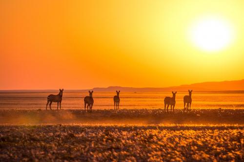
Landsat & Drones Used to Reconstruct Past Environmental Change
Vegetation cover along the Kuiseb River in the Namib Desert has increased over the last 35 years, Landsat has helped show.
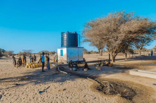
Keeping a Dry Eye on Drought in East Africa
The SERVIR team has developed models for groundwater demand based on Earth observations for parameters like rainfall and surface water from satellite missions.
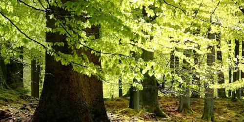
Quantifying Forests’ Impacts on Global Carbon Budget with Satellites
A new method, fusing data from many sources, has been developed for quantifying forests’ role as both carbon sink and carbon source.
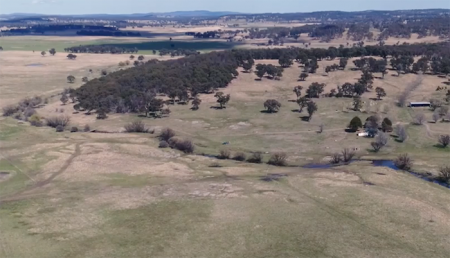
Protecting Water for Generations to Come in Australia
Australia’s natural resource regulator uses drones and satellite imagery to monitor water use and compliance with their water laws across New South Wales to ensure our water resources are protected for generations to come.
Mapping Landsat’s Long History
UtahView’s Ellie McGinty has created a Google Earth Web Map showcasing Landsat’s history.
A Harmonious New Dataset
The Harmonized Landsat Sentinel-2 dataset has been provisionally released. Come explore Landsat 8 and Sentinel-2 data… together.
Alert System Shows Potential for Reducing Deforestation, Mitigating Climate Change
Landsat-based Global Forest Watch alerts seem to be helping slow down forest loss in Africa.

Landsat Featured on Recent NOVA Now Podcast
Landsat 9 Project Scientist Jeff Masek from NASA Goddard was interviewed for NOVA Now.
Satellite Data Meets Cellular DNA for Species of Interest
Scientists are combining data from water samples containing fish DNA with satellite data to find native fish and identify their habitats.
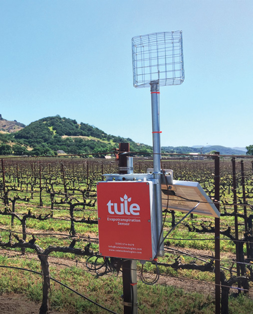
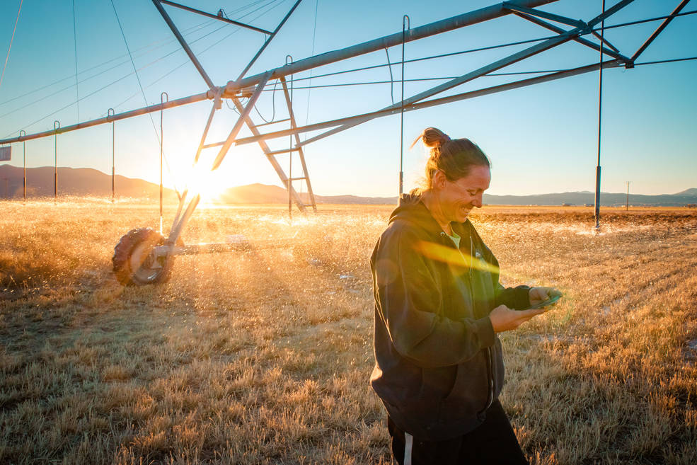
Satellite Imagery Helps Farmers Cut Water Use in Half
A young start-up is using satellite data to give California farmers better information about water, which can translate into water savings or bigger yield for the same input.
Landsat: Buttressing Knowledge About This Planet
A number of new data products with information derived from Landsat inputs have become available recently.
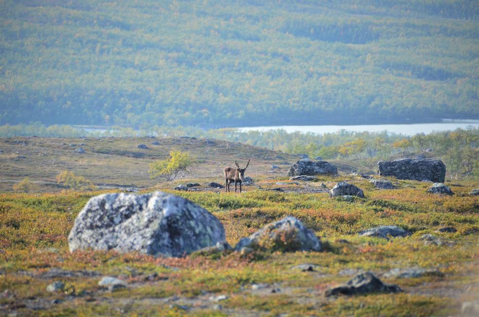
Warming Temperatures are Driving Arctic Greening
Using satellite images to track global tundra ecosystems over decades, a new study found the region has become greener, as warmer air and soil temperatures lead to increased plant growth.
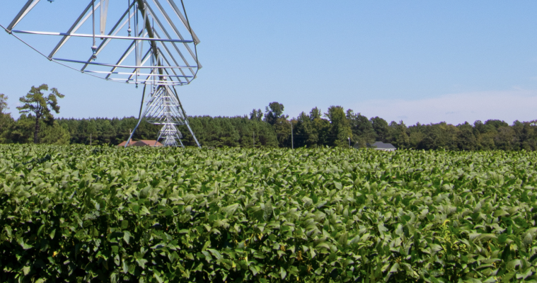
Mapping Twenty Years Of Historical US Midwestern Corn And Soybean Information with Landsat
A new data set uses Landsat data to extend the Crop Data Layer back in time.
Transforming Water Management in the U.S. West with Satellite Data
A new web-based platform called OpenET will soon be putting satellite data in the hands of farmers, water managers and conservation groups to accelerate improvements and innovations in water management.
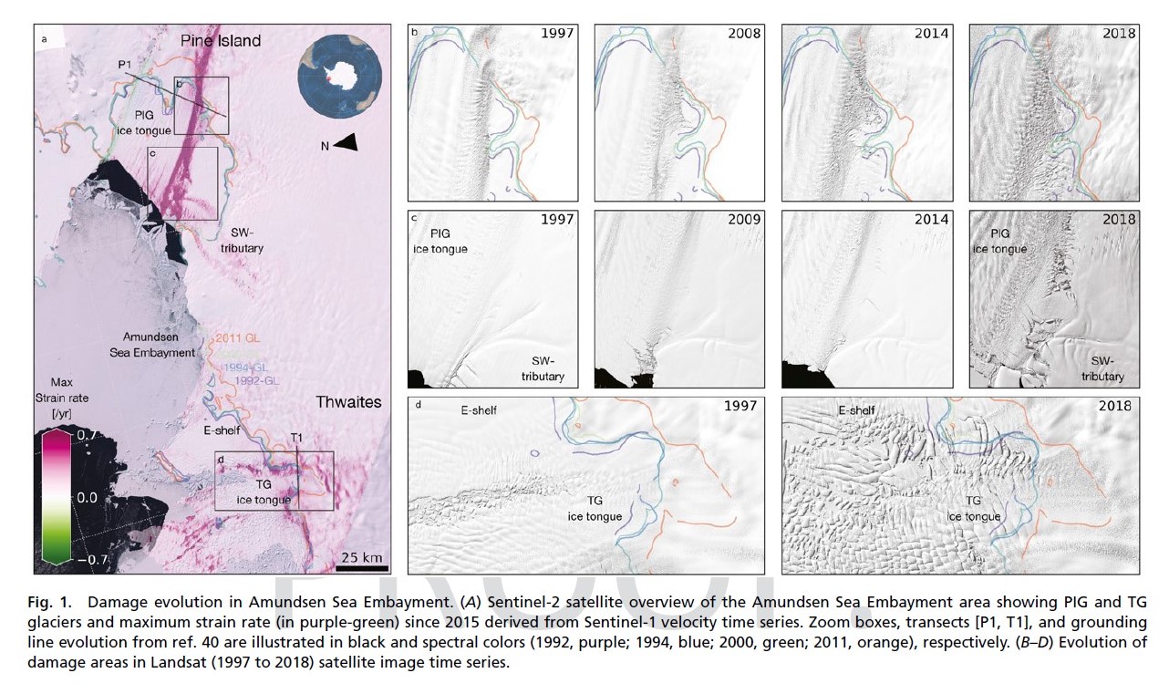
Antarctica: Cracks in the Ice
Combined satellite imagery have afforded researchers a new, accurate picture of the rapid development of damage in the shear zones on the ice shelves of Pine Island and Thwaites.
The Stuff of Trees: Three-Decades of Forest Biomass Measured Across Canada
A new study reports a net increase of 5.38 petagrams of forest biomass between 1984 and 2016; carbon-wise, that is equivalent to a train of loaded coal cars long enough to wrap itself around Earth nearly 34 times.
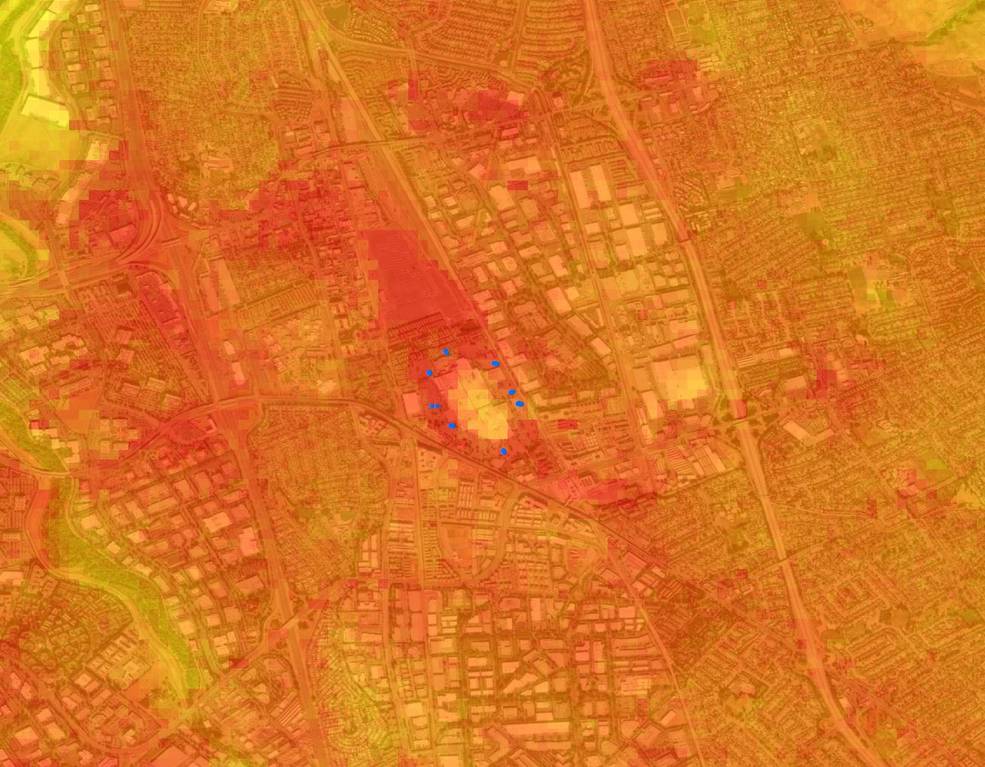
Landsat Data Informs New Projects Exploring Connections Between the Environment and COVID-19
Satellite images are helping to reveal how COVID-19 lockdown measures are impacting food security, urban surface heat, water quality and aquatic ecosystems, and more in NASA-funded studies.
Satellite Data Meets Cellular DNA for Species of Interest
Scientists are combining data from water samples containing fish DNA with satellite data to find native fish and identify their habitats.
Satellite Imagery Helps Farmers Cut Water Use in Half
A young start-up is using satellite data to give California farmers better information about water, which can translate into water savings or bigger yield for the same input.
Landsat: Buttressing Knowledge About This Planet
A number of new data products with information derived from Landsat inputs have become available recently.
Warming Temperatures are Driving Arctic Greening
Using satellite images to track global tundra ecosystems over decades, a new study found the region has become greener, as warmer air and soil temperatures lead to increased plant growth.
Mapping Twenty Years Of Historical US Midwestern Corn And Soybean Information with Landsat
A new data set uses Landsat data to extend the Crop Data Layer back in time.
Transforming Water Management in the U.S. West with Satellite Data
A new web-based platform called OpenET will soon be putting satellite data in the hands of farmers, water managers and conservation groups to accelerate improvements and innovations in water management.
Antarctica: Cracks in the Ice
Combined satellite imagery have afforded researchers a new, accurate picture of the rapid development of damage in the shear zones on the ice shelves of Pine Island and Thwaites.
The Stuff of Trees: Three-Decades of Forest Biomass Measured Across Canada
A new study reports a net increase of 5.38 petagrams of forest biomass between 1984 and 2016; carbon-wise, that is equivalent to a train of loaded coal cars long enough to wrap itself around Earth nearly 34 times.
Landsat Data Informs New Projects Exploring Connections Between the Environment and COVID-19
Satellite images are helping to reveal how COVID-19 lockdown measures are impacting food security, urban surface heat, water quality and aquatic ecosystems, and more in NASA-funded studies.
