
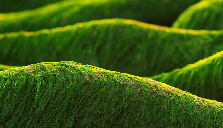
Spotting Brittany’s ‘Green Tides’ from Space
‘Green tides’ of algae have wreaked havoc across the coastlines of Brittany, France, for half a century due to high levels of agricultural runoff. With efforts to reduce these underway, a new technique using over three decades of satellite images highlights the extent of the continuing problem.
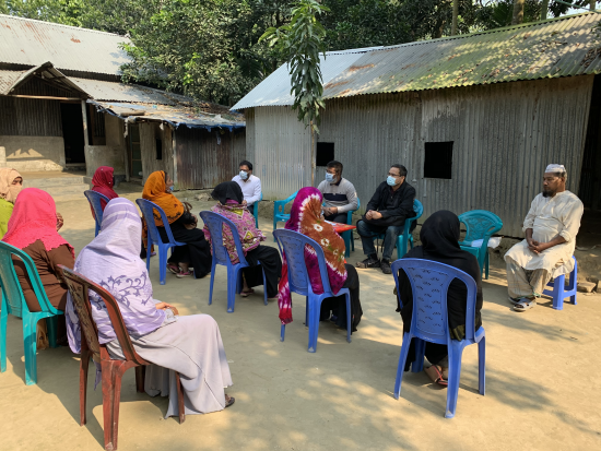
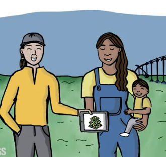
South Asian Farmers Fine Tune When to Water with Landsat
Putting NASA and USGS satellite information at farmers’ fingertips leads to less water use and better crop yields in South Asia.
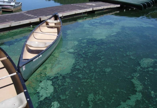
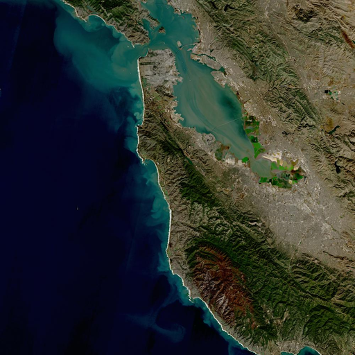
Downstream Consequences: How NASA Satellites Track Harmful Algal Blooms
Harmful algal blooms pose a health risk to fish and other wildlife as well as humans; satellites, including Landsat, are helping public health officials keep people safe.
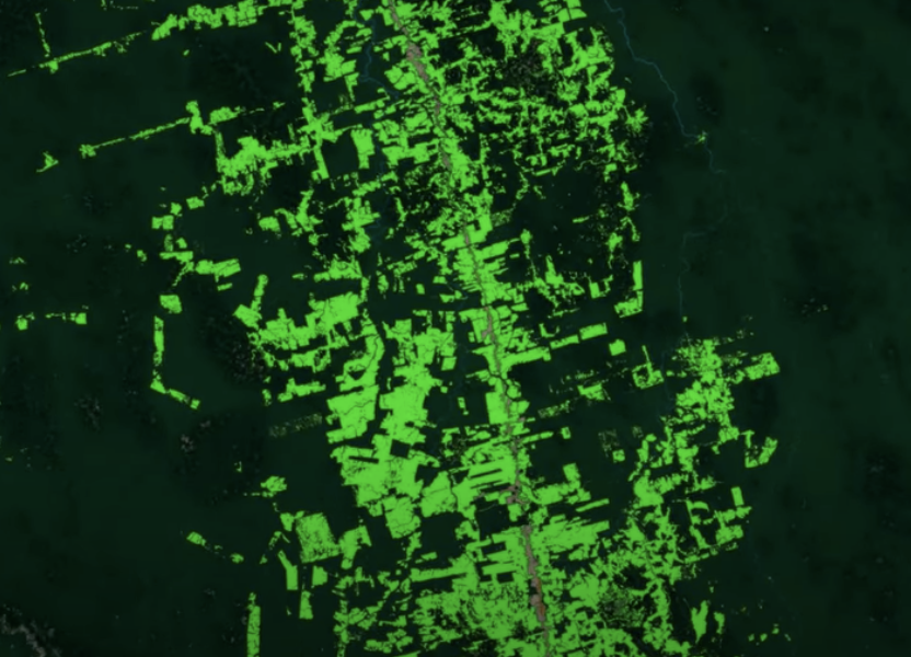
Earth Day Connections: NASA Investigates Vegetation
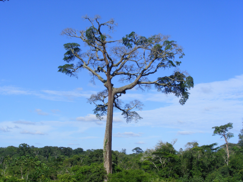
Scientists use Landsat to track changing patterns of deforestation that tells them how Amazonian agricultural practices have changed, from small family holdings to massive ranching operations.

Virginia T. Norwood, Engineer Responsible for First Landsat Multispectral Scanner, Receives 2021 ASPRS Lifetime Achievement Award
Top honors were bestowed upon Virginia Norwood in recognition of her far-reaching impact on the field of remote sensing.
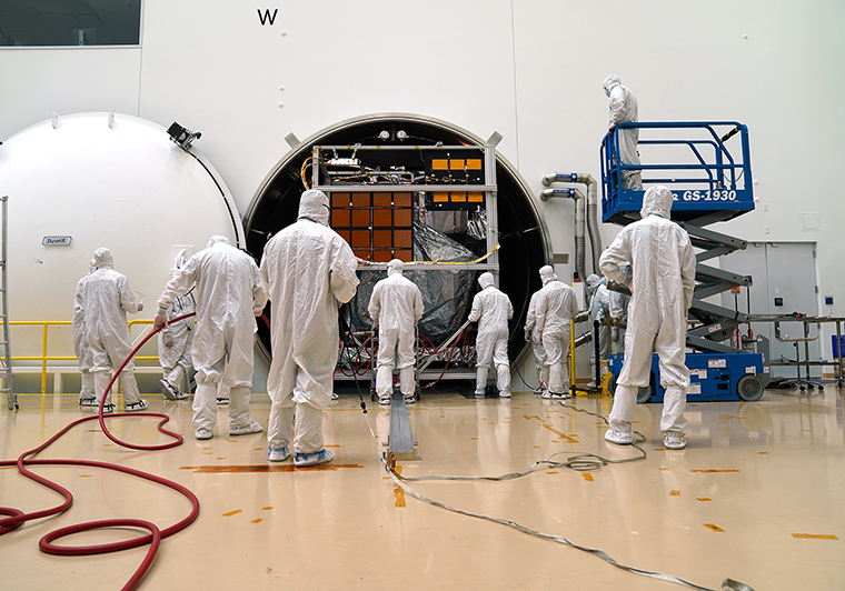
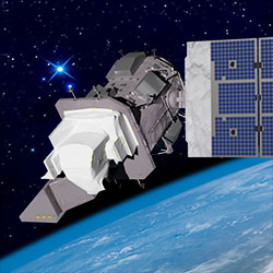
Landsat 9 Completes Test Simulating Harsh Space Environment
The Landsat 9 satellite has successfully completed its most strenuous environmental test leading up to launch.
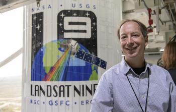
Data Chat with Dr. Jeffrey Masek
The Harmonized Landsat Sentinel-2 (HLS) project offers daily, 30-meter global land surface data products to facilitate a wide range of terrestrial Earth science research.
New USGS Case Studies Highlight Female Landsat Data Users
During the month of March, as we collectively celebrate Women History’s Month, we want to share a fantastic trio of user case study videos published by the U.S. Geological Survey.
A Harmonious New Dataset
The Harmonized Landsat Sentinel-2 dataset has been provisionally released. Come explore Landsat 8 and Sentinel-2 data… together.
Alert System Shows Potential for Reducing Deforestation, Mitigating Climate Change
Landsat-based Global Forest Watch alerts seem to be helping slow down forest loss in Africa.

Landsat Featured on Recent NOVA Now Podcast
Landsat 9 Project Scientist Jeff Masek from NASA Goddard was interviewed for NOVA Now.
A Well-Rooted Study
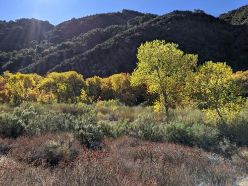
Using Landsat to keep an eye on the trees offers an effective way to monitor groundwater along river corridors in the Southwest.
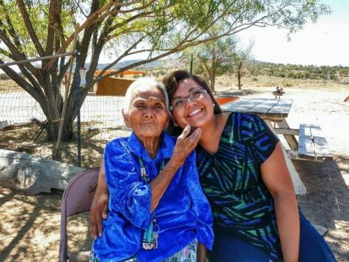
Connecting The Drops: Managing the Navajo Nation’s Water Resources with Satellites and Indigenous Knowledge
The NASA-funded Navajo Nation Drought Project has built a cloud-based web application that uses Landsat and Sentinel-2 data, among others, to improve drought reporting and management in the Navajo Nation.
AGU Panel Explores Environmental Impacts of the COVID-19 Pandemic, as Observed from Space
Landsat shows some of the ways in which COVID-19 is changing the environment.
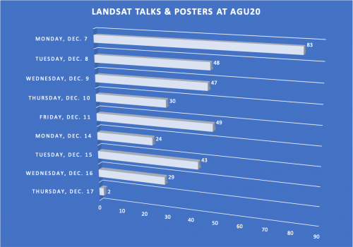
Landsat at #AGU20
This year over 350 presentations share work conducted with Landsat data.
Landsat 9—Continuing the Legacy
This new four-part video series shares the history of Landsat, how Landsat 9 works, how Landsat data gets from the satellite to the ground, and how Landsat data can be used with other data to support a wide range of research and applications. Enjoy!

Remembering David Landgrebe
November 30, 2020 • This month, the world lost a giant in the world of quantitative remote sensing. David A. Landgrebe passed away on November 21, 2020 at the age of
A Harmonious New Dataset
The Harmonized Landsat Sentinel-2 dataset has been provisionally released. Come explore Landsat 8 and Sentinel-2 data… together.
Alert System Shows Potential for Reducing Deforestation, Mitigating Climate Change
Landsat-based Global Forest Watch alerts seem to be helping slow down forest loss in Africa.
Landsat Featured on Recent NOVA Now Podcast
Landsat 9 Project Scientist Jeff Masek from NASA Goddard was interviewed for NOVA Now.
A Well-Rooted Study
Using Landsat to keep an eye on the trees offers an effective way to monitor groundwater along river corridors in the Southwest.
Connecting The Drops: Managing the Navajo Nation’s Water Resources with Satellites and Indigenous Knowledge
The NASA-funded Navajo Nation Drought Project has built a cloud-based web application that uses Landsat and Sentinel-2 data, among others, to improve drought reporting and management in the Navajo Nation.
AGU Panel Explores Environmental Impacts of the COVID-19 Pandemic, as Observed from Space
Landsat shows some of the ways in which COVID-19 is changing the environment.
Landsat at #AGU20
This year over 350 presentations share work conducted with Landsat data.
Landsat 9—Continuing the Legacy
This new four-part video series shares the history of Landsat, how Landsat 9 works, how Landsat data gets from the satellite to the ground, and how Landsat data can be used with other data to support a wide range of research and applications. Enjoy!
Remembering David Landgrebe
November 30, 2020 • This month, the world lost a giant in the world of quantitative remote sensing. David A. Landgrebe passed away on November 21, 2020 at the age of
