
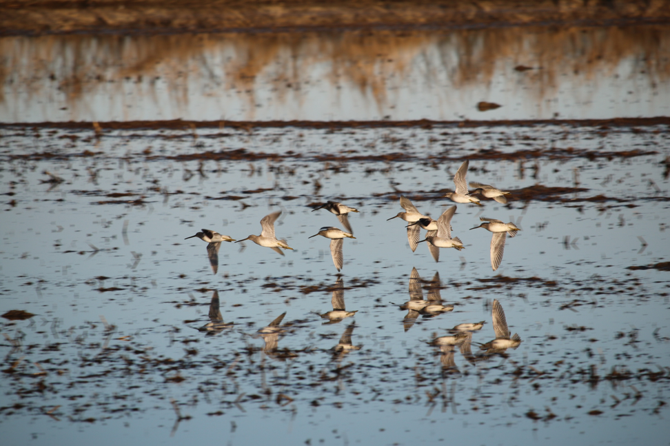
Earth Observations are for the Birds
Earth observations and citizen science are informing a program called BirdReturns to help restore lost natural wetlands.
Talking Climate Change with Conservation and Earth Scientists
Landsat 9 Project Scientist Jeff Masek joined astronaut Jessica Meir and other researchers to discuss the role of space and aviation technologies in studying our changing world as part of the Smithsonian Conservation Commons’ Earth Optimism initiative.

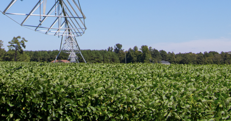
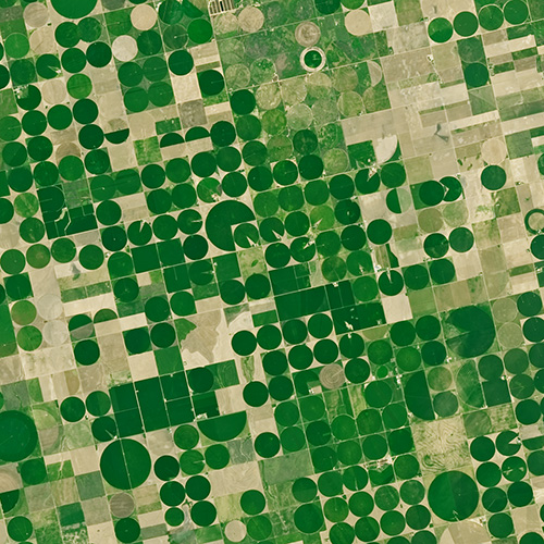
From Space to Farm
Farmers rely on the accuracy of a crucial NASA and USGS mission, Landsat, to make decisions about crops.
Landsat 9 Project Scientist on Expert Panel for Smithsonian Earth Optimism Event
Dr. Jeff Masek will talk about the Landsat data record and its role helping us understand our planet.
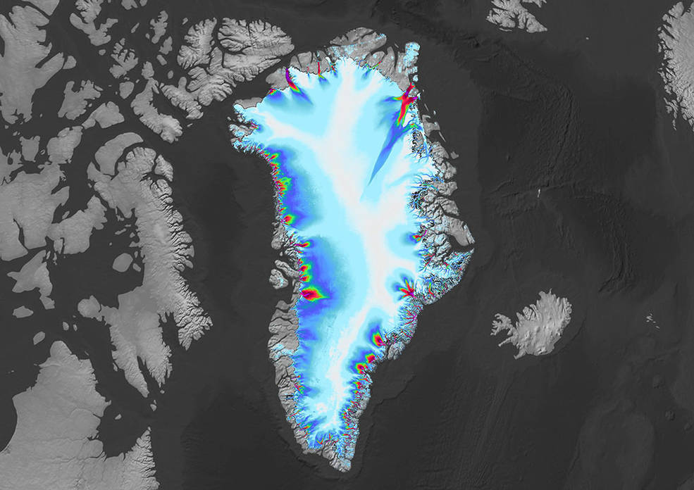
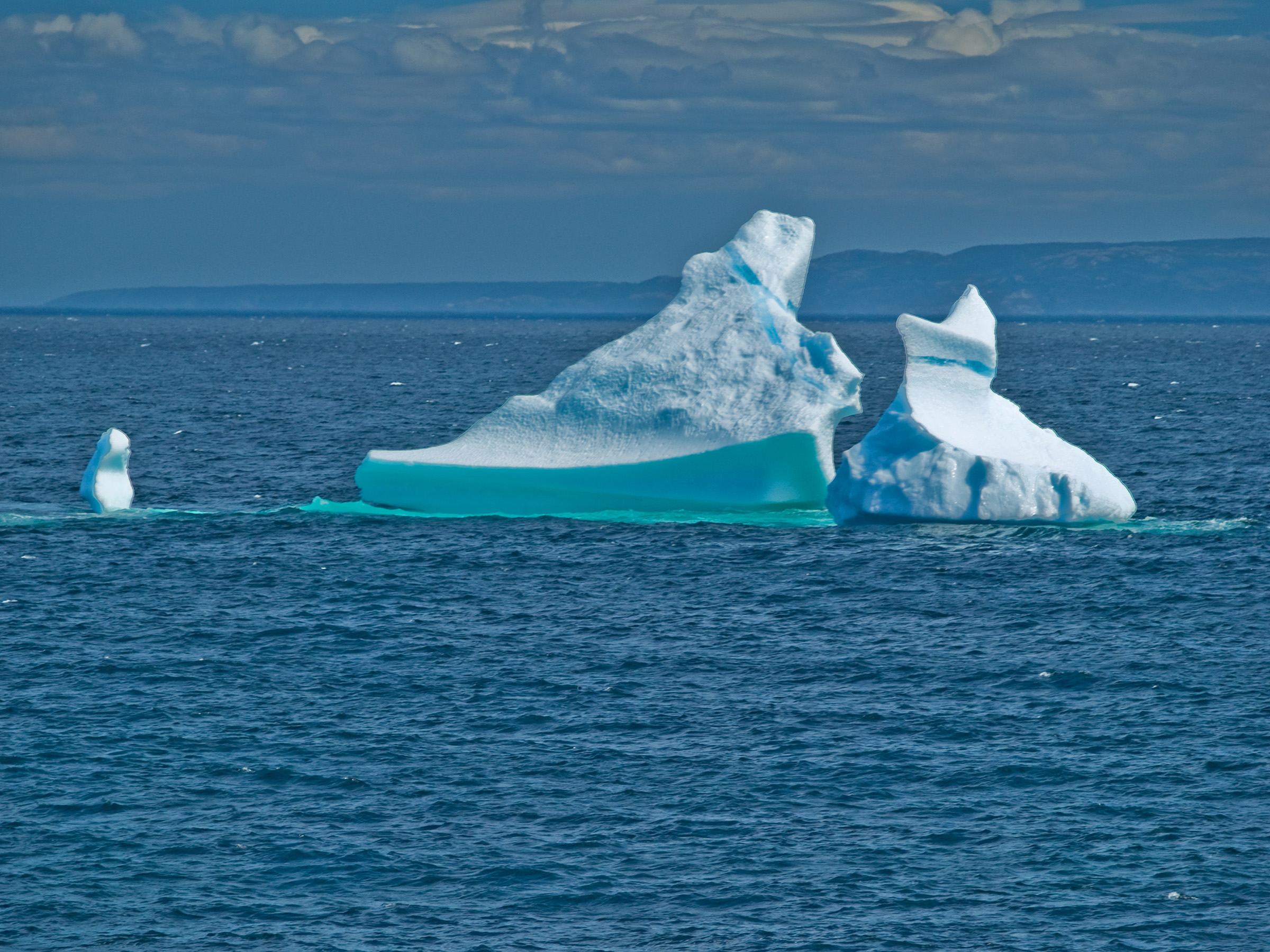
Greenland’s Retreating Glaciers Could Impact Local Ecology
Many of the Greenland’s glaciers are retreating while also undergoing other physical changes.
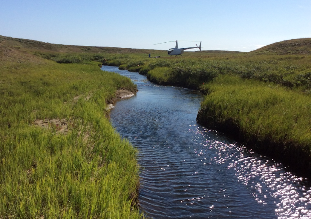
Satellite Data Meets Cellular DNA for Species of Interest
Scientists are combining data from water samples containing fish DNA with satellite data to find native fish and identify their habitats.
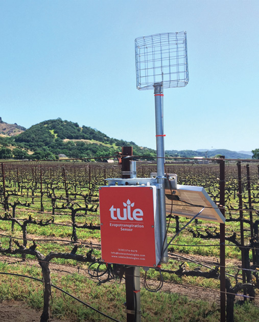
Satellite Imagery Helps Farmers Cut Water Use in Half
A young start-up is using satellite data to give California farmers better information about water, which can translate into water savings or bigger yield for the same input.
Landsat: Buttressing Knowledge About This Planet
A number of new data products with information derived from Landsat inputs have become available recently.
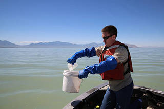
Early Detection of Algae ‘Blooms’ by Satellite Yields Healthcare Savings
The use of satellite data by environmental managers tracking harmful algal bloom outbreaks along lakefronts and coasts can result in earlier detections that yield significant savings on healthcare, lost work hours and other economic costs.
Agriculture: The View From Space
The Food and Agricultural Organization of the United Nations published an audio article about using geospatial data, including Landsat, to monitor would agriculture on soundcloud.
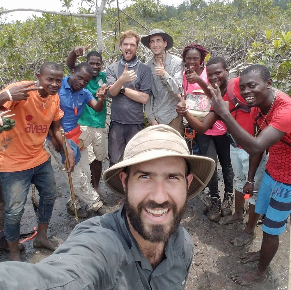
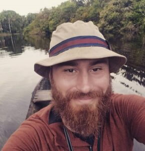
Meet Dr. David Lagomasino
Coastal ecosystems are some of Earth’s most biologically diverse environments, especially coastal mangrove forests. Dr. Lagomasino uses Earth observing data to study these vital biomes.
Landsat Helps Urban Planners Find Disparities in Access to Green Spaces
Study of two metro areas finds where parks, trees and other green spaces are located.
NASA Fosters Innovative Ways to Understand Biodiversity
NASA has funded four projects to create new, virtual portals to share a wealth of biodiversity information with land stewards around the world.
Meet Dr. Eric Bullock
Dr. Eric Bullock uses Earth observation data to explore the consequences of land use and land cover change in high biodiversity areas.
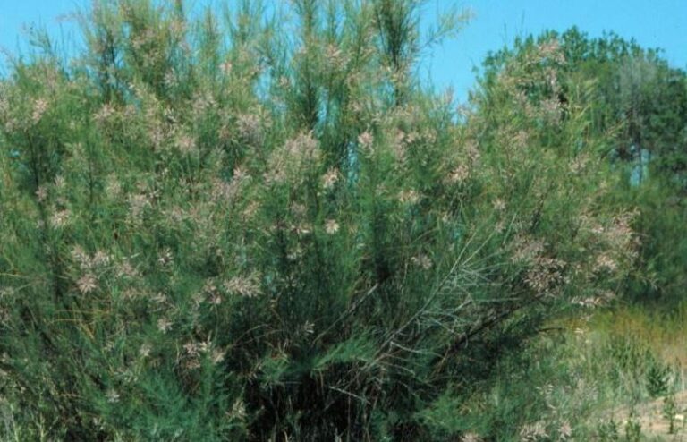
Sensing Invasive Species From Space
Invasive species cost the U.S. economy approximately $120 billion a year and disrupt the dynamics of ecosystems. Researchers are increasingly using remote sensing to map where invasive species are and where they could spread in order to minimize their damage.
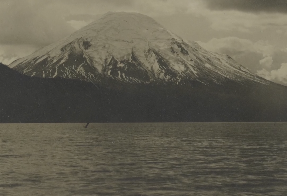
40 Years After Mount St. Helens’ Eruption, 40 Years of Forest Recovery
Landsat data (since 1972) is helping scientists Sean Healey and Zhiqiang Yang of the Rocky Mountain Research Station (U.S. Forest Service) study the long-term impact of the May 18, 1980, eruption of Mount St. Helens.
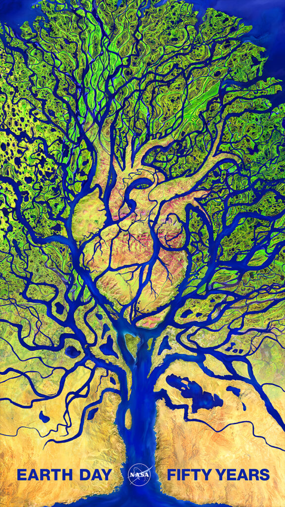
Celebrating the 50th Earth Day
The first NASA/USGS Landsat satellite was launched just two years after the first Earth Day and successive Landsat satellites have been helping us understand our planet ever since.
Early Detection of Algae ‘Blooms’ by Satellite Yields Healthcare Savings
The use of satellite data by environmental managers tracking harmful algal bloom outbreaks along lakefronts and coasts can result in earlier detections that yield significant savings on healthcare, lost work hours and other economic costs.
Agriculture: The View From Space
The Food and Agricultural Organization of the United Nations published an audio article about using geospatial data, including Landsat, to monitor would agriculture on soundcloud.
Meet Dr. David Lagomasino
Coastal ecosystems are some of Earth’s most biologically diverse environments, especially coastal mangrove forests. Dr. Lagomasino uses Earth observing data to study these vital biomes.
Landsat Helps Urban Planners Find Disparities in Access to Green Spaces
Study of two metro areas finds where parks, trees and other green spaces are located.
NASA Fosters Innovative Ways to Understand Biodiversity
NASA has funded four projects to create new, virtual portals to share a wealth of biodiversity information with land stewards around the world.
Meet Dr. Eric Bullock
Dr. Eric Bullock uses Earth observation data to explore the consequences of land use and land cover change in high biodiversity areas.
Sensing Invasive Species From Space
Invasive species cost the U.S. economy approximately $120 billion a year and disrupt the dynamics of ecosystems. Researchers are increasingly using remote sensing to map where invasive species are and where they could spread in order to minimize their damage.
40 Years After Mount St. Helens’ Eruption, 40 Years of Forest Recovery
Landsat data (since 1972) is helping scientists Sean Healey and Zhiqiang Yang of the Rocky Mountain Research Station (U.S. Forest Service) study the long-term impact of the May 18, 1980, eruption of Mount St. Helens.
Celebrating the 50th Earth Day
The first NASA/USGS Landsat satellite was launched just two years after the first Earth Day and successive Landsat satellites have been helping us understand our planet ever since.
