

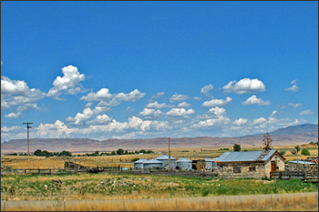
Landsat Images Offer Clearer Picture of Changes in Chesapeake Watershed
• Images taken from satellites more than 400 miles above the Earth’s surface are bringing land-cover changes throughout the Chesapeake Bay watershed into tighter focus. The images, which capture tracts
Water Watchers
Landsat doesn’t measure water vapor directly, but evaporating and transpiring water takes energy, something Landsat does observe. If they knew how much energy was going into driving evapotranspiration, Morse and Allen could estimate how much water a particular field of crops had consumed on any particular day.
Landsat-Based Water-Use Mapping Method Hailed as an Important American Government Innovation
In the dry Western states, where irrigated agriculture accounts for 86% of all water consumption, the water-use (evapotranspiration or ET) information provided by METRIC is critical for arbitrating increasingly common water-resource conflicts.
Landsat Used to Map Persian Gulf Coral Reefs
Contributor: Rashmi De Roy, World Wildlife Foundation In 2006, the WWF helped prepare the first map of coral habitats in the southeastern Persian Gulf, highlighting some of the most extensive
USDA Researchers Use Landsat to Estimate Horticultural Canopy Cover and Crop Water Demand
Horticultural crops account for almost 50% of crop sales in the United States, and these crops are carefully managed to ensure good quality. But more information is needed about the
Landsat’s Role in Chesapeake Bay Management
Four hundred years after Smith’s famous surveying expedition, North America’s largest estuary exhibits signs of stress and its once legendary seafood productivity has waned.