
Landsat data are processed, distributed, and archived by the USGS Earth Resources Observation and Science (EROS) Center in Sioux Falls, South Dakota. Landsat Collection 2 data and science products are freely available for viewing and download from EarthExplorer, LandsatLook, and GloVis. Collection 2 data can also be accessed from the Amazon Web Services (AWS) cloud platform. Links and information on how to access these services are provided below. More detailed resources can be found on the USGS website.
In addition to the data and science products distributed by the USGS, NASA has developed data and science products that further the use and applications of Landsat imagery. Harmonized Landsat Sentinel-2 (HLS) data is one of these valuable products. HLS data and other NASA Landsat- and HLS-derived products are distributed by the NASA Earth Observing System Data and Information System (EOSDIS) Distributed Active Archive Centers (DAACs). These products are freely available for viewing and download from various NASA data viewers and portals, which are linked below.
Landsat data are also available for visualization, computing, and analysis on other platforms, such as the Esri ArcGIS Online Landsat Explorer and Google Earth Engine. The Esri ArcGIS Online Landsat Explorer is freely available to anyone with internet access and Google Earth Engine is free for non-commercial use.
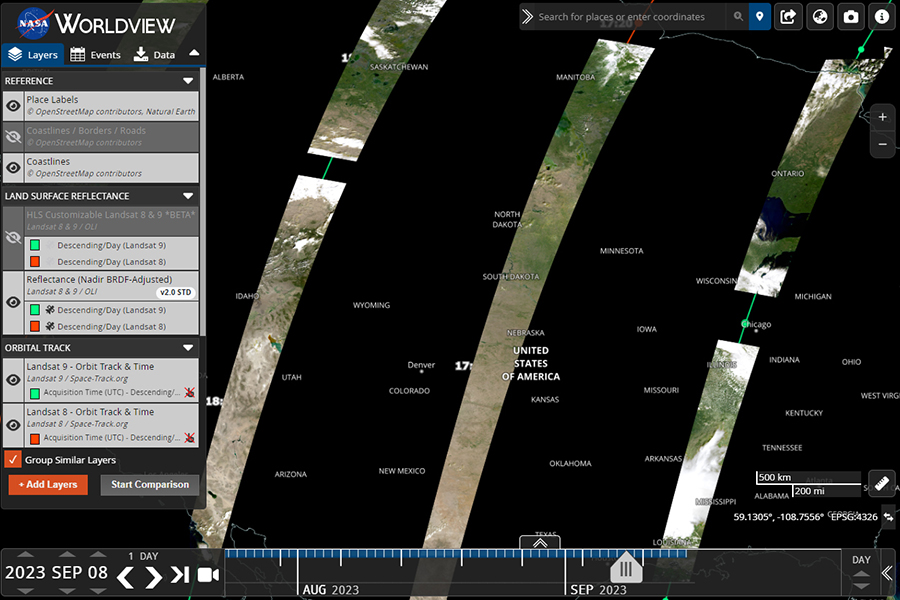
NASA Worldview is an interactive data viewer that provides the capability to browse full-resolution, global, daily satellite images. Many of the layers are updated daily, which supports time-critical application areas. Users can preview and download image snapshots and animated visualizations. NASA Worldview provides access to HLS Reflectance data, including vegetation indices and different band combinations. Learn more by Exploring Our Magnificent Earth with NASA Worldview.
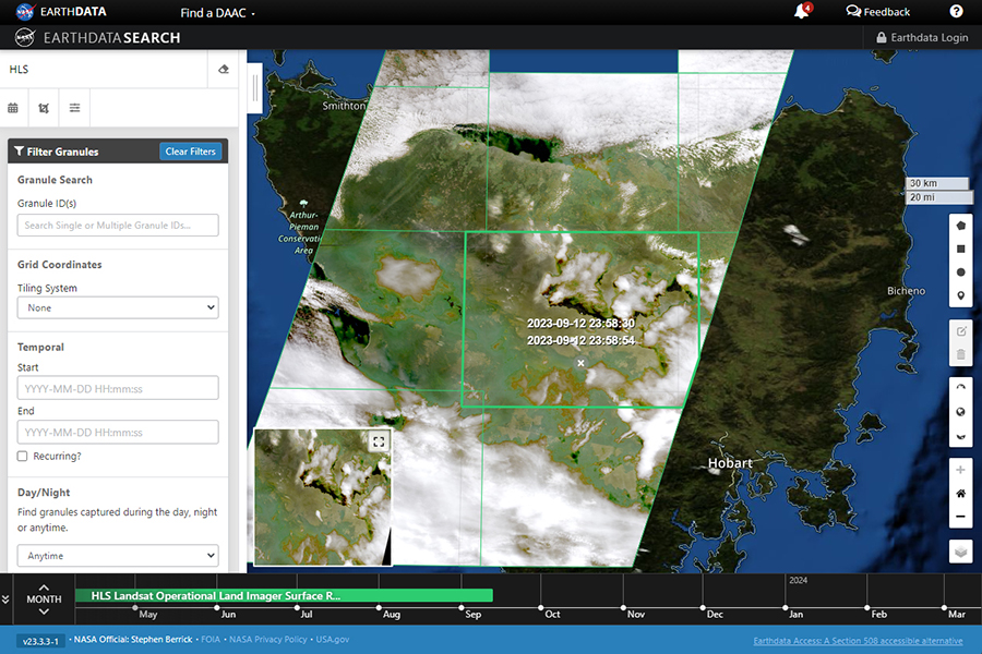
NASA Earthdata Search provides access to Earth observation data, including data from the EOSDIS DAACs. It is a powerful search and discovery map-based web application that includes resources for accessing and using data, as well as tools for viewing imagery and creating visualizations. Earthdata Search allows users to query data based on a keyword search and a variety of parameters. HLS data and other NASA Landsat- and HLS-derived products are available on this platform.
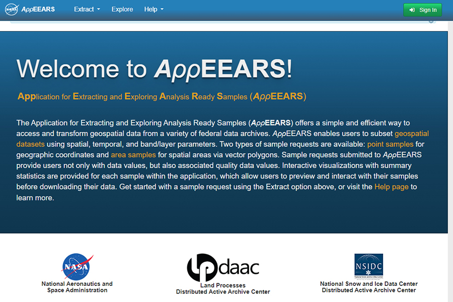
The NASA Application for Extracting and Exploring Analysis Ready Samples (AppEEARS) was developed by the LP DAAC to provide a simple and efficient way of accessing and transforming geospatial data from federal data archives. The interface enables users to extract data based on polygons or points and define subsets based on temporal and band/layer parameters. AppEEARS provides access to Landsat Collection 2 ARD Surface Reflectance and HLS Surface Reflectance data.
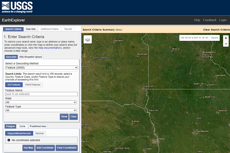
The USGS EarthExplorer web application provides free downloads of an extensive collection of digital data including satellite imagery, digital aerial photography, and cartographic products. Landsat data are one of the several products available for download. Users can navigate to a location, query, and download Landsat Collection 2 Level-1 data products, as well as Analysis Ready Data (ARD), Level-2 science products, and Level-3 science products.
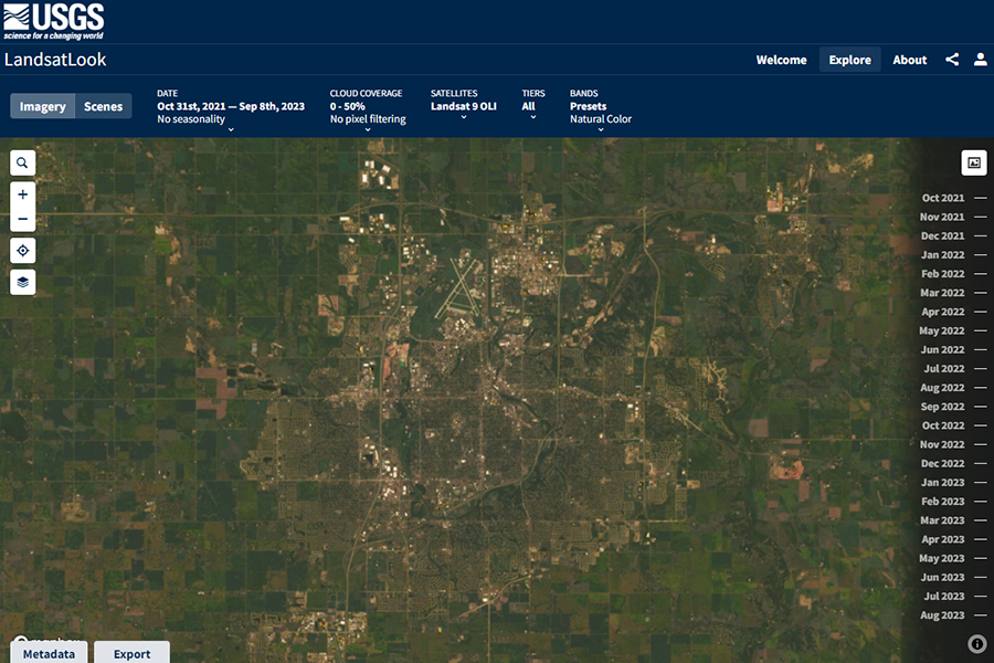
The USGS LandsatLook application is an online tool that allows rapid viewing of and access to Landsat Collection 2 Level-2 Surface Reflectance and Surface Temperature data. It allows users to query and filter scenes by area of interest, sensor, acquisition date, and cloud cover; visualize dynamic mosaics; filter out cloud-contaminated pixels; download individual bands; and generate video animations of time-lapses that show dynamic changes.
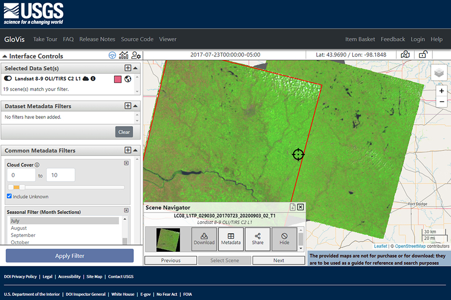
The USGS Global Visualization Viewer (GloVis) is an online search and download tool for select remote sensing data sets, including Landsat Collection 2 Level-1 scenes. With easy-to-use navigation tools, users can narrow their search down by selecting targeted data sets, panning to a geographic location, defining parameters, and applying metadata filters, such as acquisition date or cloud cover. Multiple scenes can be viewed and full-band source imagery can be downloaded.
Landsat Collection 2 data can be accessed from the AWS cloud platform. With AWS, users can leverage the data storage and processing capabilities that cloud services provide and explore ways to analyze the growing Landsat data record. Cloud access allows users to perform analysis on scenes or areas of interest using widely available open-source tools. It saves on pre-processing time, employs cloud-optimized file formats, and produces results that can be verified or enhanced by others.
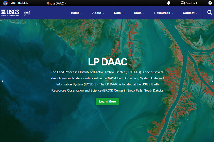
The Land Processes Distributed Active Archive Center (LP DAAC), located at the USGS EROS Center, is one of several discipline-specific data centers within the NASA EOSDIS. The center was established to process, distribute, and archive NASA data products related to land processes collected by Earth Observing System (EOS) sensors. HLS data is one of several products housed at the LP DAAC. LP DAAC data products can be accessed through the NASA Earthdata Search portal (see below).
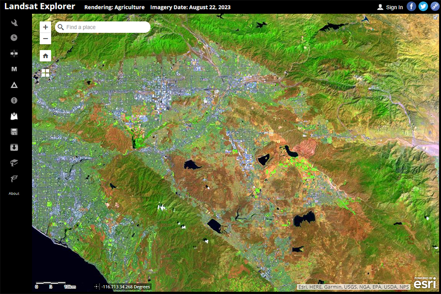
The Landsat Explorer, developed by Esri using publicly available image services, is an accessible and freely available web application that allows users to view the Landsat data archive. The application provides an interface for displaying Landsat data using different band combinations and spectral indices. It allows users to filter and select specific dates to view and compare; perform change detection; generate spectral and temporal profiles; and create scatterplots using spectral bands.
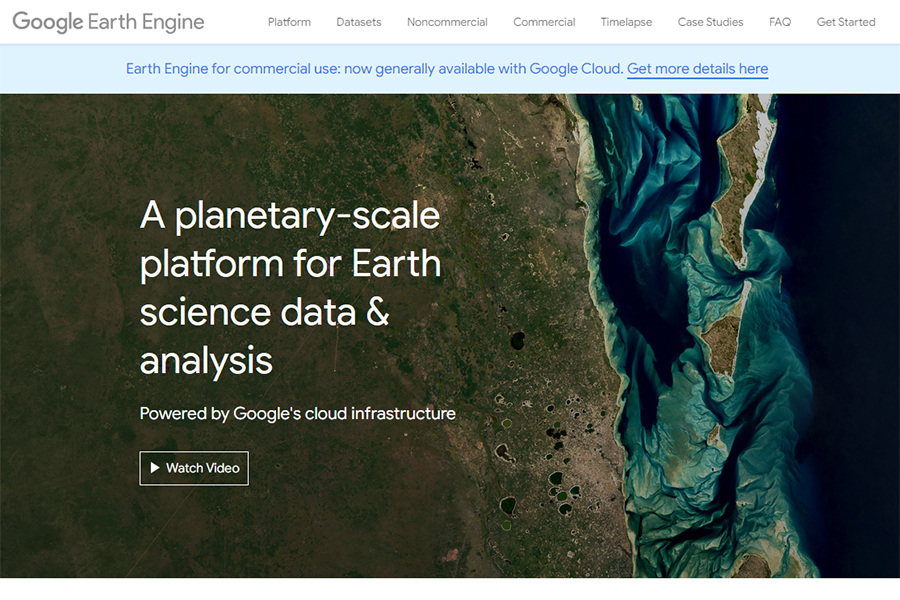
Google Earth Engine is a cloud-based geospatial analysis platform that enables users to visualize and analyze satellite imagery and geospatial datasets. Scientists, researchers, and developers can use it to detect changes, map trends, and quantify differences on the Earth’s surface. Google Earth Engine remains free for academic and research use. The public data catalog includes a variety of Earth science datasets, including Landsat Collection 2 data, Sentinel-2 data, and numerous Landsat-derived data products.
Disclaimer: This web page contains hypertext links to information created and maintained by other organizations. NASA is not responsible for the content of any off-site pages. Reference herein to any specific commercial products, processes, or services by trade name, trademark, manufacturer, or otherwise, does not constitute or imply its endorsement or recommendation by the United States Government.
