Landsat data have become an invaluable resource for understanding and monitoring the Earth and its natural resources. The long temporal record, global coverage, free and open access, and versatile applications make Landsat data an ideal tool for learning and advancing remote sensing skills and studying global and regional trends and patterns. There are numerous educational resources for learners of all ages and experience levels. The resources listed below are a subset of training courses, tutorials, webinars, and software programs that can assist users in learning how to download, process, and analyze Landsat data.
NASA ARSET Program
The NASA Applied Remote Sensing Training (ARSET) Program offers free self-paced training modules, live webinars, and in-person courses for beginner, intermediate, and advanced practitioners. The program empowers the global community through remote sensing education and assists applied science professionals and policymakers in using Earth observation data to support management and decision-making. Training courses cover a range of web portals, analysis tools, topics, and data, including Landsat.
- NASA ARSET Program Overview
- Training: Fundamentals of Remote Sensing
- Training: Spectral Indices for Land and Aquatic Applications (October 2023)
- Training: Monitoring Water Quality of Inland Lakes Using Remote Sensing (July 2023)
- Training: Connecting Citizen Science with Remote Sensing (January 2023)
- Training: Satellite Remote Sensing for Agricultural Applications (April 2020)
- Training: Investigating Time Series of Satellite Imagery (April 2019)
- Training: NASA Earth Science Data for Wildland Fire Decision Making (April 2017)
- Training: Land Cover Classification with Satellite Imagery (January 2017)
NASA Earthdata Webinars and Tutorials
NASA Earthdata is a gateway to one of the largest repositories of Earth observation data. It provides full and open access to scientists, educators, students, and the public with a wealth of data, tools, and information to aid in the understanding of Earth’s processes. NASA Earthdata offers webinars and tutorials that are designed to assist the end-user community in learning more about NASA datasets and their applications.
- Tutorial: What is Remote Sensing?
- Webinar: Advancing Science Capabilities with Data Harmonization: NASA’s Harmonized Landsat Sentinel-2 Product (May 2022)
- Webinar: From Pixels to Products: An Overview of Satellite Remote Sensing (March 2021)
- Webinar: Mapping Global Urbanization from Landsat Data and High-Resolution Reference Data (November 2018)
- Webinar: Discover and Access Landsat Analysis Ready Data (ARD) from the USGS Archive (June 2018)
- Webinar: Know Your Landsat: Understanding and Accessing Landsat Data (October 2014)
NASA Landsat and Remote Sensing Tutorials
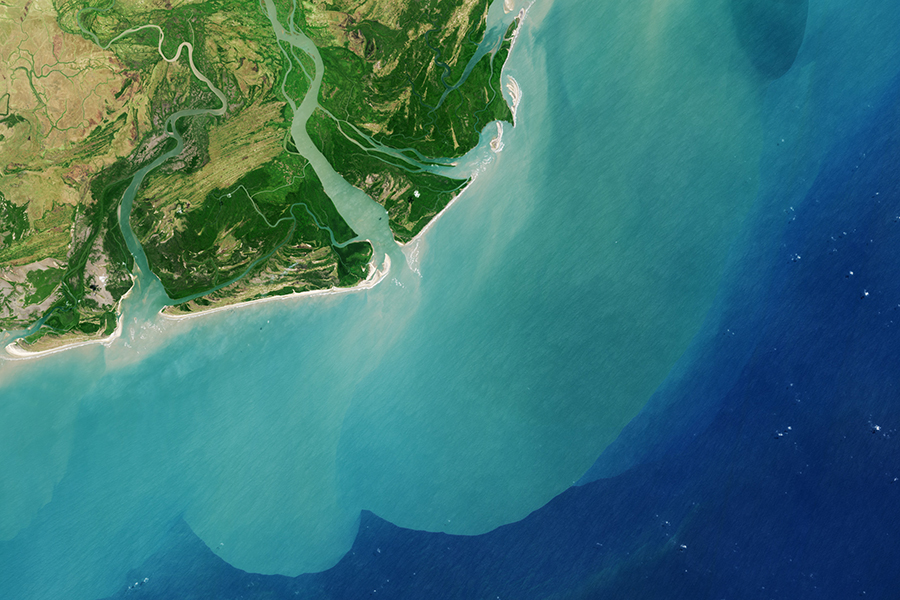
The NASA Landsat Communications and Public Engagement Team and NASA Earth Observatory, an online platform for image-driven stories about Earth Systems, have created some introductory Landsat and remote sensing tutorials. These tutorials are designed to provide an understanding of satellite data in an engaging way and inspire a range of audiences and learners to create and interpret stunning Landsat images.
- Creating a Landsat Image in Photoshop (ArcGIS StoryMap, October 2023)
- How to Make a Landsat Image Using Adobe Photoshop (Full Video Tutorial, October 2023)
- How to Pan-sharpen Landsat Imagery (June 2017)
- Why is that Forest Red and that Cloud Blue? How to Interpret a False-Color Satellite Image (March 2014)
- How to Interpret a Satellite Image: Five Tips and Strategies (November 2013)
- How To Make a True-Color Landsat 8 Image (October 2013)
AmericaView Resources
AmericaView is a nationwide, university-based, and state-implemented network that advances Earth observation education through remote sensing science, applied research, workforce development, technology transfer, and community outreach. AmericaView and its StateView members offer educational and research resources designed empower individuals and organizations in the fields of remote sensing and Earth observation. The following StateView members have developed Landsat-related educational content.
- AlaskaView (University of Alaska Fairbanks): GIS Image Analysis in ArcGIS Pro (Free Online Course)
- IndianaView (Purdue University): Python Programming with ArcGIS Pro (Free Tutorial)
- Rhode IslandView (University of Rhode Island): Remote Sensing with Landsat in Rhode Island (ArcGIS StoryMap)
- TennesseeView (University of Tennessee): Educational Workshops and Trainings
- VermontView (University of Vermont): Downloading Landsat 8 OLI Data and Computing NDVI in ArcGIS Pro (Video Tutorial)
- West VirginiaView (West Virginia University): Free Online Geospatial Courses
Cloud Computing Resources
Landsat Collection 2 data can be accessed from Google Earth Engine and Amazon Web Services (AWS). Cloud storage and computing platforms enable Landsat data to be stored, managed, and analyzed in a cost-effective, accessible, and scalable manner. These services also provide access to powerful computing resources, task automation, and innovative capabilities. There are several introductory and advanced resources for learning how to process and analyze Landsat data in these cloud computing platforms.
- Google Earth Engine Catalog - Landsat Collection 2
- Google Earth Engine Landsat Algorithms Guide
- Google Earth Engine 101 Part 1 (Video Tutorial by Google Earth)
- Google Earth Engine 101 Part 2 (Video Tutorial by Google Earth)
- Analyzing a Landsat 8 image in Google Earth Engine (Video Tutorial by Google Earth)
- Cloud-Based Remote Sensing with GEE (eBook)
- Google Earth Engine 101: An Introduction for Complete Beginners (Video Tutorial by Stanford Geospatial Center)
- Loading Landsat 8 data into Google Earth Engine (Video Tutorial by James Cook University)
- Using Google Earth Engine for Land Monitoring Applications, Part 1/3 (Training by NASA ARSET)
- Using Google Earth Engine for Land Monitoring Applications, Part 2/3 (Training by NASA ARSET)
- Using Google Earth Engine for Land Monitoring Applications, Part 3/3 (Training by NASA ARSET)
- LandTrendr in Google Earth Engine (Kennedy Geospatial Lab at Oregon State University)
- LandTrendr Pixel Time Series Plotter (Kennedy Geospatial Lab at Oregon State University)
- Registry of Open Data on AWS - USGS Landsat
- Landsat Commercial Cloud Direct Access Users Guide (USGS User Guide)
- Landsat Cloud Direct Access Requester Pays Tutorial (USGS Tutorial)
- Landsat Spatio Temporal Asset Catalog (STAC) Tutorial (USGS Tutorial)
Open Source Software Programs & Resources
Open-source GIS and remote sensing software programs are a valuable resource for geospatial students and professionals. They offer a wide range of features and functionality that are generally comparable to proprietary software programs. The source code is openly available to users, which fosters innovation, promotes collaboration, and allows customization. The open-source GIS and remote sensing software programs and packages listed below are a select few.
Commercial Software Programs & Resources
Commercial GIS and remote sensing software programs offer a wide range of features and functionalities for working with geospatial data. They offer some advantages over open-source software, such as access to technical support, established training programs, powerful tools, and tested algorithms. Commercial software programs are also often designed with a user-friendly interface and can be easier to use than open-source programs.
- Introduction to ArcGIS Pro
- Esri Imagery and Remote Sensing Tutorials
- Tutorial: Get Started With Imagery
- Tutorial: Monitor Forest Change Over Time
- Tutorial: Evaluate Ethiopia’s Changing Landscape
- Tutorial: Depict Land Use Change With Time Animation
- Tutorial: Classify Land Cover to Measure Shrinking Lakes
Disclaimer: This web page contains hypertext links to information created and maintained by other organizations. NASA is not responsible for the content of any off-site pages. Reference herein to any specific commercial products, processes, or services by trade name, trademark, manufacturer, or otherwise, does not constitute or imply its endorsement or recommendation by the United States Government.

