
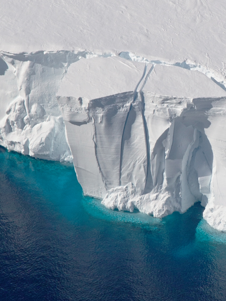
NASA Mapping Hurricane Damage to Everglades and Puerto Rico Forests
Last spring, NASA researchers flew over the Everglades and Puerto Rico to measure how mangroves and rainforests grow and evolve over time, then hurricanes Irma and Maria struck.
Landsat Abounds at #AGU16
Over 375 presentations at this year’s AGU Fall feature Landsat.
Landsat at the 2015 AGU Fall Meeting
At this year’s AGU Fall meeting over 325 presentations feature research done using Landsat data. The Landsat-related papers and posters run the gamut of disciplines from cryosphere to biogeoscience to hydrology to global environmental change to natural hazards to informatics.
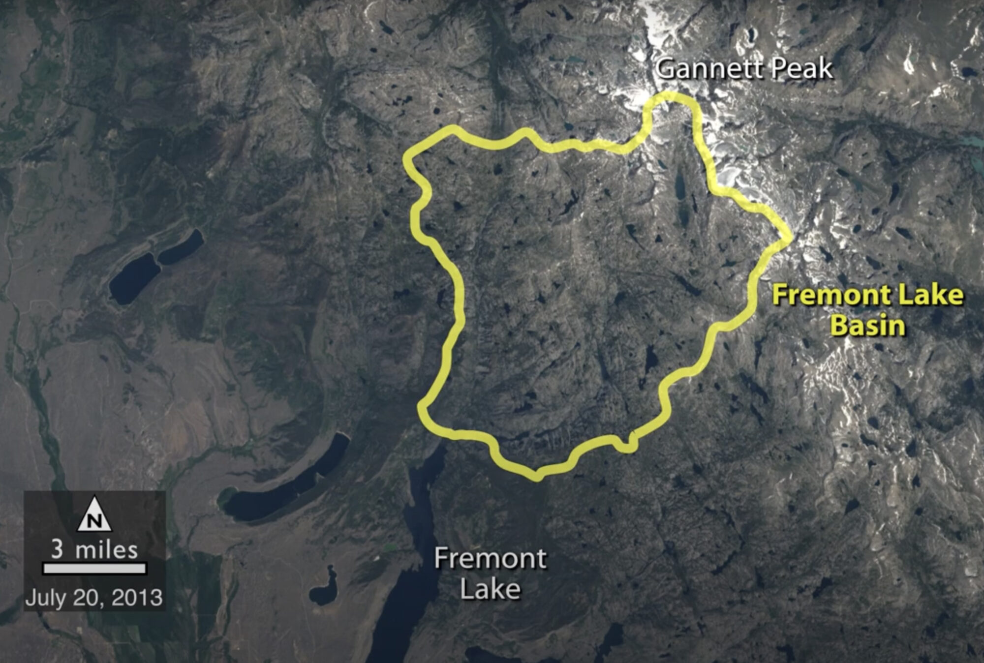
Historical Satellite Images Reveal Snow is Melting Earlier in Wyoming
A NASA study of a basin in northwestern Wyoming revealed that the snowmelt season in the area is now ending on average about sixteen days earlier than it did from the 1970s through the 1990s.

Commissioning the Landsat Data Continuity Mission
On the beautifully clear Monday morning of Feb. 11, 2013, the Landsat Data Continuity Mission made its way from California’s Vandenberg Air Force Base to low Earth orbit. The more
Landsat Data Bit by Bit: What Goes into Getting it Right
The great strength of Landsat data is its long record, the ability to look at our planet over the past 40 years and see what changes man and nature have
