

Landsat data have allowed scientists to study and monitor the U.S. National Parks since 1972, supporting biodiversity, recreation, and human health and wellness. Explore curated content and learn how Landsat data are used to monitor, manage, and protect these diverse landscapes.

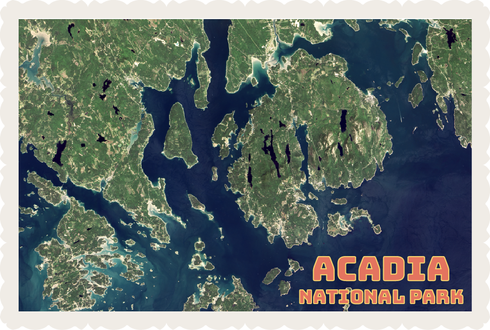

Landsat satellites provide invaluable data used to monitor, manage, and protect the diverse landscapes of the U.S. National Park Service. Take a tour of our favorite U.S. national parks as seen by Landsat and learn how more than 50 years of data is benefiting society.


Landsat satellites provide invaluable data used to monitor, manage, and protect the diverse landscapes of the U.S. National Park Service. Take a tour of our favorite U.S. national parks as seen by Landsat and learn how more than 50 years of data is benefiting society.
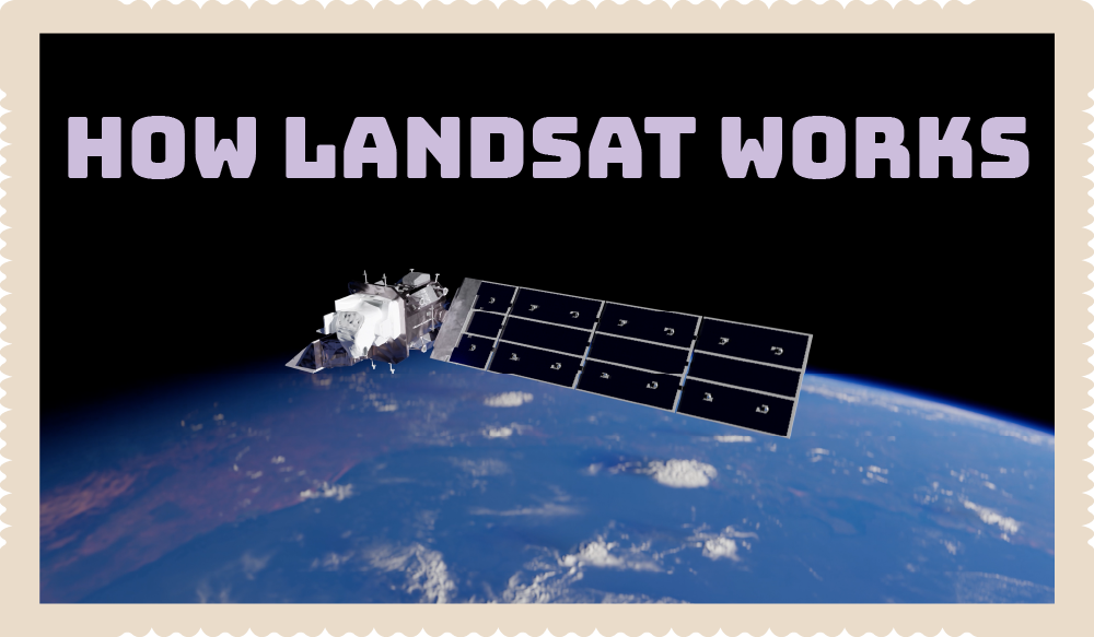
Landsat images might look like astronaut photos, but they contain information used by scientists to better understand our changing planet and help manage Earth’s resources. Learn how Landsat images are created and used to benefit society.
Landsat images might look like astronaut photos, but they contain information used by scientists to better understand our changing planet and help manage Earth’s resources. Learn how Landsat images are created and used to benefit society.
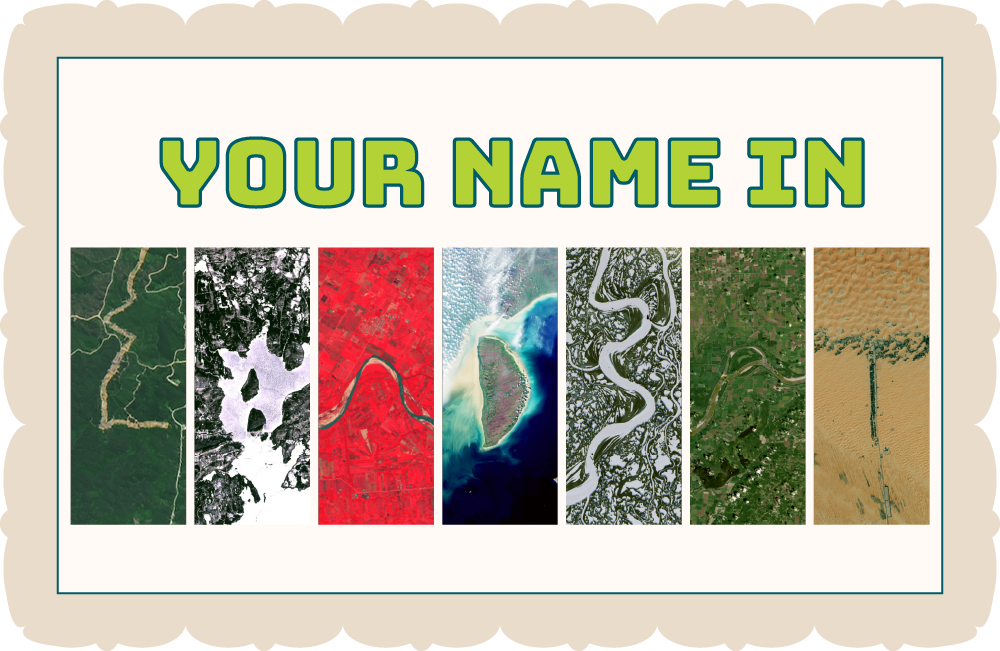
Make your very own poster with your name in Landsat letters. Just type in your name, save the graphic, and print. You can hover over each image to get the coordinates and you can also click on the letter to learn more about the image.
Make your very own poster with your name in Landsat letters. Just type in your name, save the graphic, and print. You can hover over each image to get the coordinates and you can also click on the letter to learn more about the image.
Explore America’s National Trails System with this fun boardgame. Travel the nation’s historical trails and national water trails and discover how Landsat sees our parks and rivers from space.
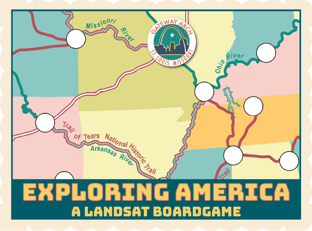
Explore America’s National Trails System with this fun boardgame. Travel the nation’s historical trails and national water trails and discover how Landsat sees our parks and rivers from space.


From the vantage point of space, data from Landsat has helped increase our understanding of our planet, improve lives, and safeguard our future. Remotely sensed data from Landsat and other NASA instruments helps scientists and resource managers map and measure our planet’s vital signs and study natural and human-caused changes to our climate and environment. Explore the science of remote sensing with these curated stories and activities.

We’re celebrating 50 years of the Landsat program with five week of summer fun at Camp Landsat! Explore curated activities, StoryMaps, and interactive and learn about how Landsat benefits society.
Join us for nine weeks of summer camp fun! This virtual camp explores a new theme each week about how Landsat satellites help manage, protect, and preserve some of your favorite places on Earth. Your virtual camp counselors have curated an exciting collection of videos, interactives, and downloadable activities you can do at home or with friends of all ages.
