Landsat Next Defined

Landsat Next Defined

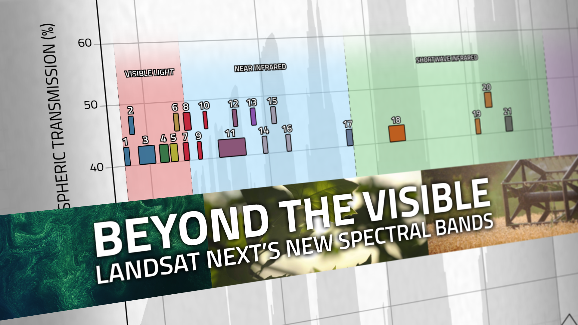
Landsat Next is on the horizon—the new mission will not only ensure continuity of the longest space-based record of Earth’s land surface, it will fundamentally transform the breadth and depth of actionable information freely available to end users. Take a look at the new capabilities that will define the next Landsat mission.

Read More »
Landsat Next Defined

Landsat Next Defined

Landsat Next is on the horizon—the new mission will not only ensure continuity of the longest space-based record of Earth’s land surface, it will fundamentally transform the breadth and depth of actionable information freely available to end users. Take a look at the new capabilities that will define the next Landsat mission.

Read More »

“Without Landsat, ‘we would be flying blind. We need those eyes in the sky to complement our ground efforts.'”


“Landsat 8 global ice mapping is enabled by its better data acquisition rate.”


“Our ability to analyze decades of history through the Landsat data record provided a strong backbone to this work.”


“The long time span covered by the Landsat scenes allows us to determine long-term flow velocity trends. The high temporal resolution lets us analyze seasonal flow velocity variations of numerous outlet glaciers…The monitoring system provides a powerful tool to examine the flow velocity pattern throughout time and space, and we have detected an acceleration pattern for a number of outlet glaciers.”


“Landsat provides wide coverage of the Himalayas for years with spatial and spectral quality, especially now, with Landsat 8 that has enhanced spectral resolution, which enables the monitoring of glacier state.”


“Having water consumption maps produced quickly on Smartphones has been everyone’s dream. In two years time we hope to see all farmers watching their fields from their phones and scheduling irrigations. EEEFlux is making Landsat the evapotranspiration satellite.”


“We like to think about Landsat as being, for this particular problem, sort of the sweet spot—the perfect asset. We found Landsat was really good at mapping the bulk of biomass for this particular test area we were looking at.”


“OpenET is working to make the unseen process of evapotranspiration as easy to track as checking the amount of rainfall in the daily weather forecast.”


“Landsat, a joint program of the U.S. Geological Survey (USGS) and NASA, offers an unparalleled record of our changing planet, with satellites that have been observing the Earth since 1972 to the present day.”


“Last year the White House found that GPS, weather satellites, and Landsat are the three most critical types of Earth-orbiting assets for civil applications, because they’re used by many economic sectors and fields of research.”


“This is an example of something government can do well: investing in infrastructure that broadly benefits society, and provides a stable platform for the development of businesses and economic activity. Landsat is the data equivalent of the interstate highway system, a public good that has spawned a thriving for-profit remote sensing industry in the US and beyond.”


“Landsat has given us a critical perspective on our planet over the long term and will continue to help us understand the big picture of Earth and its changes from space. With this view we are better prepared to take action on the ground and be better stewards of our home.”


“Landsat, with its five-decade record of robust collection, calibration and archiving, and its longstanding service as a global reference to cross-calibrate other missions, improves not only the quality of those systems but the overall quality of the global ‘system of systems’.”


“Landsat’s free and open data policy allows our coastline mapping methods to be easily scaled up and applied to other coastal regions, lowering barriers to understanding recent patterns and processes of coastal change globally.”


“Landsat data gives us a fuller picture of the planet we live on and the resources humanity needs to survive.”


“Until we made the map of coral reefs with Landsat 7, global maps of reefs had not improved a lot since the amazing maps that Darwin drafted.”


“Landsat pays dividends not only to the prosperity of the global economy, but also to people and planet.”


“We believe this type of continuous mapping of forest metrics at expansive scales would not have been possible without the excellent radiometric characteristics of Landsat 8, particularly the high level of quantization and the outstanding signal-to-noise ratio, which enables fine distinctions that were not previously possible.”


“As one of the longest data archives suitable for this purpose, Landsat data allows us to analyze coastal wetland change over time-periods that enable us to monitor long-term directional change in the extent of the world’s coastal ecosystems and distinguish them from natural fluctuations. Our work on tidal flats and global coastal wetland change would not be possible without free access to a long-term, spatially comprehensive dataset such as Landsat.”


“There is no other asset in the sky that can show us what Landsat does in terms of the effect of this eruption and also the effect of recovery following the eruption.”


“Our research would not have been possible if it weren’t for decades of reliable Landsat data to help us look back in time. We hope these findings will encourage people to not only mitigate the effects of increased wildfire activity, but also to limit emissions and curb global warming.”


“Until we made the map of coral reefs with Landsat 7, global maps of reefs had not improved a lot since the amazing maps that Darwin drafted.”


“When fighting broke out, the [New York Times] graphics team pulled up images from [the] Landsat 8 satellite to look for changes on the ground.”


“That’s the beauty of Landsat—it allows us to quantify these spatial patterns that are of high interest to water managers.”


Landsat 9 bw
Landsat 9 bw
Landsat 9 bw

The NASA/USGS Landsat Program provides the longest continuous space-based record of Earth’s land in existence. Landsat data give us information essential for making informed decisions about Earth’s resources and environment.