Landsat Enables World’s Most Comprehensive Mangrove Assessment
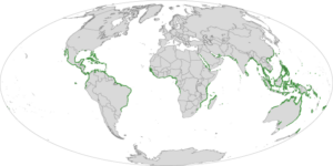
By Laura E.P. Rocchio The most definitive map of Earth’s mangrove forests has been created with Landsat data. A group of scientists, led by Chandra

By Laura E.P. Rocchio The most definitive map of Earth’s mangrove forests has been created with Landsat data. A group of scientists, led by Chandra
