![This map shows cropland distribution across the world in a nominal 30-meter resolution.](https://landsat.gsfc.nasa.gov/wp-content/uploads/2017/11/20171114_nu4-1024x669-1.png)
New Landsat-Based Map of Worldwide Croplands Supports Food and Water Security
A new map was released today detailing croplands worldwide in the highest resolution yet.
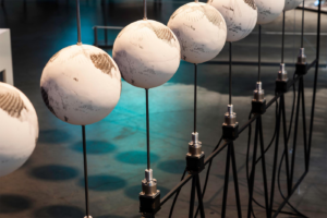
Uncharted, a cartographic art installation, was on display for the 2017 Pecora 20 in Sioux Falls, South Dakota.