Landsat 8’s robust data processing system also enables images to be available for public use within five hours of their arrival at the U.S. Geological Survey (USGS) Earth Resources Observation and Science (EROS) Center in Sioux Falls, S.D. Since 2008, all Landsat data is free to all. Enhanced Landsat 8 data have quickly found their way into a wide range of operational applications, including forest health monitoring by the U.S. Forest Service, burn severity mapping by the USGS, NASA and the National Park Service, and cropland mapping by the National Agricultural Statistical Service.
“Before launch, I stated that Landsat 8 would be the best Landsat satellite yet — and I think the first year has proven that,” said James Irons, Landsat 8 project scientist at NASA’s Goddard Space Flight Center in Greenbelt, Md. “Scientists are very pleased with the results. They can see more detail and can identify land cover more easily.”
In land cover classification tests, conducted by Curtis Woodcock of Boston University, the Landsat 8 classification results were 19.5 percent more accurate than those developed from Landsat 7. Australian researchers are finding that improved Landsat 8 data have enhanced their ability identify and quantify areas of land degradation or improvement in the extensive Australian outback.
“Landsat 8’s geometric and geodetic accuracy is so good that the USGS now has the means to use Landsat 8 data to significantly improve the geometric accuracy of the entire 4.6 million image Landsat archive,” Tom Loveland, USGS-EROS senior scientist, noted. “That’s a rare bonus — to be able to improve the historical record.”
With the help of Landsat 8’s thermal imagery, Ted Scambos and University of Colorado, Boulder, researchers found locations in eastern Antarctica that were several degrees colder than the -128.6 F (-89.2 C) record set in 1983.
Further Information:
+ NASA-USGS Landsat 8 Satellite Celebrates First Year of Success
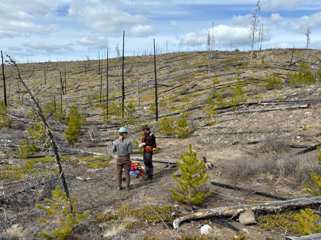
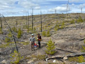
Understanding Forests After Fire With Landsat and LiDAR
Field researchers Sarah Smith-Tripp and Lukas Olson stand in a high-severity burn with minimal tree cover in central British Columbia. This area burned in the Pelican Lakes Fire in 2015.