As reported in the May issue of the Landsat Project Update, USGS librarian Carol Deering has analyzed the occurrence of Landsat-related articles in over 300 professional journals to determine the disciplines that use Landsat data most frequently.
Deering’s results verify the use of Landsat data across a wide spectrum of scientific fields—from coastal management to biogeography. Visit the USGS Landsat Project Update to learn more and to see a graphical representation of the study results.

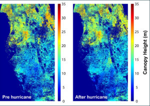
Mapping Forest Damage from Hurricane Milton on Florida’s West Coast
Rising sea levels and increased ocean temperatures are supercharging hurricanes. Using satellite data can help monitor vulnerable ecosystems.


