The first NASA/USGS Landsat satellite was launched just two years after the first Earth Day and successive Landsat satellites have been helping us understand our planet ever since.
Landsat featured prominently in our celebrations for the fiftieth Earth Day. Here, we captured a few places where Landsat made an appearance:
Earth Day Countdown
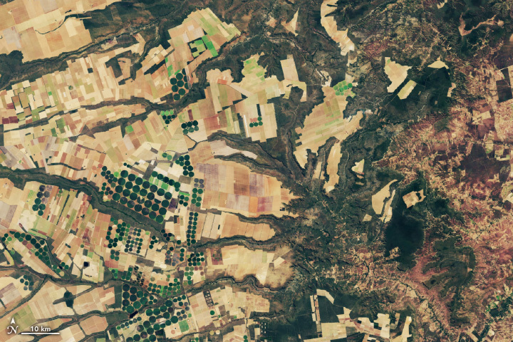
T-49: Mapping U.S. Crops and Farmland from Space
blog post by Samson Reiny
Growing food is one of humanity’s most expansive and essential uses of the environment, and it’s something we can now track in great detail from satellites. From vast swaths of corn fields to smaller clusters of citrus groves, Landsat satellites help the U.S. Department of Agriculture (USDA) track what’s growing on America’s farmland. On a color-coded map, a patchwork of corn (yellow) and soybeans (green) span the Midwest, while a rainbow of crops cover California’s Central Valley.
Landsat, jointly managed by NASA and the U.S. Geological Survey, collects data-rich images of Earth’s land cover with a resolution that can detect individual farm fields. By combining Landsat data with information from other satellites and on-the-ground surveys, the USDA maps each crop and tabulates the acreages every year. The program started in 1997, grew to include all of the contiguous United States in 2009, and continues today.
The crop data helps officials evaluate damage from floods, droughts and other natural disasters, while resource managers can use it to direct crop rotation, study land-use change and monitor water use.
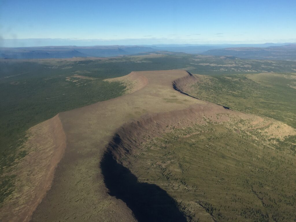
T-38: Glaciers on the Move
blog post by Kathryn Mersmann
Condense 48 years into six seconds, and Alaska’s glaciers move at a pace that’s anything but glacial. The rivers of ice flow and surge and shift and retreat, and time-lapse videos created from decades of satellite images track the changes over time.
The videos can help researchers study how glaciers behave over time, which in turn lets them forecast what will happen in a warming climate. Mark Fahnestock, a glaciologist at the University of Alaska Fairbanks, created these time-lapse videos for each glacier in Alaska and the Yukon, using images from the NASA/USGS Landsat satellites. He painstakingly searched for one cloud-free, late-summer satellite image for each year, going back to 1972 when the first Landsat satellite launched (Landsat 9 is slated to launch in 2021).
“When you play these movies,” Fahnestock said, “you get a sense of how dynamic these systems are and how unsteady the ice flow is.”
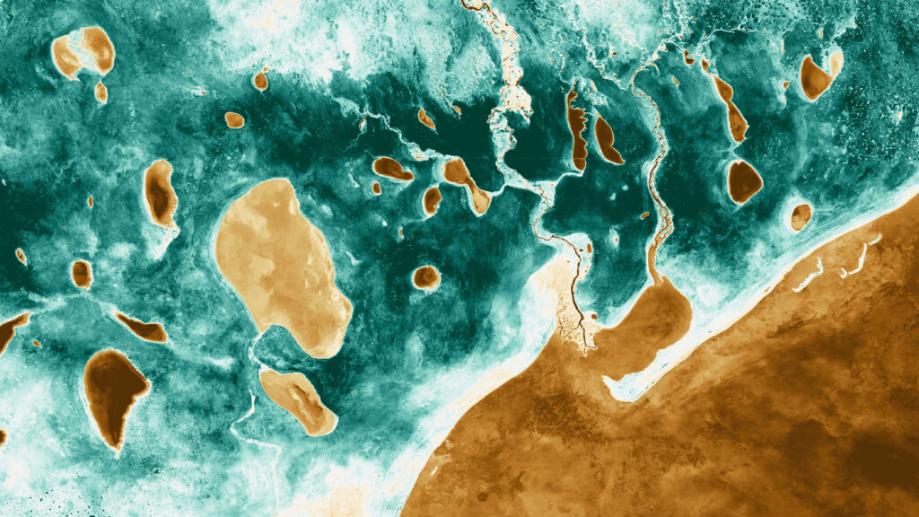
T-35: Landsat Sees Beauty on Earth
excerpted from blog post by Kathryn Mersmann
Since the launch of the first Landsat satellite in 1972, the joint NASA/USGS mission has gathered and archived more than 8 million images of Earth. These data-rich images are free and publicly available, allowing scientists to study how people and nature are changing the planet, and helping resource managers make better informed decisions.
Landsat satellites detect wavelengths of light that are both visible and invisible to us. A false color image is one that uses a visible color to stand for in the signal from an invisible wavelength.
Erupting volcanoes glow in false-color images, where the heat from lava flows stand from the ash and clouds.
Natural color images can reveal details of Earth’s surface as well, like sediment-heavy rivers as they swirl into the ocean.
T-15: Tracking Amazon Deforestation from Above
blog post by Kathryn Mersmann
In the early 2000s, the Brazilian rainforest was losing more than 8,000 square miles per year, an area nearly the size of New Jersey. But beginning in 2004, following several years of particularly rapid deforestation, the tide abruptly turned. Within a few years of adopting aggressive new environmental regulations, large-scale deforestation dropped by roughly 50 percent. By 2012, forest clearing was down nearly 80 percent.
Strengthened satellite-based forest monitoring systems played a key role in the turnaround, explained Raoni Rajão, an expert in environmental policy at Federal University of Minas Gerais. For several years, Brazilian government scientists had tracked deforestation with a system based on Landsat data called PRODES, but the data was mostly kept within government labs and agencies.
In 2002, with public outrage about deforestation growing, INPE began posting the full dataset online, complete with deforestation maps for all of the Brazilian rainforest. “That move toward transparency and accountability proved crucial because it made it possible for the science community, NGOs, and the public to engage,” said Rajão.
Read more about how satellites track Amazon deforestation here.
T-12: 48 Years of Land from Space
blog post by Kathryn Mersmann
As people celebrated the first Earth Day 50 years ago, NASA engineers and scientists were hard at work on a new remote sensing mission. While astronaut photos provided spectacular glimpses of our home planet in the vastness of space, and weather satellites showed clouds moving across oceans and continents, this new satellite would collect digital information on Earth’s surface at a much finer scale. It was called the Earth Resources Technology Satellite, or ERTS, and with it scientists could study forests, crop fields, urban areas and more – assuming they had the specialized, bulky devices needed to view an image.
ERTS launched in 1972, and a few years later was given a new name that is much more familiar to today’s scientists, farmers, resource managers and urban planners: Landsat. The Landsat series of satellites has continued since then, providing a 48-year unbroken record of Earth’s land surface. The record will continue with the 2021 launch of Landsat 9, a joint mission between NASA and the U.S. Geological Survey.
T-8: Water for Crops
blog post by Kathryn Mersmann
As the climate of our home planet changes, some places are drying out and others are getting wetter, including the land producing the food we eat.
NASA’s fleet of satellites has watched over Earth for more than half a century, collecting valuable agriculture data. This allows scientists to monitor farmland – tracking the overall food supply, where specific crops are grown and how much water it takes to grow them, with data from the joint NASA/USGS Landsat satellites and others. With that information, farmers can find new ways to grow more crops with less water.
It’s more important than ever for farmers to adapt farming practices to a warming world. The data collected by our Earth-observing fleet helps farmers learn about the planet that sustains us – and make better decisions about how to cultivate it.
T-1: Since the Beginning
blog post by Kathryn Mersmann
Since before the first Earth Day fifty years ago, NASA has had eyes on our planet from space. A few years before the first Earth Day, our very first weather satellites captured images of clouds moving in Earth’s atmosphere. Today, a constellation of satellites generates near-real-time images of precipitation around the globe.
Shortly after the first Earth Day, NASA and U.S. Geological Survey researchers were preparing to launch the first Earth Resources Technology Satellite, later named Landsat 1, to collect images of the land. Now, engineers are building and preparing to launch Landsat 9 to continue that record.
A few years after the first Earth Day, the Nimbus-7 satellite imaged changing sea ice in the Arctic and Antarctic. Now, NASA has a 40-year record of sea ice extent at both poles.
These are just a few of the many ways our view of Earth has sharpened since the first Earth Day.
#EarthDayAtHome with Earth Scientist Michael Freilich
“Thanks to satellites and to science, we now know much more about Earth than we did on the first Earth Day fifty years ago.”
—Dr. Michael Freilich, former director of NASA’s Earth Science division
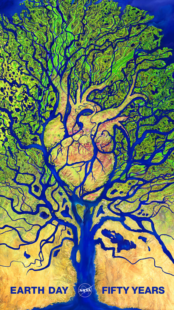
NASA Earth Day Poster 2020 – Combining Art and Science
“I mostly pulled imagery from Landsat series of missions which NASA operates in conjunction with the U.S. Geological Survey. My main resource for the delta was taken from my all-time favorite Earth as Art image, the Lena Delta in Siberia…”
—NASA Art Director Jenny Mottar on data she used to create her NASA Earth Day 2020 poster composition.
Related reading and viewing:
+ The Largest Group of Earth Scientists on Earth
+ NASA Looks Back at 50 Years of Earth Day
+ On Earth Day 50, NASA Researchers Look To the Future
Other Activities:
+ Landsat at Home
+ NASA at Home
+ GLOBE Observer at Home
+ EROS Reaches Out to Kids with Landsat Activities