
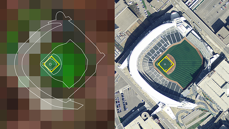
Landsat satellites collect data along a wide ground track that spans 185 kilometers (115 miles) but with a spatial resolution that allows them to see the human signature on the landscape. Each Landsat pixel covers a 30 by 30 meter area (98 by 98 feet), about the size of a baseball diamond. This still image shows the Landsat path over Minneapolis, the site of the 2014 Major League Baseball All-Star game, and reveal the individual pixels.
The yellow square is 30 meters on a side, exactly the size of a single pixel of Landsat data and slightly larger than a baseball diamond. The aerial photograph on the right shows Target Field in Minneapolis. The Landsat data on the left shows healthy vegetation in green while streets and buildings range from reddish-brown to white. Landsat’s spatial resolution of 30 meters allows us to see the landscape at a human scale while simultaneously collecting data across a broad swath 185 kilometers (or 115 miles) wide.
See more:
+ Zoom into Target Field with Landsat [flickr]


