
Landsat’s Role in Protecting Human Health
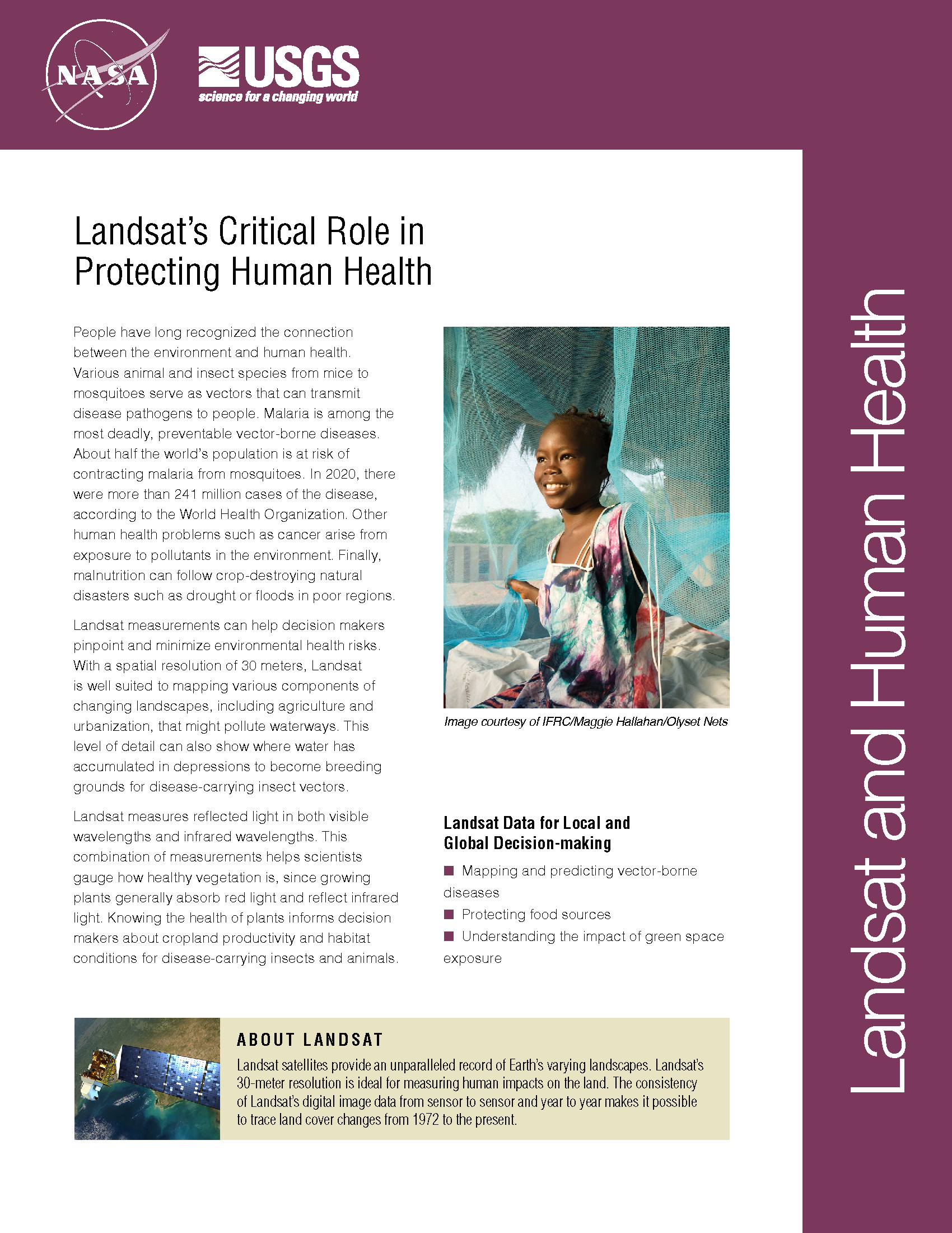
People have long recognized the connection between the environment and human health. Various animal and insect species from mice to mosquitoes serve as vectors that can transmit disease pathogens to people. Malaria is among the most deadly, preventable vector-borne diseases. About half of the world’s population (3.3 billion people) is at risk of contracting malaria from mosquitoes, according to the World Health Organization. Other human health problems such as cancer arise from exposure to pollutants in the environment. Finally, malnutrition can follow crop-destroying natural disasters such as drought or floods in poor regions. Landsat measurements can help decision makers pinpoint and minimize environmental health risks. With a spatial resolution of 30 meters, Landsat is well suited to mapping various components of changing landscapes, including agriculture and urbanization, that might pollute waterways. This level of detail can also show where water has accumulated in depressions to become breeding grounds for disease-carrying insect vectors. Landsat measures reflected light in both visible wavelengths and infrared wavelengths. This combination of measurements helps scientists gauge how healthy vegetation is, since growing plants generally absorb red light and reflect infrared light. Knowing the health of plants informs decision makers about cropland productivity and habitat conditions for disease-carrying insects and animals.
Detecting Landslides in Nepal with Landsat
Justin Roberts-Pierel from the Joint Center for Earth Systems Technology, uses Landsat 8 to detect landslides in the Himalayas. He provided information about his studies at #AGU15. We talked with him about his work.
How the 2010 Haitian Earthquake & Resulting Human Migration Affected Landslide Occurrences
At #AGU15 Yurika Kato, a Geosciences graduate student at the University of Missouri-Kansas City, presented his research about how the 2010 Haitian earthquake and resulting human migration affected landslide occurrences in the Port-au-Prince province. We spoke with Kato about his research.
Tracking Microbiological Health Hazards in Burkina Faso
Elodie Robert from the French National Center for Scientific Research presented preliminary results of her research at #AGU15 that aims to track microbiological heath hazards based on surface water turbidity in West Africa.
Landsat Images Advance Watershed Restoration in Western Tanzania
For those who live along its shores, Lake Tanganyika in east Africa is the backbone of local transportation and serves as an essential source of household water and protein. Every night, fishers lure nocturnal, sardine-like fish called dagaa with compression lamps that are strung between their boats. From the shore, the lake sparkles with the lights of miniature moons as people gather the treasured catch.
Water Mapping Technology Rebuilds Lives in Arid Regions
Turkana County in northwest Kenya has been reeling from several years of crippling drought. As a consequence, the nomadic peoples in the region have suffered. Livestock such as goats and cattle, the sole source of income for these pastoralists, have perished by the droves from starvation, and the resulting economic hardship has left many children malnourished. Many have also died from violent clashes over increasingly scarce resources.
Research Shows Green Space Keeps You From Feeling Blue
If you start feeling better as spring begins pushing up its tender shoots, you might be living proof of a trend discovered in data from the Survey of the Health of Wisconsin: The more green space in the neighborhood, the happier people reported feeling.
