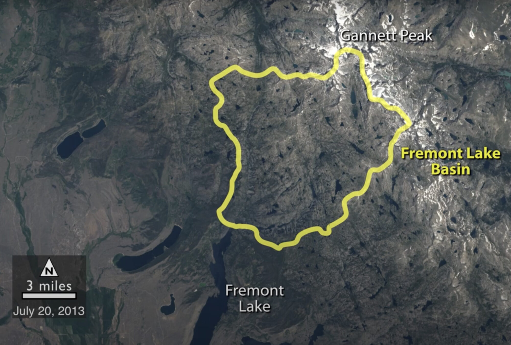
Historical Satellite Images Reveal Snow is Melting Earlier in Wyoming
A NASA study of a basin in northwestern Wyoming revealed that the snowmelt season in the area is now ending on average about sixteen days earlier than it did from the 1970s through the 1990s.
Landsat's Global Perspective
On July 23rd, 1972, the first Landsat spacecraft launched into orbit. At the time, it was called “Earth Resources Technology Satellite,” or ERTS, and was the first satellite to use a scanning spectrophotometer. Previous satellites relied on film cameras (ejecting the exposed film to be caught by planes) or transmitted the signal from television cameras. The scanning sensor and its successor sensors on subsequent Landsat satellites revolutionized how we study our home planet.
Landsat Looks to the Moon
Every full moon, Landsat 8 turns its back on Earth. As the satellite’s orbit takes it to the nighttime side of the planet, Landsat 8 pivots to point at the moon. It scans the distant lunar surface multiple times, then flips back around to continue its task of collecting land-cover information of the sunny side of Earth below. These monthly lunar scans are key to ensuring the land-imaging instrument aboard Landsat 8 is detecting light consistently. For a well-known and stable source of light, nothing on our planet beats the moon, which lacks an atmosphere and has an unchanging surface, barring the odd meteorite.
Maps for Good: Saving Trees and Saving Lives with Petapixel-Scale Computing
Google has leveraged the massive amount of data collected about our planet from space over the last four-plus decades—Landsat being one of the key data sets. In this video, Google Earth Engine founder Rebecca Moore shares how Google Earth began and some of the ways it can be used to make sense of decades and petabytes worth of data.
1977 Video: Landsat—Satellite for all Seasons
This 1977 NASA video series, “Landsat—Satellite for All Seasons,” provides examples of early Landsat applications.
Landsat Video From the Archives
The Landsat program is the longest continuous global record of Earth observations from space—ever. On July 23, 1972 NASA launched the first satellite in this program, then known as ERTS, the Earth Resources Technology Satellite and later renamed Landsat 1. In 2012, for the 40th birthday of Landsat, NASA edited together selections of an archive video from 1973 about the ERTS launch. Featured in this 1973 video was a senior geologist at NASA, Nicholas Short, and at Dartmouth College, Robert Simpson and David Lindgren. NASA and the U.S. Department of the Interior through the U.S. Geological Survey (USGS) jointly manage Landsat, and the USGS preserves a more than 40-year archive of Landsat images that is freely available over the Internet.

