
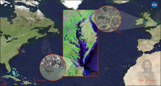
Landsat Image Presented to Queen Elizabeth II
In a historical event for NASA’s Goddard Space Flight Center, Queen Elizabeth II of England visited the NASA campus on May 8, 2007. One of the many diplomatic gifts presented to the Queen was a poster commemorating John Smith’s voyage of discovery in 1607 using data from Landsat 7, MODIS, and EO-1.
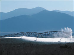
Precious Resources: Water & Landsat’s Thermal Band
Like most decisions, political and otherwise, having a thermal band on future Landsat missions is a matter of money. In order to show the intrinsic worth of a thermal band, water managers have attempted to quantify the monetary benefits of the improved water efficiency made possible with thermal data from Landsat.
U.S. Uses Landsat Satellite Data To Fight Hunger, Poverty
Remote sensing is a critical tool for agriculture, land use worldwide Source: Cheryl Pellerin, America.gov, U.S. Department of State Over the 35 years that U.S. Landsat Earth-observation satellites have collected images
U.S. Satellite Images of Earth Help Countries Worldwide
Landsat agencies committed to making data available to science community Source: Cheryl Pellerin, America.gov, U.S. Department of State U.S. agencies responsible for the Landsat series of Earth observation satellites have agreed
U.S. Agencies Moving Forward in Planning Landsat 7 Successor
35-year record of Earth observations is global scientific asset Source: Cheryl Pellerin, America.gov, U.S. Department of State After 35 years and 2 million images of the planet’s surface – and two
Landsat – Protecting the Price of Bread
Landsat satellite data are behind the accurate global crop production estimates that enable such price stability.
Landsat Mid-Decadal Global Land Survey on the Horizon
In the tradition of the Landsat GeoCover data products, a new mid-decadal global land survey is being created via partnership with USGS and NASA. The global data set, which will be
USGS Collaborates on Unique, Comprehensive View of Antarctica
Source: USGS The U. S. Geological Survey (USGS) in collaboration with the National Aeronautics and Space Administration (NASA) and the British Antarctic Survey (BAS) is developing a unique and versatile map
