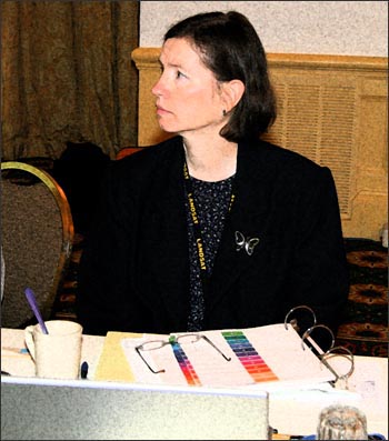
In this role, she keeps close ties with the Lockheed Martin engineers who built the satellite in the event that troubleshooting a Landsat 7 problem requires their knowledge and expertise.

“After launch in 1999, all the folks who helped build the satellite headed off to other programs… if anything goes wrong on the satellite, I get in touch with them and arrange for them to help the Flight Operations Team (FOT) solve the problem,” Arvidson explains.
Arvidson also serves as the custodian of the vast technical library of Landsat 7 program documentation produced by Lockheed Martin during the construction of the satellite.
She works closely with the FOT on mission scheduling–helping to balance satellite duty cycle (when and where Landsat 7 can collect data) with user requests (when and where data users need Landsat images). She also monitors the Long Term Acquisition Plan (LTAP). LTAP is a detailed strategy for collecting as many Landsat 7 scenes from around the world as possible based on seasonality, current weather conditions, data redundancy, and geographic location.
Arvidson regularly reports the LTAP status to the Landsat Project Science Office and relays requests for special science-related acquisitions back to the FOT schedulers. She documents this work by publishing papers on these efforts.
She also serves as a liaison to International Cooperators (IC)—the owners and operators of ground stations around the world that receive data downlinks from Landsat 5 and Landsat 7—supporting the USGS in making sure the Landsat international partners have the technical information they need to acquire, process and archive the Landsat data downlinked to their stations.
She also supports the semi-annual meetings with the international ground station personnel and advocates for ICs, when the U.S. ground system implements changes, to minimize the impact on their foreign systems.
Her path to Landsat
After graduating from college, Arvidson worked as an analyst on the Nimbus-7 satellite project at NASA’s Goddard Space Flight Center. It was during this time that a friend suggested she interview for a position with General Electric to work on the Landsat 4 ground system (pre-launch).
After a successful interview, she was hired by GE and has been working with the same company ever since (although GE sold their aerospace division to to Martin Marietta in 1993 and its since become Lockheed Martin). Arvidson has worked on aspects of the Landsat ground systems for all but two years since 1979.
Because Arvidson has been with the Landsat program since 1979, she has a lot of historical knowledge about the program and she knows the U.S. and international Landsat collaborators well. She can integrate her understanding of the project interfaces, politics, and data flow into a big picture perspective, helping her to make sound decisions.
“I can talk science to the science folks, spacecraft to the spacecraft folks, operations to the operations folks, and help one group understand the other’s requirements,” she asserts.
Her pre-Landsat background
Arvidson has a Bachelors of Science in Zoology. Her undergraduate study helped her, “to think through problems, to write efficiently and well, and to be a self-starter.”
The key to Arvidson’s ability to perform her job successfully are: her people skills, her writing skills, her ability to stay abreast of the big picture and to understand the ramifications that a change in one part of the system will have on the rest of the system.
Her feelings about her job
Arvidson enjoys and appreciates her job because of its world travel opportunities and for the international friends she has made along the way.
She also feels good, “knowing that I’m working on a project that benefits mankind, that’s going to help us understand what we’re doing to planet Earth and how we need to change in order to preserve the Earth for future generations.”
If this appeals to you
For those interested in Arvidson’s line of work, she says not to be intimidated by the words “space” or “engineering.” Instead, hone your problem solving abilities and work on your verbal and written communication skills.
She further advises you to, “get involved early with internships, summer studies, [or] find someone in the field and do a project with them.”
And she says, “most importantly, go with your passions. Mine are to travel and to help preserve this planet for future generations. I can do that with Landsat!”
Contributor: Laura E.P. Rocchio

Be Part of What’s Next: Emerging Applications of Landsat at AGU24
Anyone making innovative use of Landsat data to meet societal needs today and during coming decades is encouraged to submit and abstract for the upcoming “Emerging Science Applications of Landsat” session at AGU24.


