
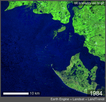
In this activity we will make an animated GIF from a Landsat time series using LandTrendr.
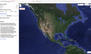
Step 1. Go to Earth Engine Apps
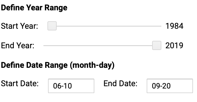
Step 2. Set the range of years and dates to animate over
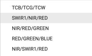
Step 3. Select an RGB/band display combination
Step 4. Set the desired animation frame rate
Step 5. Click 5 points to close a rectangle (go slow)
(may take a minute or two)
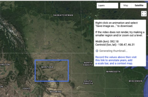
Step 6. Once rendered right click on the animation and and “save image as..” to download
Optional annotations:
Step 7. Record the width and centroid information
Step 8. Go to Snazzy EE-TS-GIF
Step 9. Follow the instructions to input the centroid, lat, long and upload the gif
Other tutorials for making animated GIFs with Landsat time series data:
+ Justin Braaten’s Snazzy-EE-TS-GIF tutorial on GitHub
+ Qiusheng Wu’s “Creating Landsat timelapse animations with animated text using Earth Engine” on Medium
Read More about LandTrendr:
+ Sensing Forest Disturbance: Landsat Sees Insect Outbreaks From Space
+ Big Data Helps Scientists Dig Deeper
Want to share your creation with the world? Use the hashtags #Landsat and #EarthDayatHome on Twitter and post your completed Landsat GIF. Accompany your tweet with you favorite thing about our home planet!
