
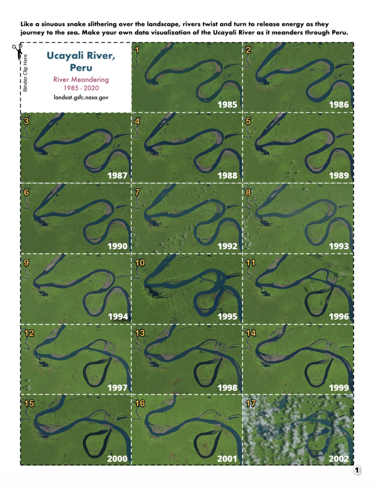
 In this activity, we will make a flip book showing the change over time of two different rivers which we can observe using Landsat and other remote sensing instruments. Follow the steps to create your own time series of Peru’s meandering Ucayali River. For even more fun, try coloring in the line art of Bolivia’s Mamoré River on the back of the flipbook!
Directions:
- Print out the Flipbook PDF .
- Cut along the dotted lines. For best results, cut each page individually, do not stack.
- Put images in order and align the images on right edge.
- Secure with binder clip and have fun flipping through time!
Learn more about Landsat and meandering rivers:
+ Sharp Bends Make Rivers Meander
Zoltan Sylvester, a sedimentary geologist and researcher at the Bureau of Economic Geology at The University of Texas at Austin, made these images for a blog post about exploring changes on the Earth’s surface seen with Landsat data and Google Earth engine. This example shows the Ucayali River changing its course through time. Other changes like vegetation, the spread of cities, and the melting of glaciers can also be observed with satellite data.
Want to share your creation with the world? Use the hashtag #CampLandsat on Twitter or Facebook and post your completed flipbook.
