NASA, AmericaView, and USGS have created a fun and educational new poster to celebrate Earth Science Week 2017. The poster offers a Landsat mosaic of the United States on its front and a board game to explore the many ways Landsat helps us study our planet.
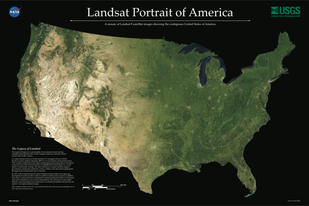
The Legacy of Landsat
The Landsat Program is a central pillar of our national remote sensing capability and represents the world’s longest continuous remotely sensed record of the Earth’s surface.
As a joint initiative between NASA and the U.S. Geological Survey (USGS), the first Landsat satellite (originally ERTS-1) was developed and launched in July 1972. Landsat satellites have provided uninterrupted space-based data of the Earth’s surface for more than 45 years and have established the United States as a world leader in land remote sensing. The data collected by Landsat satellites support government, commercial, industrial, civilian, military, and educational applications throughout the United States and worldwide.
This Landsat 8 mosaic of the U.S. was created by Descartes Labs (www.descarteslabs.com) in 2017 and used with permission.
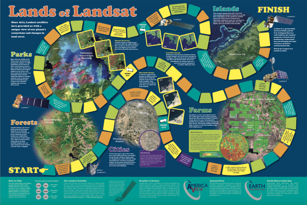
Lands of Landsat Board Game
Travel along a timeline of Landsat satellites and discover how Landsat benefits society. Landsat allows scientists study forests and islands from space, helps farmers monitor water, and tracks changes in our planet’s landscape.
+ Download Poster (127 Mb)
+ Download Game (481 Mb)
Spanish Version:
Additional Resources
+ AmericaView
AmericaView is a nationwide, university-based, and state- implemented consortium that advances the widespread use of remote-sensing data and technology through education, outreach, and workforce development for the public and private sectors.
+ USGS EROS Earth at Art
+ USGS Landsat
+ NASA Earth Observatory