
The Landsat program consists of a series of Earth-observing satellite missions jointly managed by NASA and the U.S. Geological Survey (USGS). To date, there have been nine missions, eight of which have been operational. Since the launch of Landsat 1 (formerly known as ERTS-1) in 1972, Landsat satellites have continuously and consistently captured images of the Earth’s land surfaces. With over five decades of observations, the Landsat program has created a data archive of unmatched quality and coverage that has vastly improved our understanding of the Earth, its natural resources, and its dynamic processes.

Expected Launch Date: TBD
Status: Under Review

Launch Date: September 27, 2021
Status: Operational
Instruments: Operational Land Imager 2 (OLI-2), Thermal Infrared Sensor 2 (TIRS-2)
Number of Spectral Bands: 9 from OLI-2, 2 from TIRS-2
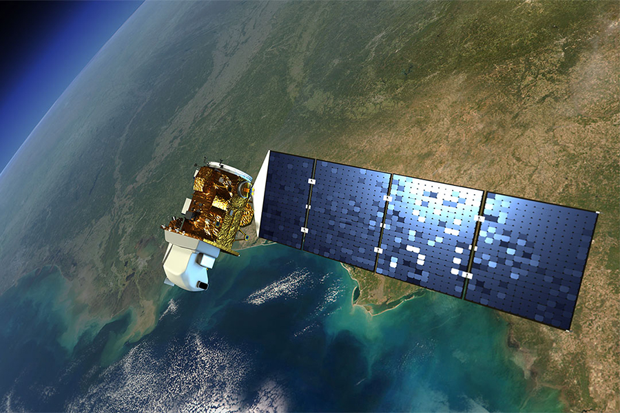
Launch Date: February 11, 2013
Status: Operational
Instruments: Operational Land Imager (OLI), Thermal Infrared Sensor (TIRS)
Number of Spectral Bands: 9 from OLI, 2 from TIRS

Launch Date: April 15, 1999
Status: Decommissioned on June 4, 2025
Instrument: Enhanced Thematic Mapper Plus (ETM+)
Number of Spectral Bands: 8

Launch Date: October 5, 1993
Status: Failed to achieve orbit
Instrument: Enhanced Thematic Mapper (ETM)
Number of Spectral Bands: 8
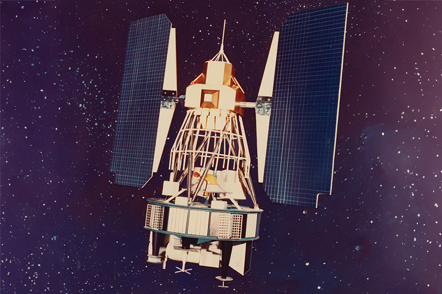
Launch Date: March 1, 1984
Status: Decommissioned on June 5, 2013
Instruments: Thematic Mapper (TM), Multispectral Scanner (MSS)
Number of Spectral Bands: 7 from TM, 4 from MSS
Launch Date: July 6, 1982
Status: Decommissioned on June 15, 2001
Instruments: Thematic Mapper (TM), Multispectral Scanner (MSS)
Number of Spectral Bands: 7 from TM, 4 from MSS

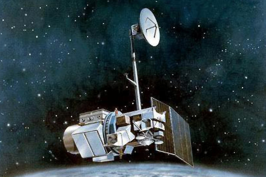
Launch Date: March 5, 1978
Status: Decommissioned on September 7, 1983
Instruments: Multispectral Scanner (MSS), Return Beam Vidicon (RBV)
Number of Spectral Bands: 4 from MSS, 1 from 2-camera RBV

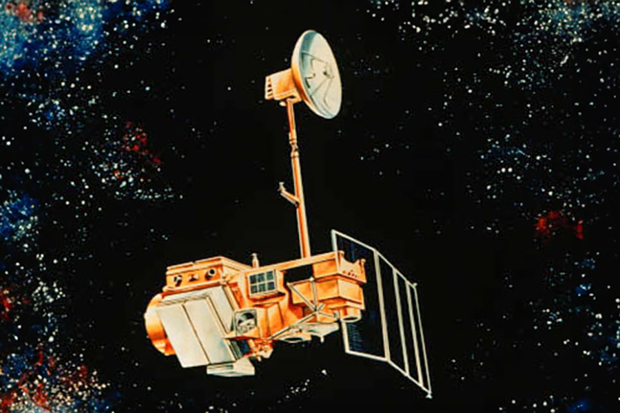
Launch Date: January 22, 1975
Status: Decommissioned on July 27, 1983
Instruments: Multispectral Scanner (MSS), Return Beam Vidicon (RBV)
Number of Spectral Bands: 4 from MSS, 3 from 3-camera RBV
Launch Date: July 23, 1972
Status: Decommissioned on January 6, 1978
Instruments: Multispectral Scanner (MSS), Return Beam Vidicon (RBV)
Number of Spectral Bands: 4 from MSS, 3 from 3-camera RBV
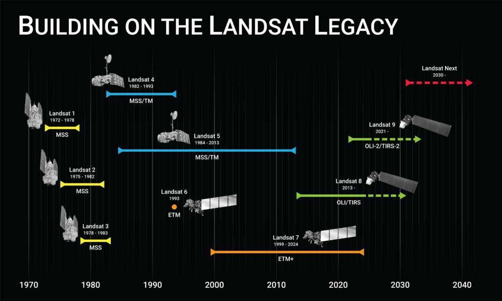
On July 23, 1972, the first Earth Resources Technology Satellite (ERTS-1), later renamed Landsat 1, was launched. After more than five decades of observations and eight operational missions, the Landsat program continues to deliver scientifically valuable and visually stunning images of the Earth.

The Landsat program was conceived in 1966 largely as a direct result of the demonstrated utility of the Mercury and Gemini orbital photography to Earth resource studies. Over the course of mission operations, there has been an intriguing, rich, and unpredictable history that was shaped by key agencies and prominent individuals.