Search
Close this search box.

Landsat 7 Flies Its 50,000th Orbit

Landsat 7 Flies Its 50,000th Orbit

The Yalu River
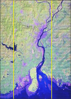
Landsat 7’s 50,000th orbit took the satellite over China and Korea. The Yalu River which divides China and North Korea can be seen above in an image acquired on that orbit, [This image falls on WRS-2 Path 118 Row 32, acquired on Sept. 8, 2008]
The Landsat 7 satellite flew its 50,000th orbit on Monday, September 8, 2008. Landsat 7 has been orbiting the Earth since its launch in April 1999. Landsat satellites provide an unparalleled record of Earth’s varying landscapes to help us understand how Earth is changing and what those changes mean for life on our planet. The consistency of Landsat’s data from sensor to sensor and year to year, makes it possible to trace land cover changes from 1972 to the present. Landsat sensors have captured over two million digital images of Earth’s continents and surrounding coastal regions. NASA designs the Landsat Earth-observing satellites; USGS manages the satellites, archives the imagery, and makes the data available to all interested users.

On Key

Recent Posts

On Key

Related Posts