
Abstract
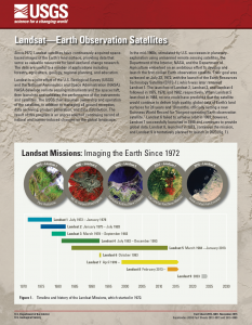
Since 1972, Landsat satellites have continuously acquired space-based images of the Earth’s land surface, providing data that serve as valuable resources for land use/land change research. The data are useful to a number of applications including forestry, agriculture, geology, regional planning, and education. Landsat is a joint effort of the U.S. Geological Survey (USGS) and the National Aeronautics and Space Administration (NASA). NASA develops remote sensing instruments and the spacecraft, then launches and validates the performance of the instruments and satellites. The USGS then assumes ownership and operation of the satellites, in addition to managing all ground reception, data archiving, product generation, and data distribution. The result of this program is an unprecedented continuing record of natural and human-induced changes on the global landscape.
+ Landsat—Earth Observation Satellites (USGS Fact Sheet 2015-3081)

Landsat & LCLUC: Science Meeting Highlights
Outreach specialists from the Landsat Communications and Public Engagement team participated in community engagement efforts at the joint NASA and University of Maryland Land Cover Land Use Change (LCLUC) meeting.


