Contributor: Alexander F. H. Goetz, University of Colorado at Boulder

More than 10 percent of the United States’ High Plains region is made up of sand dunes and sand sheets that are currently stabilized by the natural grasses growing on them and by irrigated farming. If future climate change leads to increased temperatures and less rainfall in this arid region, as some climate models predict, these sandy landscapes could be “reactivated” and begin blowing as they did in the “dust bowl” years of the 1930s.
Information about the dunes in this 800,000 square-kilometer region – encompassing parts of Colorado, South Dakota, Nebraska, Kansas, Oklahoma, Texas, and New Mexico – has been available for decades. However, a systematic study of the relationship between humans and the land and land-use change on a large geographic scale is only now possible utilizing satellite observations.
Alexander Goetz, professor of geological sciences at the University of Colorado is leading a research team to create an effective way to assess how the High Plains will be affected by future climate change. Using Landsat 5 data from 1984 to the present, Goetz’ team has completed a detailed study of land cover change in northeastern Colorado and is creating a 15-year database of land cover and human-induced land cover changes in the region.
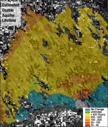
One of the more striking observations is the dramatic shift from dry-land farming and flood irrigation to center-pivot irrigation since 1985. Some of the pivots are located in the dune areas and these spots would become dune reactivation sites if the irrigation were discontinued, according to Goetz.
Combining land-cover data with meteorological and future climate data in a regional climate model, Goetz plans to produce a model-based method for estimating future dune reactivation and identifying the areas with the highest potential for reactivation. The team will also investigate the potential effect of abandoning farmed and irrigated lands on dune reactivation.
Landsat 7 data provides the researchers with many more images than were previously available, since the team can acquire images from every pass of the satellite over the region. With multiple images during a growing season, they can more precisely distinguish crop types and change. Goetz expects that by extending the Landsat data set beyond 2000, he will be able to catch a significant drought year, which will help to validate models for the effect of low rainfall in the High Plains.
Spectral Characterization
The measured wavelength locations of the ETM+ spectral bands are compared to Landat 5’s TM in Table 8.1 The spectral bandwidths are determined by the combined response of all optical

