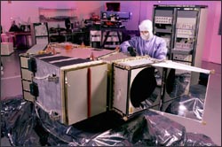
“While Landsat instruments are fundamentally just electrooptical transducers that ingest photons and eject a digital bit stream, this transduction relies upon the state of the art in numerous technologies including optics, precision electromechanics, detectors, advanced materials, cryogenics, and signal processing.” —Aram Mika, 1997
Technical descriptions of the Landsat satellites can be found by following the links at the bottom of this page.
For regularly updated information on the Landsats 5, 7, and 8 missions visit the USGS Landsat website.
For detailed information on Landsat 7 data use, visit the Landsat 7 Science Data Users Handbook.
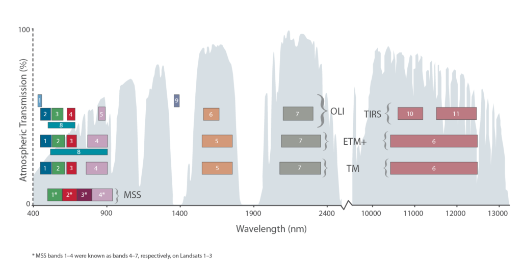
Visual comparison of Landsat spectral bands

Full spectral response data is located here: TM/ETM+, OLI, TIRS
To compare the exact band designations in tabular form, please visit the USGS page “What are the band designations for the Landsat satellites?” For detailed information on Landsat 8 (formerly the Landsat Data Continuity Mission, LDCM), visit the Landsat 8 section of this site or read the LDCM brochure .
Visit the USGS Landsat Website for:
- technical documentation,
- ground station facts,
- Landsat calibration parameter file details,
- satellite ephemeris information,
- satellite anomaly investigations,
- data acquisition information,
- image processing particulars,
- and data product guidance.
- Landsat 8 Science Data Users Handbook
Visit the L7 Science Data Users Handbook for:
- background Landsat program information,
- spacecraft characteristics,
- Landsat 7 payload details,
- ground system details,
- orbit and coverage particulars,
- data properties,
- artifact characterization,
- instrument calibration information,
- calibration parameter file details,
- level 1 data processing details,
- data product information,
- product ordering guidance,
- system performance details,
- automatic cloud cover assessments,
- and application information.
Related Information:
- + A comparison of L5, L7, IRS-P6 and CBERS-2 (PDF)
- + Atmospheric Correction Parameter Calculator (for Single Thermal Band Instruments) *retired

